Eastman, Georgia
| Eastman, Georgia | |
|---|---|
| City | |
|
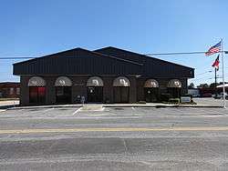
Eastman City Hall in Eastman | |
| Nickname(s): Azalea City, Paris of the Wiregrass[1] | |
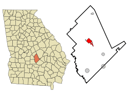 Location in Dodge County and the state of Georgia | |
| Coordinates: 32°11′52″N 83°10′45″W / 32.19778°N 83.17917°WCoordinates: 32°11′52″N 83°10′45″W / 32.19778°N 83.17917°W | |
| Country | United States |
| State | Georgia |
| County | Dodge |
| Area | |
| • Total | 5.47 sq mi (14.16 km2) |
| • Land | 5.42 sq mi (14.03 km2) |
| • Water | 0.05 sq mi (0.13 km2) |
| Elevation | 390 ft (119 m) |
| Population (2010) | |
| • Total | 4,962 |
| • Density | 916/sq mi (353.8/km2) |
| Time zone | EST (UTC-5) |
| • Summer (DST) | EDT (UTC-4) |
| ZIP code | 31023 |
| Area code(s) | 478 |
| FIPS code | 13-25552[2] |
| GNIS feature ID | 0355610[3] |
| Website |
cityofeastman |
Eastman is a city in Dodge County, Georgia, United States. The population was 4,962 at the 2010 census.[4] The city was established in 1872, and is the county seat of Dodge County.[5] The first Stuckey's store, now well known throughout the Southeastern United States, was founded in Eastman in 1937.
History
Eastman was founded in 1871 as the seat of the newly formed Dodge County. It was incorporated as a town in 1873 and as a city in 1905.[6] Eastman is named for W. P. Eastman, who, with W. E. Dodge, presented the county with a courthouse.[7]
During that same time period, Ira Roe Foster, former Quartermaster General of Georgia, operated a sawmill in Dodge County. In 1869, Foster built a residence in what would become Eastman. Foster was one of many who came to the area to participate in the sawmill boom. During the boom, it was estimated that, on average, there was one mill every two miles along the industrial corridor created by the Macon and Brunswick Railroad.[8] Unlike earlier eras, when timber was transported downstream in large river rafts, sawmills along the industrial corridor shipped their timber by rail. In his book The New South Comes to Wiregrass Georgia 1860-1910, author Mark V. Wetherington states: "Ira R. Foster shipped lumber to Brunswick, where it was loaded onto timber schooners and transported to international markets like Liverpool, Rio de Janeiro, and Havana."[8] When Eastman was incorporated in 1872, Foster served as its first mayor.[9]
Geography
Eastman is located in the center of Dodge County at 32°11′52″N 83°10′45″W / 32.19778°N 83.17917°W (32.197760, -83.179271).[10] U.S. Route 23 passes through the center of town, leading northwest 17 miles (27 km) to Cochran and southeast 20 miles (32 km) to McRae. U.S. Route 341 bypasses the city on the southwest, leading west 20 miles (32 km) to Hawkinsville and southeast with US 23 to McRae.
According to the United States Census Bureau, Eastman has a total area of 5.5 square miles (14.2 km2), of which 5.4 square miles (14.0 km2) is land and 0.04 square miles (0.1 km2), or 0.93%, is water.[4]
Demographics
| Historical population | |||
|---|---|---|---|
| Census | Pop. | %± | |
| 1890 | 1,082 | — | |
| 1900 | 1,235 | 14.1% | |
| 1910 | 2,355 | 90.7% | |
| 1920 | 2,707 | 14.9% | |
| 1930 | 3,022 | 11.6% | |
| 1940 | 3,311 | 9.6% | |
| 1950 | 3,597 | 8.6% | |
| 1960 | 5,118 | 42.3% | |
| 1970 | 5,416 | 5.8% | |
| 1980 | 5,330 | −1.6% | |
| 1990 | 5,153 | −3.3% | |
| 2000 | 5,440 | 5.6% | |
| 2010 | 4,962 | −8.8% | |
| Est. 2015 | 5,285 | [11] | 6.5% |
As of the census[2] of 2000, there were 13,541[13] people, 5,261 households, and 1,318 families residing in the city. The population density was 1,067.3 people per square mile (411.8/km²). There were 2,418 housing units at an average density of 474.4 per square mile (183.1/km²). The racial makeup of the city was 60.28% White, 37.35% African American, 0.24% Native American, 0.48% Asian, 0.06% Pacific Islander, 1.16% from other races, and 0.44% from two or more races. Hispanic or Latino of any race were 1.80% of the population.
There were 2,154 households out of which 27.2% had children under the age of 18 living with them, 37.9% were married couples living together, 19.9% had a female householder with no husband present, and 38.8% were non-families. 35.5% of all households were made up of individuals and 15.5% had someone living alone who was 65 years of age or older. The average household size was 2.28 and the average family size was 2.96.
In the city the population was spread out with 29.5% under the age of 18, 8.5% from 18 to 24, 24.6% from 25 to 44, 21.1% from 45 to 64, and 16.3% who were 65 years of age or older. The median age was 34 years. For every 100 females there were 92.9 males. For every 100 females age 18 and over, there were 77.4 males.
The median income for a household in the city was $23,604, and the median income for a family was $30,500. Males had a median income of $27,292 versus $20,497 for females. The per capita income for the city was $14,332. About 20.2% of families and 23.5% of the population were below the poverty line, including 33.1% of those under age 18 and 25.0% of those age 65 or over.
Climate
| Climate data for Eastman, Georgia | |||||||||||||
|---|---|---|---|---|---|---|---|---|---|---|---|---|---|
| Month | Jan | Feb | Mar | Apr | May | Jun | Jul | Aug | Sep | Oct | Nov | Dec | Year |
| Record high °F (°C) | 83 (28) |
84 (29) |
92 (33) |
95 (35) |
102 (39) |
110 (43) |
109 (43) |
105 (41) |
102 (39) |
102 (39) |
89 (32) |
85 (29) |
110 (43) |
| Average high °F (°C) | 57.0 (13.9) |
61.2 (16.2) |
69.9 (21.1) |
77.7 (25.4) |
84.4 (29.1) |
84.4 (29.1) |
91.5 (33.1) |
91.3 (32.9) |
87.1 (30.6) |
78.8 (26) |
69.7 (20.9) |
60.9 (16.1) |
76.6 (24.8) |
| Average low °F (°C) | 35.0 (1.7) |
37.6 (3.1) |
45.1 (7.3) |
51.9 (11.1) |
59.7 (15.4) |
59.7 (15.4) |
69.8 (21) |
69.1 (20.6) |
64.2 (17.9) |
53.0 (11.7) |
44.8 (7.1) |
37.8 (3.2) |
52.9 (11.6) |
| Record low °F (°C) | −2 (−19) |
10 (−12) |
15 (−9) |
29 (−2) |
39 (4) |
45 (7) |
56 (13) |
52 (11) |
36 (2) |
28 (−2) |
12 (−11) |
4 (−16) |
−2 (−19) |
| Average precipitation inches (mm) | 5.05 (128.3) |
4.38 (111.3) |
4.84 (122.9) |
3.58 (90.9) |
2.93 (74.4) |
4.53 (115.1) |
5.12 (130) |
3.90 (99.1) |
3.33 (84.6) |
2.73 (69.3) |
3.18 (80.8) |
3.67 (93.2) |
46.4 (1,178.6) |
| Source #1: The Weather Channel [14] | |||||||||||||
| Source #2: Weatherbase [15] | |||||||||||||
Major highways
- U.S. Route 23
- U.S. Route 341
- Georgia State Route 27
- Georgia State Route 46
- Georgia State Route 87
- Georgia State Route 117
Recreation
Eastman has few recreational activities. The Dodge County Golf Club has a 9-hole golf course, a swimming pool and private golf cart selection. It is positioned next to the railroad tracks that run through the town. It also has a public baseball field located at the former Boys & Girls Club. The Eastman-Dodge County Recreational Fields, located along the Eastman-Dublin Highway (Highway 117), offers the following public sports for kids: football, baseball, tee ball, cheerleading, and soccer.
Education
Dodge County School District
Dodge County students in kindergarten to twelfth grades are in the Dodge County School District, which consists of a pre-K school, two elementary schools, a middle school, and a high school.[16][17] The district has 210 full-time teachers and over 3,500 students.[16]
- Dodge PreK School
- South Dodge Elementary School
- North Dodge Elementary School
- Dodge County Middle School
- Dodge County High School[18]
Higher education

- Mercer University — Eastman Regional Academic Center[19]
- Middle Georgia State College — Eastman Aviation Campus (previously known as Georgia Aviation Technical College before it merged with the Middle Georgia College).[20]
Peabody School
Peabody School, also known as Peabody High School, is an historic school building located on Herman Avenue in Eastman, Georgia.[21] Built in 1938, it was designed by Eastman-born American architect Edward Columbus Hosford, who is noted for the courthouses and other buildings that he designed in Florida, Georgia and Texas. In the days of segregation, it was an all-black public school. It was closed in 1970 and its students were integrated into Dodge County High School and other formerly all-white public schools in Dodge County.
On November 20, 2004, the building was added to the National Register of Historic Places. It was then vacant and in private ownership.
Notable people
- Terry Coleman, Speaker of the House for 2003-2004 Legislative Session of Georgia General Assembly
- Ira Roe Foster, 19th century polymath, first mayor of Eastman, Quartermaster General of the State of Georgia, state senator and representative, brigadier general in Georgia Militia, built a sawmill in Dodge County[9]
- Willie E. Gary, attorney, motivational speaker and cable television executive
- Edward Columbus Hosford, architect that created courthouses and later in life constructed specialized buildings. The first courthouse he built was the Dodge County Courthouse (1908) and the last building was the Peabody School (1938).
- Martha Hudson, Olympic athlete who won the gold medal in 4 × 100 metre relay at 1960 Summer Olympic Games in Rome
- Hank Mobley, hard bop and soul jazz tenor saxophonist and composer
- Hugh Royer, Jr., professional golfer who played on PGA Tour in 1950s, 1960s and 1970s
- Tempest Storm, stripper born Annie Blanche Banks, burlesque star, and motion picture actress
- Scott Stuckey, filmmaker and record producer in Washington, D.C.; creator of children's television show Pancake Mountain
- W. S. Stuckey, Jr., Democratic Party member of United States House of Representatives who represented Georgia's 8th congressional district (1967–1977), president of Stuckey's (1958–1966) and later Chairman of the Board
- W. S. Stuckey, Sr., founded Stuckey's in 1937
References
- ↑ "Eastman". Retrieved 13 July 2015.
- 1 2 "American FactFinder". United States Census Bureau. Retrieved 2008-01-31.
- ↑ "US Board on Geographic Names". United States Geological Survey. 2007-10-25. Retrieved 2008-01-31.
- 1 2 "Geographic Identifiers: 2010 Demographic Profile Data (G001): Eastman city, Georgia". U.S. Census Bureau, American Factfinder. Retrieved October 21, 2015.
- ↑ "Find a County". National Association of Counties. Retrieved 2011-06-07.
- ↑ Hellmann, Paul T. (May 13, 2013). Historical Gazetteer of the United States. Routledge. p. 228. Retrieved 30 November 2013.
- ↑ Gannett, Henry (1905). The Origin of Certain Place Names in the United States. Govt. Print. Off. p. 112.
- 1 2 Mark V. Wetherington (1 September 2001). The New South Comes to Wiregrass Georgia, 1860-1910 - Timber Is King. Univ. of Tennessee Press. pp. 113–114. ISBN 978-1-57233-168-6.
- 1 2 Philip Cobb, Mrs. Wilton (1932). "History of Dodge County". Retrieved 27 October 2013.
- ↑ "US Gazetteer files: 2010, 2000, and 1990". United States Census Bureau. 2011-02-12. Retrieved 2011-04-23.
- ↑ "Annual Estimates of the Resident Population for Incorporated Places: April 1, 2010 to July 1, 2015". Retrieved July 2, 2016.
- ↑ "Census of Population and Housing". Census.gov. Retrieved June 4, 2015.
- ↑ "Census 2000". U.S. Census Bureau. Retrieved 10 April 2011.
- ↑ "The Weather Channel: Monthly Avearges". The Weather Channel. Retrieved 2010-06-06.
- ↑ "Historical Weather for Eastman, Georgia, United States". Weatherbase. Retrieved 2010-06-06.
- 1 2 "school-stats.com". Retrieved 2010-05-21.
- ↑ Georgia Board of Education, Retrieved June 6, 2010.
- ↑ Dodge County High School, Retrieved July 27, 2010.
- ↑ Mercer University Eastman Regional Academic Center, Retrieved July 27, 2010.
- ↑ Middle Georgia College- Aviation Campus, Retrieved July 27, 2010.
- ↑ Peabody High School, Retrieved July 27, 2010.
External links
- City of Eastman official website
- Eastman-Dodge County Chamber of Commerce
- Orphans Cemetery historical marker
Municipalities and communities of Dodge County, Georgia, United States | ||
|---|---|---|
| City |  | |
| Towns | ||
| CDP | ||
| Unincorporated community | ||
| Footnotes | ‡This populated place also has portions in an adjacent county or counties | |