Eastborough, Kansas
| Eastborough, Kansas | |
|---|---|
| City | |
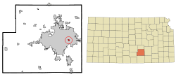 Location within Sedgwick County and Kansas | |
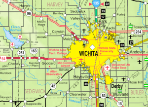 KDOT map of Sedgwick County (legend) | |
| Coordinates: 37°41′11″N 97°15′32″W / 37.68639°N 97.25889°WCoordinates: 37°41′11″N 97°15′32″W / 37.68639°N 97.25889°W | |
| Country | United States |
| State | Kansas |
| County | Sedgwick |
| Incorporated | 1937 |
| Government | |
| • Type | Mayor-council |
| • Mayor | John Johnson |
| Area[1] | |
| • Total | 0.40 sq mi (1.04 km2) |
| • Land | 0.40 sq mi (1.04 km2) |
| • Water | 0 sq mi (0 km2) |
| Elevation | 1,371 ft (418 m) |
| Population (2010)[2] | |
| • Total | 773 |
| • Estimate (2015)[3] | 768 |
| • Density | 1,900/sq mi (740/km2) |
| Time zone | Central (CST) (UTC-6) |
| • Summer (DST) | CDT (UTC-5) |
| ZIP codes | 67206-67208 |
| Area code | 316 |
| FIPS code | 20-19300 [4] |
| GNIS feature ID | 0474118 [5] |
| Website | eastborough-ks.gov |
Eastborough is a city in Sedgwick County, Kansas, United States, and a suburb of Wichita. As of the 2010 census, the city population was 773.[6] Eastborough is entirely enclosed within the city of Wichita.
History
Eastborough was originally envisioned by Burdon Hunter, a British architect. The first development in the Eastborough area began in 1929, but the discovery of oil in the area postponed its establishment until the middle of the 1930s. Sale of Eastborough Village started April 10, 1929. It was planned to incorporate when the first thirty homes were completed. Although Eastborough found itself in disputes with the neighboring Woodlawn subdivision, i. e. they could not agree upon a name for the street between them. The disputes were resolved after the two agreed to apply together for incorporation. Eastborough and Woodlawn were incorporated as the city of Eastborough on June 1, 1937.[7]
Eastborough's location near a major shopping center in Wichita (Towne East Square) caused a bit of friction between residents of Wichita and Eastborough in the 1980s through the 1990s as traffic to and from Towne East Square often would go through Eastborough (and be ticketed for exceeding Eastborough's 20 mile per hour speed limit). This was allieviated when Wichita upgraded Kellogg Avenue U.S. Route 54 such that Eastborough was no longer the best route to Towne East. It should be noted, however, that Eastborough retains its 20-mile per hour speed limit on Douglas Avenue, a four lane divided highway, and routinely monitors Douglas Avenue for unsuspecting motorists who do not realize the speed limit dropped from 35 miles per hour outside Eastborough.
Geography
Eastborough is located at 37°41′11″N 97°15′32″W / 37.68639°N 97.25889°W (37.6864752, -97.2588378).[8] According to the United States Census Bureau, the city has a total area of 0.40 square miles (1.04 km2), all of it land.[1]
Eastborough is entirely enclosed within the city of Wichita, Kansas, and relies upon Wichita for water purification and sewage treatment. Eastborough residents pay 60% more for water than Wichita residents. Fire service is provided by the City of Wichita on a contractual basis. Eastborough maintains its own police force of seven officers which is approximately one officer for every 42 homes.
Demographics
| Historical population | |||
|---|---|---|---|
| Census | Pop. | %± | |
| 1940 | 312 | — | |
| 1950 | 708 | 126.9% | |
| 1960 | 1,001 | 41.4% | |
| 1970 | 1,141 | 14.0% | |
| 1980 | 854 | −25.2% | |
| 1990 | 896 | 4.9% | |
| 2000 | 826 | −7.8% | |
| 2010 | 773 | −6.4% | |
| Est. 2015 | 768 | [3] | −0.6% |
| U.S. Decennial Census | |||

Eastborough is part of the Wichita, KS Metropolitan Statistical Area.
2010 census
As of the census[2] of 2010, there were 773 people, 306 households, and 223 families residing in the city. The population density was 1,932.5 inhabitants per square mile (746.1/km2). There were 328 housing units at an average density of 820.0 per square mile (316.6/km2). The racial makeup of the city was 96.8% White, 0.9% African American, 0.4% Native American, 0.9% Asian, 0.3% from other races, and 0.8% from two or more races. Hispanic or Latino of any race were 0.8% of the population.
There were 306 households of which 32.0% had children under the age of 18 living with them, 68.6% were married couples living together, 2.0% had a female householder with no husband present, 2.3% had a male householder with no wife present, and 27.1% were non-families. 23.2% of all households were made up of individuals and 7.5% had someone living alone who was 65 years of age or older. The average household size was 2.53 and the average family size was 3.01.
The median age in the city was 46.3 years. 26.1% of residents were under the age of 18; 4.1% were between the ages of 18 and 24; 17.7% were from 25 to 44; 37.9% were from 45 to 64; and 14.2% were 65 years of age or older. The gender makeup of the city was 49.2% male and 50.8% female.
2000 census
As of the census[4] of 2000, there were 826 people, 308 households, and 254 families residing in the city. The population density was 2,047.3 people per square mile (797.3/km²). There were 320 housing units at an average density of 793.1 per square mile (308.9/km²). The racial makeup of the city was 97.22% White, 0.48% African American, 0.12% Native American, 0.73% Asian, and 1.45% from two or more races. Hispanic or Latino of any race were 1.09% of the population.
There were 308 households out of which 36.4% had children under the age of 18 living with them, 75.0% were married couples living together, 5.5% had a female householder with no husband present, and 17.5% were non-families. 14.3% of all households were made up of individuals and 6.2% had someone living alone who was 65 years of age or older. The average household size was 2.68 and the average family size was 2.99.
In the city the population was spread out with 27.4% under the age of 18, 3.5% from 18 to 24, 20.2% from 25 to 44, 35.5% from 45 to 64, and 13.4% who were 65 years of age or older. The median age was 44 years. For every 100 females there were 104.5 males. For every 100 females age 18 and over, there were 100.0 males.
The median income for a household in the city was $138,564, and the median income for a family was $150,635. Males had a median income of $82,730 versus $48,750 for females. The per capita income for the city was $71,101. About 4.4% of families and 5.8% of the population were below the poverty line, including 11.4% of those under age 18 and 2.0% of those age 65 or over.
Government
The Eastborough government consists of a mayor and five council members. The council meets the 4th Tuesday of each month at 5:30 pm.[9][10]
Notable people
Notable individuals who were born in and/or have lived in Eastborough include:
- Olive Ann Beech (1903-1993), aviation entrepreneur[11]
References
- 1 2 "US Gazetteer files 2010". United States Census Bureau. Retrieved 2012-07-06.
- 1 2 "American FactFinder". United States Census Bureau. Retrieved 2012-07-06.
- 1 2 "Annual Estimates of the Resident Population for Incorporated Places: April 1, 2010 to July 1, 2015". Retrieved July 2, 2016.
- 1 2 "American FactFinder". United States Census Bureau. Retrieved 2008-01-31.
- ↑ "US Board on Geographic Names". United States Geological Survey. 2007-10-25. Retrieved 2008-01-31.
- ↑ "2010 City Population and Housing Occupancy Status". U.S. Census Bureau. Retrieved March 6, 2011.
- ↑ History of Eastborough, City of Eastborough, 2009. Accessed 2009-07-26.
- ↑ "US Gazetteer files: 2010, 2000, and 1990". United States Census Bureau. 2011-02-12. Retrieved 2011-04-23.
- ↑ Eastborough Directory of Public Officials
- ↑ Eastborough - Government
- ↑ "'First Lady of Aviation' Made Mark Beyond The Corporate Boardroom". The Wichita Eagle. 1993-07-07. Retrieved 2016-04-06.
External links
| Wikimedia Commons has media related to Eastborough, Kansas. |
- City
- Schools
- USD 259, local school district
- Historical
- Photos: Eastborough, wichitaphotos.org
- Maps
- Eastborough City Map, KDOT
Municipalities and communities of Sedgwick County, Kansas, United States | ||
|---|---|---|
| Cities |  | |
| CDPs | ||
| Unincorporated communities | ||
| Townships | ||
| Footnotes | ‡This populated place also has portions in an adjacent county or counties | |