East Selino
| East Selino Ανατολικό Σέλινο | |
|---|---|
|
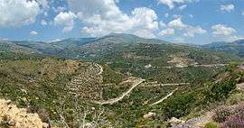
Landscape around Moni | |
 East Selino | |
|
Location within the regional unit 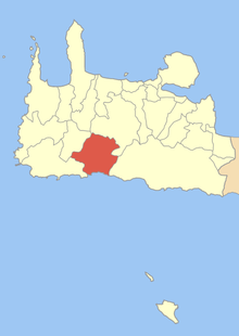 | |
| Coordinates: 35°16′N 23°51′E / 35.267°N 23.850°ECoordinates: 35°16′N 23°51′E / 35.267°N 23.850°E | |
| Country | Greece |
| Administrative region | Crete |
| Regional unit | Chania |
| Municipality | Kantanos-Selino |
| Government | |
| • Mayor | Eleftherios Papaderos |
| Population (2011)[1] | |
| • Municipal unit | 1,021 |
| Time zone | EET (UTC+2) |
| • Summer (DST) | EEST (UTC+3) |
| Postal code | 730 09 |
| Area code(s) | 28230 |
| Vehicle registration | ΧΝ, XB |
| Website | Anatoliko Selino |
East Selino (Greek: Ανατολικό Σέλινο) is a former municipality in the Chania regional unit, Crete, Greece. Since the 2011 local government reform it is part of the municipality Kantanos-Selino, of which it is a municipal unit.[2] It is situated on the south-west coast of the island of Crete. It was part of the former Selino Province which covered the mountain and coastal region west of Sfakia. The seat of the municipality was Kampanos.
The municipal unit is subdivided into the following communities (constituent villages in brackets):
- Epanochori (Epanochori, Agia Eirini, Prines, Seliniotikos Gyros, Tsiskiana)
- Kampanos (Kampanos, Maralia)
- Rodovani (Rodovani, Agriles, Kamaria, Livada, Maza)
- Skafi (Skafi, Argastiri, Pera Skafi)
- Sougia (Sougia, Koustogerako, Livadas, Moni)
- Temenia (Temenia, Pappadiana, Stratoi)
Within Anatoliko Selino lies the Agia Eirini Gorge, the ruins of the ancient cities of Elyros, Lissos, Yrtakina and Syia and many Byzantine churches. The area's main product is olive oil. Sougia is a growing beach resort with a few small hotels and tavernas.
See also
References
- ↑ "Απογραφή Πληθυσμού - Κατοικιών 2011. ΜΟΝΙΜΟΣ Πληθυσμός" (in Greek). Hellenic Statistical Authority.
- ↑ Kallikratis law Greece Ministry of Interior (Greek)
External links
| Wikimedia Commons has media related to East Selino. |