East River Bridge (Sheet Harbour)
| East River Bridge | |
|---|---|
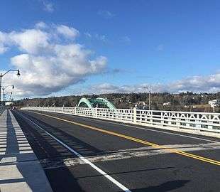 The East River Bridge in 2015, a few days after opening. The old bridge is visible in the background (the green arch). | |
| Coordinates | 44°55′09″N 62°30′55″W / 44.91917°N 62.51528°WCoordinates: 44°55′09″N 62°30′55″W / 44.91917°N 62.51528°W |
| Carries | 2 lanes of Nova Scotia Trunk 7 |
| Crosses | Northeast Arm of Sheet Harbour[1] |
| Locale |
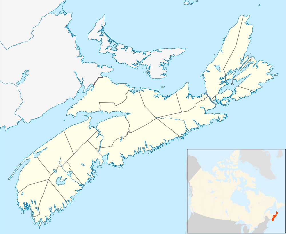
Sheet Harbour, Nova Scotia Watt Section, Nova Scotia |
| Maintained by | Nova Scotia Department of Transportation |
| Characteristics | |
| Design | Multi-span |
| Total length | 183 m (600 ft)[2] |
| History | |
| Designer |
Ryan Swinemar[3] Tim Jordan[3] |
| Construction begin | September 2014[2] |
| Opened |
17 December 2015 (for pedestrians)[4] 18 December 2015 (for vehicles)[4] |
 | |
The East River Bridge is a multi-span bridge in Sheet Harbour, Nova Scotia that carries Trunk 7 over the Northeast Arm of Sheet Harbour. It replaced a bridge of the same name that was built in 1956 and demolished in 2016. Construction began on the current bridge in September 2014 and was finished on 17 December 2015, with a bridge walk commemorating the closing of the old East River Bridge and the opening of the new bridge. The old structure was a green arch bridge with a half-through, two-hinge type arch that was built in 1956, but was nearing the end of its lifespan leading to plans for construction of a new bridge funded by the federal and provincial governments. Nova Scotia had considered repairs to the old bridge in an effort to extend its lifespan, but ultimately elected to construct a new bridge.
East River Bridge (1957–2016)

The East River Bridge was a green arch bridge, which had a half-through, two-hinge type arch, as well as a built-up box-cross section for support. It was constructed in 1956 and was nearing the end of its projected life span when the new East River Bridge was opened in late 2015.[2][5] It bridge was 213 metres (699 ft) in length, with a main span of 140 metres (460 ft). It spanned the Northeast Arm of Sheet Harbour, just north of the new bridge.[1][2] The structure had engineering ties with the Angus L. MacDonald Bridge in Halifax.[4] The deck carried the two lanes of Trunk 7, and was hung from the arch by vertical steel wide flange shape hangers. Its ribs were reinforced heavily in 1988.[5] It was closed on 17 December 2015 with a bridge walk, and was demolished over the course of the next year.
2014–16 replacement project

The Nova Scotia Government had originally proposed minor repairs for the structure, but they decided that a new bridge would be more cost-effective.[2] Unlike the old bridge, the new bridge was designed without overhead steel arches that would have doubled the cost.[3] It was built on the same site as the old bridge's predecessor, which was constructed in 1907.[3]
Construction of the $19 million bridge began in September 2014.[2] The Nova Scotia Government contributed $11.8 million to the project, with the remaining $7.2 million coming from the Government of Canada.[4] The contractor, Dexter Construction, poured 2,260 cubic metres (2,960 cu yd) of concrete over 650 t (720 short tons) of rebar. The new bridge relies on two pillars set in the granite below the Northeast Arm. They were built with a technique which involved drilling steel pipes into the riverbed, then surrounding them with concrete and steel, instead of installing cofferdams, which would be more costly and would disrupt the river. Near completion, a deck, railings and sidewalks, were laid.[3] Overall, the structure is two metres (6.6 ft) wider than the old bridge. It includes a wider shoulder for cyclists. Several modifications were made to the roads on the Sheet Harbour side, near the bridge. Trunk 7 was aligned with what was previously Riverside Drive, which is now non-existent. Church Point Road and Pool Road were aligned to the new Trunk 7. The access road to Sheet Harbour Consolidated School and Duncan MacMillan High School was slightly modified. A minor loop called Sprott Lane was extended along a part of the old Trunk 7 for a few households.[2] There is no toll to access the bridge.
The bridge opened on 17 December 2015, with a bridge walk, in which Sheet Harbour residents walked across the old bridge to commemorate its closure, then walked back across the new bridge signifying its opening. That same day, the new bridge was opened for pedestrians, and open to traffic the following day.[4] The new bridge has a projected lifespan of at least 75 years, until 2090.[3][4] It also has a sidewalk, which connects to Sheet Harbour's current sidewalk system.[6] Officials hope this will encourage active transportation.[4]
The old East River Bridge was closed immediately after the bridge walk and demolition was completed in early September 2016.[2][4]
See also
-
 Bridges portal
 -
 Nova Scotia portal
References
- 1 2 "Northeast Arm". Natural Resources Canada. Retrieved 4 June 2016.
- 1 2 3 4 5 6 7 8 "East River Bridge Replacement Project". Nova Scotia Department of Transportation and Infrastructure Renewal. Retrieved 2 December 2015.
- 1 2 3 4 5 6 Beswick, Aaron (18 December 2014). "East River bridge project on track". The Chronicle Herald. Truro, Nova Scotia. Retrieved 2 December 2015.
- 1 2 3 4 5 6 7 8 "Sheet Harbour Residents Celebrate New East River Bridge". Nova Scotia Department of Transportation and Infrastructure Renewal. Retrieved 19 December 2015.
- 1 2 "East River: Sydney River Arch Bridges, Cape Breton County, NS". Harbourside Engineering Inc. Retrieved 3 December 2015.
- ↑ "Grand Opening Sheet Harbour Sidewalk Streetscape Project". Sheet Harbour Chamber of Commerce. Retrieved 30 September 2015.