East Cocalico Township, Lancaster County, Pennsylvania
| East Cocalico Township, Pennsylvania | |
|---|---|
| Township | |
|
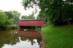
Bucher's Mill Covered Bridge in East Cocalico Township | |
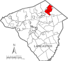 Map of Lancaster County, Pennsylvania highlighting East Cocalico Township | |
 Map of Lancaster County, Pennsylvania | |
| Country | United States |
| State | Pennsylvania |
| County | Lancaster |
| Settled | 1732 |
| Incorporated | 1838 |
| Government | |
| • Type | Board of Supervisors |
| Area | |
| • Total | 20.6 sq mi (53 km2) |
| Population (2000) | |
| • Total | 9,954 |
| • Density | 482.9/sq mi (186.4/km2) |
| Time zone | Eastern (EST) (UTC-5) |
| • Summer (DST) | EDT (UTC-4) |
| Area code(s) | 717 |
| Website | East Cocalico Township |
East Cocalico Township is a township in northeastern Lancaster County, Pennsylvania, United States. At the 2000 census the population was 9,954.
History
Cocalico Township was divided into East Cocalico and West Cocalico Townships in 1838. The Bucher Thal Historic District was listed on the National Register of Historic Places in 1987.[1]
Geography
According to the U.S. Census Bureau, the township has a total area of 20.6 square miles (53 km2), all of it land.
Demographics
As of the census[2] of 2000, there were 9,954 people, 3,461 households, and 2,709 families residing in the township. The population density was 482.9 people per square mile (186.5/km²). There were 3,557 housing units at an average density of 172.6/sq mi (66.6/km²). The racial makeup of the township was 95.76% White, 0.47% Black or African American, 0.11% Native American, 2.22% Asian, 0.03% Pacific Islander, 0.53% from other races, and 0.87% from two or more races. 1.38% of the population were Hispanic or Latino of any race.
There were 3,461 households, out of which 37.0% had children under the age of 18 living with them, 69.5% were married couples living together, 5.8% had a female householder with no husband present, and 21.7% were non-families. 17.3% of all households were made up of individuals, and 6.3% had someone living alone who was 65 years of age or older. The average household size was 2.82 and the average family size was 3.21.
In the township the population was spread out, with 28.3% under the age of 18, 6.8% from 18 to 24, 30.6% from 25 to 44, 21.9% from 45 to 64, and 12.4% who were 65 years of age or older. The median age was 36 years. For every 100 females there were 100.3 males. For every 100 females age 18 and over, there were 98.2 males.
The median income for a household in the township was $50,580, and the median income for a family was $55,401. Males had a median income of $38,833 versus $24,189 for females. The per capita income for the township was $21,387. About 2.3% of families and 3.4% of the population were below the poverty line, including 5.2% of those under age 18 and 3.4% of those age 65 or over.
References
- ↑ National Park Service (2010-07-09). "National Register Information System". National Register of Historic Places. National Park Service.
- ↑ "American FactFinder". United States Census Bureau. Retrieved 2008-01-31.
Coordinates: 40°12′36″N 76°07′59″W / 40.21000°N 76.13306°W