East Carroll Parish, Louisiana
| East Carroll Parish, Louisiana | |
|---|---|
|
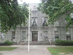
The East Carroll Parish Courthouse in Lake Providence | |
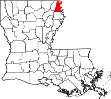 Location in the U.S. state of Louisiana | |
 Louisiana's location in the U.S. | |
| Founded | March 26, 1877 |
| Named for | Charles Carroll of Carrollton |
| Seat | Lake Providence |
| Largest town | Lake Providence |
| Area | |
| • Total | 442 sq mi (1,145 km2) |
| • Land | 421 sq mi (1,090 km2) |
| • Water | 22 sq mi (57 km2), 4.9% |
| Population | |
| • (2010) | 7,759 |
| • Density | 18/sq mi (7/km²) |
| Congressional district | 5th |
| Time zone | Central: UTC-6/-5 |
East Carroll Parish (French: Paroisse de Carroll Est) is a parish located in the U.S. state of Louisiana. As of the 2010 census, the population was 7,759.[1] The parish seat is Lake Providence.[2]
The original Carroll Parish, before it was divided into "East" and "West" segments, was named for Charles Carroll of Carrollton,[3] Maryland, the only Roman Catholic signer of the Declaration of Independence and the last surviving signer of the document. The parish was split in 1877.[4] Prior to 1814, all of the territory covered by the current East Carroll Parish was part of the now defunct Warren Parish.
The famous black bear hunt waged in 1907 by U.S. President Theodore Roosevelt began in East Carroll Parish near Lake Providence. When a particular bear managed to elude the hunters, the camp was moved to Bear Lake in Madison Parish near Tallulah. The 21-year-old Arthur Spencer of Richland Parish took a picture of Roosevelt in the heavily armed hunting party. Among the hunters was future Governor John M. Parker, the vice-presidential choice of the Bull Moose Party ticket in the 1916 presidential election.[5]
Law and government
East Carroll Parish is heavily Democratic in political configuration.
In 1988, Governor Michael S. Dukakis of Massachusetts carried East Carroll Parish over then Vice President George Herbert Walker Bush, himself a Massachusetts native, 1,809 votes (52.3 percent) to 1,536 (44.4 percent).[6] In the 2004 presidential race, East Carroll gave the George W. Bush - Richard B. Cheney electors 1,357 votes (40 percent) to 1,980 ballots (58 percent) for the Democrat John Kerry - John Edwards slate.[7]
In 2012, U.S. President Barack H. Obama swept the parish with 2,478 votes (61.8 percent) to Republican Mitt Romney's 1,508 (37.6 percent).[8] In 2008, Obama had handily defeated John S. McCain in East Carroll Parish, 2,267 (63.7 percent) to 1,254 (35.2 percent).[9]
Geography
According to the U.S. Census Bureau, the parish has a total area of 442 square miles (1,140 km2), of which 421 square miles (1,090 km2) is land and 22 square miles (57 km2) (4.9%) is water.[10]
Major highways
Adjacent counties and parishes
- Chicot County, Arkansas (north)
- Issaquena County, Mississippi (east)
- Warren County, Mississippi (southeast)
- Madison Parish (south)
- Richland Parish (southwest)
- West Carroll Parish (west)
Demographics
| Historical population | |||
|---|---|---|---|
| Census | Pop. | %± | |
| 1880 | 12,134 | — | |
| 1890 | 12,362 | 1.9% | |
| 1900 | 11,373 | −8.0% | |
| 1910 | 11,637 | 2.3% | |
| 1920 | 11,231 | −3.5% | |
| 1930 | 15,815 | 40.8% | |
| 1940 | 19,023 | 20.3% | |
| 1950 | 16,302 | −14.3% | |
| 1960 | 14,433 | −11.5% | |
| 1970 | 12,884 | −10.7% | |
| 1980 | 11,772 | −8.6% | |
| 1990 | 9,709 | −17.5% | |
| 2000 | 9,421 | −3.0% | |
| 2010 | 7,759 | −17.6% | |
| Est. 2015 | 7,307 | [11] | −5.8% |
| U.S. Decennial Census[12] 1790-1960[13] 1900-1990[14] 1990-2000[15] 2010-2013[1] | |||
2010
Whereas according to the 2010 U.S. Census Bureau:
- 28.9% White
- 69.0% Black
- 0.2% Native American
- 0.6% Asian
- 0.0% Native Hawaiian or Pacific Islander
- 0.7% Two or more races
- 1.6% Hispanic or Latino (of any race)
2000
As of the census[16] of 2000, there were 9,421 people, 2,969 households, and 2,140 families residing in the parish. The population density was 22 people per square mile (9/km²). There were 3,303 housing units at an average density of 8 per square mile (3/km²). The racial makeup of the parish was 31.60% White, 67.29% Black or African American, 0.18% Native American, 0.33% Asian, 0.25% from other races, and 0.35% from two or more races. 1.19% of the population were Hispanic or Latino of any race.
There were 2,969 households out of which 36.50% had children under the age of 18 living with them, 40.00% were married couples living together, 27.70% had a female householder with no husband present, and 27.90% were non-families. 25.60% of all households were made up of individuals and 11.30% had someone living alone who was 65 years of age or older. The average household size was 2.82 and the average family size was 3.40.
In the parish the population was spread out with 30.30% under the age of 18, 11.50% from 18 to 24, 27.20% from 25 to 44, 18.50% from 45 to 64, and 12.50% who were 65 years of age or older. The median age was 31 years. For every 100 females there were 104.60 males. For every 100 females age 18 and over, there were 106.90 males.
The median income for a household in the parish was $20,723, and the median income for a family was $24,554. Males had a median income of $22,099 versus $18,672 for females. The per capita income for the parish was $9,629. About 32.60% of families and 40.50% of the population were below the poverty line, including 56.80% of those under age 18 and 32.70% of those age 65 or over. The county's per-capita income makes it one of the poorest counties in the United States.
2011 poverty data
Of 3,197 counties ranked by the U.S. Census Bureau in 2011 for "estimated percent of people of all ages in poverty", East Carroll Parish was fifth. It was estimated that 44 percent of the county's residents lived in poverty.[17]
Education
Public schools in East Carroll Parish are operated by the East Carroll Parish School Board.
Communities

Towns
- Lake Providence (parish seat)
Unincorporated Communities
Notable residents
- Fuaed Abdo Ahmed, 20-year-old man who in August 2013 killed two hostages at Tensas State Bank in St. Joseph in Tensas Parish, had previously lived in East Carroll Parish and attended Briarfield Academy, where he played football[18]
- Buddy Caldwell, District Attorney in East Carroll, elected in 2007 as the attorney general of Louisiana
- Vail M. Delony, state representative, 1950–1967; Speaker of the Louisiana House, 1964–1967
- John Martin Hamley, state representative, 1912-1924; clerk of the state House, 1924-1931; elected parish tax assessor, 1933`
- Mose Jefferson, convicted felon, older brother of William J. Jefferson, was born in Lake Providence.
- William J. Jefferson, convicted felon, former U.S. representative from Louisiana's 2nd Congressional District, was born in Lake Providence.
- James Nelson Lee, city and state district court judge in Bunkie and Avoyelles Parish 1956-1985, born in Lake Providence[19]
- James E. Paxton, district attorney for Louisiana 6th Judicial District (East Carroll, Madison, and Tensas parishes) since 2008[20]
- Francis Xavier Ransdell, state 6th Judicial District judge from 1900 to 1936
- Joseph Ransdell, a Democrat who served in Congress from 1913 to 1931. Ransdell was born in Alexandria but resided for many years in Lake Providence.
- David Voelker, entrepreneur and philanthropist in New Orleans; born in Lake Providence
- Frank Voelker, Jr., attorney in Lake Providence and New Orleans; former chairman of the Louisiana Sovereignty Commission; candidate for governor of Louisiana in 1963
- Frank Voelker, Sr., judge of the 6th Judicial District, 1937-1963; son-in-law of Judge Francis Ransdell
- Charles L. Vining, Jr., state representative from East and West Carroll parishes, 1968–1972
- Norris C. Williamson, state senator from 1916 to 1932; advocate of cotton planter interest and worked to gain state funding to eradicate the cattle tick
- John D. Winters, historian at Louisiana Tech University, author of The Civil War in Louisiana (1963), was born in Mississippi but reared in Lake Providence.
- Captan Jack Wyly, Democratic political activist
Gallery
 Beginning corn crop (2013) surrounds both sides of the Louisiana State Cotton Museum in Lake Providence
 The city of Lake Providence is named for the oxbow lake
 A dock on Lake Providence
 The East Carroll Parish Police Jury office complex in Lake Providence
 Delta Bank in downtown Lake Providence
See also
| Wikimedia Commons has media related to East Carroll Parish, Louisiana. |
References
- 1 2 "State & County QuickFacts". United States Census Bureau. Retrieved August 9, 2013.
- ↑ "Find a County". National Association of Counties. Retrieved 2011-06-07.
- ↑ Gannett, Henry (1905). The Origin of Certain Place Names in the United States. Govt. Print. Off. p. 112.
- ↑ "East Carroll Parish". Center for Cultural and Eco-tourism. Retrieved September 4, 2014.
- ↑ "East Carroll Parish Genealogy". eastcarrollparishlouisianagenealogy.blogspot.com. Retrieved June 10, 2013.
- ↑ "East Carroll Parish presidential election returns, November 8, 1988". staticresults.sos.la.gov. Retrieved November 20, 2012.
- ↑ "East Carroll Parish presidential election returns, November 2, 2004". staticresults.sos.la.gov. Retrieved November 20, 2012.
- ↑ "Louisiana general election returns, November 6, 2012". staticresults.sos.la.gov. Retrieved November 11, 2012.
- ↑ "East Carroll Parish presidential election returns, November 4, 2008". staticresults.sos.la.gov. Retrieved November 20, 2012.
- ↑ "2010 Census Gazetteer Files". United States Census Bureau. August 22, 2012. Retrieved August 20, 2014.
- ↑ "County Totals Dataset: Population, Population Change and Estimated Components of Population Change: April 1, 2010 to July 1, 2015". Retrieved July 2, 2016.
- ↑ "U.S. Decennial Census". United States Census Bureau. Retrieved August 20, 2014.
- ↑ "Historical Census Browser". University of Virginia Library. Retrieved August 20, 2014.
- ↑ "Population of Counties by Decennial Census: 1900 to 1990". United States Census Bureau. Retrieved August 20, 2014.
- ↑ "Census 2000 PHC-T-4. Ranking Tables for Counties: 1990 and 2000" (PDF). United States Census Bureau. Retrieved August 20, 2014.
- ↑ "American FactFinder". United States Census Bureau. Retrieved 2008-01-31.
- ↑ "Table 1: 2011 Poverty and Median Income Estimates - Counties". Small Area Income and Poverty Estimates. U.S. Census Bureau. 2011.
- ↑ "Tensas bank suspect blamed ex-girlfriend's family, wanted to leave country, August 15, 2013". Alexandria Daily Town Talk. Retrieved August 15, 2013.
- ↑ "Judge James N. Lee (ret.)". Alexandria Town Talk. Retrieved August 14, 2014.
- ↑ "James E. Paxton". sixthda.com. Retrieved October 4, 2013.
External links
Further reading
- Sutter, John D. "The most unequal place in America." CNN. October 29, 2013.
 |
Chicot County, Arkansas | | ||
| West Carroll Parish | |
Issaquena County, Mississippi | ||
| ||||
| | ||||
| Richland Parish | Madison Parish | Warren County, Mississippi |
Municipalities and communities of East Carroll Parish, Louisiana, United States | ||
|---|---|---|
| Town | | |
| Unincorporated communities | ||
Coordinates: 32°44′N 91°14′W / 32.73°N 91.24°W