East Brewton, Alabama
| East Brewton, Alabama | |
|---|---|
| City | |
 Location in Escambia County and the state of Alabama | |
| Coordinates: 31°5′32″N 87°3′11″W / 31.09222°N 87.05306°W | |
| Country | United States |
| State | Alabama |
| County | Escambia |
| Area | |
| • Total | 3.44 sq mi (8.92 km2) |
| • Land | 3.41 sq mi (8.83 km2) |
| • Water | 0.03 sq mi (0.09 km2) |
| Elevation | 98 ft (30 m) |
| Population (2010) | |
| • Total | 2,478 |
| • Density | 727/sq mi (280.8/km2) |
| Time zone | Central (CST) (UTC-6) |
| • Summer (DST) | CDT (UTC-5) |
| ZIP code | 36426-36427 |
| Area code(s) | 251 |
| FIPS code | 01-22216 |
| GNIS feature ID | 0117739 |
| Website |
eastbrewton |
East Brewton is a city in Escambia County, Alabama, United States. It was incorporated in October 1918.[1] At the 2010 census the population was 2,478.[2]
Geography
East Brewton is located in east-central Escambia County at 31°5′33″N 87°3′11″W / 31.09250°N 87.05306°W (31.092408, -87.053174).[3] It is bordered to the northwest by the city of Brewton, across Murder Creek.
U.S. Route 29 and Alabama State Route 41 pass through the center of East Brewton as Forrest Avenue and lead northwest into the center of Brewton. In the other direction, US 29 runs east, then northeast, 44 miles (71 km) to Andalusia, while AL 41 leads south 7 miles (11 km) to the Florida line. Milton, Florida, is 34 miles (55 km) south of East Brewton via AL 41 and Florida State Road 87.
According to the U.S. Census Bureau, East Brewton has a total area of 3.4 square miles (8.9 km2), of which 3.4 square miles (8.8 km2) is land and 0.04 square miles (0.1 km2), or 1.02%, is water.[2]
Demographics
| Historical population | |||
|---|---|---|---|
| Census | Pop. | %± | |
| 1920 | 826 | — | |
| 1930 | 1,002 | 21.3% | |
| 1940 | 1,340 | 33.7% | |
| 1950 | 2,173 | 62.2% | |
| 1960 | 2,511 | 15.6% | |
| 1970 | 2,336 | −7.0% | |
| 1980 | 3,012 | 28.9% | |
| 1990 | 2,579 | −14.4% | |
| 2000 | 2,496 | −3.2% | |
| 2010 | 2,478 | −0.7% | |
| Est. 2015 | 2,419 | [4] | −2.4% |
| U.S. Decennial Census[5] | |||
As of the census[6] of 2000, there were 2,496 people, 1,043 household, and 688 families residing in the city. The population density was 712.3 people per square mile (275.3/km2). There are 1249 housing units at an average density of 356.4 per square mile (137.8/km2). The racial makeup of the city was 77.07% White, 10.29% Black or African American, 10.48% Native American, 0.08% Pacific Islander, 1.44% from other races, and 0.64% from two or more races. 1.96% of the population were Hispanic or Latino of any race.
There are 1,043 household out of which 31.6% have children under the age of 18 living with them, 46.4% were married couples living together, 15.3% had a female householder with no husband present, and 34.0% were non-families. 29.9% of all households were made up of individuals and 12.2% had someone living alone who was 65 years of age or older. The average household size was 2.39 and the average family size was 2.94.
The median income for a household in the city was $23,125, and the median income for a family was $30,610. Males had a median income of $22,138 versus $12,540 for females. The per capita income for the city was $12,531. About 18.5% of families were above the poverty line, including 36.7% of those under age 18 and 22.0% of those age 65 or over.
2010 census
As of the census[7] of 2010, there were 2,478 people, 992 household, and 661 families residing in the city. The population density was 708 people per square mile (272.3/km2). There are 1,226 housing units at an average density of 350.3 per square mile (134.7/km2). The racial makeup of the city was 74.7% White, 20.8% Black or African American, .6% Native American, 0.0% Pacific Islander, 2.6% from other races, and 1.3% from two or more races. 3.1% of the population were Hispanic or Latino of any race.
There are 992 household out of which 31.0% have children under the age of 18 living with them, 37.6% were married couples living together, 23.6% had a female householder with no husband present, and 33.4% were non-families. 28.5% of all households were made up of individuals and 12.0% had someone living alone who was 65 years of age or older. The average household size was 2.50 and the average family size was 3.03.
The median income for a household in the city was $26,065, and the median income for a family was $34,120. Males had a median income of $35,833 versus $17,458 for females. The per capita income for the city was $15,181. About 26.4% of families and 29.7% of the population were above the poverty line, including 39.1% of those under age 18 and 13.1% of those age 65 or over.
References
- ↑ http://www.encyclopediaofalabama.org/article/h-3192
- 1 2 "Geographic Identifiers: 2010 Demographic Profile Data (G001): East Brewton city, Alabama". American Factfinder. U.S. Census Bureau. Retrieved January 21, 2016.
- ↑ "US Gazetteer files: 2010, 2000, and 1990". United States Census Bureau. 2011-02-12. Retrieved 2011-04-23.
- ↑ "Annual Estimates of the Resident Population for Incorporated Places: April 1, 2010 to July 1, 2015". Retrieved July 2, 2016.
- ↑ "U.S. Decennial Census". Census.gov. Retrieved June 6, 2013.
- ↑ "American FactFinder". United States Census Bureau. Retrieved 2008-01-31.
- ↑ "American FactFinder". United States Census Bureau. Retrieved 2015-07-23.
External links
- City of East Brewton official website
- Escambia County Industrial Development Authority
- Coastal Gateway Regional Economic Development Alliance
Coordinates: 31°05′33″N 87°03′11″W / 31.092408°N 87.053174°W
Municipalities and communities of Escambia County, Alabama, United States | ||
|---|---|---|
| Cities | 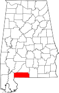 | |
| Towns | ||
| Unincorporated communities | ||
| Indian reservation | ||