Durweston
| Durweston | |
 Parish church of St Nicholas |
|
 Durweston |
|
| Population | 398 [1] |
|---|---|
| OS grid reference | ST858085 |
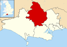
| District | North Dorset |
| Shire county | Dorset |
| Region | South West |
| Country | England |
| Sovereign state | United Kingdom |
| Police | Dorset |
| Fire | Dorset and Wiltshire |
| Ambulance | South Western |
| EU Parliament | South West England |
| UK Parliament | North Dorset |
Coordinates: 50°52′32″N 2°12′08″W / 50.8755°N 2.2022°W
Durweston (/dərˈwɛstən/ dər-WESS-tən) is a village and civil parish in the English county of Dorset. It lies within the North Dorset administrative district, 2 miles (3.2 km) north-west of the town of Blandford Forum. It is sited by the River Stour at the point where it flows out of the Blackmore Vale through a steep, narrow gap between the Dorset Downs and Cranborne Chase. In the 2011 census the parish had a population of 398.[1]
History
In 1086 Durweston appeared in two entries in the Domesday Book, being recorded as Derwinestone and Dervinestone. It was in Pimperne Hundred, had fifteen households and a total taxable value of 6.5 geld units. The tenants-in-chief were Aiulf the chamberlain and Hawise, wife of Hugh son of Grip.[2][3] Dyrwyneston may be another variation.[4]
Durweston parish was previously two parishes: Durweston and Knighton. The present-day parish church is on the site of the church that belonged to Knighton parish; the original Durweston church occupied a site near Durweston Mill, though little trace remains today. The two parishes were combined in 1381 for reasons not known. The current church was mostly rebuilt in 1846, though the tower dates from the 15th century.[5]
A new village hall was opened in Durweston in April 2003. It is a venue for entertainment events and social gatherings, and is also a business conference centre for the wider community of North Dorset.
Geography
Durweston village is sited on the southwest bank of the River Stour at an altitude of 40 to 50 metres (130 to 160 ft).[6] Measured directly, it is 2 miles (3.2 km) northwest of Blandford Forum, 5.5 miles (8.9 km) southeast of Sturminster Newton and 9 miles (14 km) south of Shaftesbury.[7] The A357 main road between Blandford and Sturminster passes through the village. Durweston parish covers 1,800 acres (730 ha) and extends west from the river over chalk hills,[5] reaching an altitude of about 190 metres (620 ft).[6][8]
Culture

Durweston is one of the last places in the area, if not the last, to maintain a tradition known as "shroving", a regional juvenile begging custom of obscure origin.[9] Every Shrove Tuesday children from Durweston Primary School process around the village during the morning, calling on local people, singing songs and giving flowers. Those who are visited may also give the children bread or other tidbits to eat. One suggestion for the tradition's origin is that it is a survival of a medieval dole, though it was unrecorded in the region before the end of the 18th century. By the 1950s it continued in only a few places, and only survives at Durweston due to a bequest in 1925.[9]
For many generations the people who live in Durweston have sung a collection of carols unique to their village, now known as the Durweston Carols. These were probably composed between 1750–1850, and form part of a forgotten repertory from English parish churches. These came to be known as 'gallery carols' because they were often performed by groups of voices and instruments in the west gallery of country parish churches and, until 1877, there was a gallery in Durweston Church. During the Christmas period of 2009, residents of the village and the surrounding area gathered to record and document the Durweston Carols.[10]
Media
Durweston has its own monthly village magazine "Durweston News", as well as a bi-monthly Christian "Benefice Magazine" shared with the neighbouring parishes of Stourpaine, Pimperne and Bryanston.
Miscellaneous
A coastal minesweeper called "HMS Durweston" was launched at the Dorset Yacht Company’s Hamworthy yard on 18 August 1955.
References
- 1 2 "Area: Durweston (Parish), Key Figures for2011 Census: Key Statistics". Neighbourhood Statistics. Office for National Statistics. Retrieved 4 July 2014.
- ↑ "Dorset A–G". The Domesday Book Online. domesdaybook.co.uk. Retrieved 5 July 2014.
- ↑ "Place: Durweston". Open Domesday. domesdaymap.co.uk. Retrieved 5 July 2014.
- ↑ Plea Rolls of the Court of Common Pleas; National Archives; CP 40/541; year 1396; http://aalt.law.uh.edu/AALT6/R2/CP40no541a/aCP40no541afronts/IMG_0148.htm; 5th entry, middle of line 2
- 1 2 "'Durweston', An Inventory of the Historical Monuments in Dorset, Volume 3: Central (1970), pp. 89-92". British History Online. University of London & History of Parliament Trust. November 2013. Retrieved 6 July 2014.
- 1 2 Ordnance Survey 1:50,000 Landranger Map, sheet 194 (Dorchester & Weymouth), published 2010, ISBN 978-0-319-23190-6
- ↑ Bartholomew 1:100,000 National Map Series, sheet 4 (Dorset), published 1980, ISBN 0-7028-0327-8
- ↑ Ordnance Survey 1:25,000 Pathfinder map, sheet ST 80/90 (Blandford Forum), published 1974
- 1 2 Ronald Hutton (2001). Stations of the Sun: A History of the Ritual Year in Britain. Oxford University Press. Retrieved 5 July 2014.
- ↑ http://www.durweston.org.uk/DURWESTONCAROLS.htm
External links
![]() Media related to Durweston at Wikimedia Commons
Media related to Durweston at Wikimedia Commons