Durkee, Oregon
| Durkee, Oregon | |
|---|---|
| Unincorporated community | |
|
Café in Durkee | |
 Durkee, Oregon  Durkee, Oregon | |
| Coordinates: 44°34′56″N 117°27′53″W / 44.58222°N 117.46472°WCoordinates: 44°34′56″N 117°27′53″W / 44.58222°N 117.46472°W | |
| Country | United States |
| State | Oregon |
| County | Baker |
| Elevation | 2,651 ft (808 m) |
| Time zone | Pacific (PST) (UTC-8) |
| • Summer (DST) | PDT (UTC-7) |
| Area code(s) | 458 and 541 |
| GNIS feature ID | 1136236[1] |

Durkee is an unincorporated community in Baker County, Oregon, United States. It has a post office with the ZIP code of 97905.[2] Durkee lies at the Vandercar Road exit of Interstate 84.[3] Durkee is known as the site of Oregon's only cement plant, the Ash Grove Cement Company plant in nearby Nelson. It one of Baker County's largest private employers.[4][5]
Durkee was originally a stage stop called Express, and by the 1860s it was the only transfer point between Umatilla, Oregon, and Boise, Idaho. It prospered as a water stop and telegraph station for the railroad, and later as a stop on Highway 30, the only paved road in the area. The community was platted in 1908, even though the population had already peaked.[6]
References
- ↑ "Durkee". Geographic Names Information System. United States Geological Survey. November 28, 1980. Retrieved November 20, 2016.
- ↑ Zip Code Lookup
- ↑ U.S. Geological Survey Geographic Names Information System: Durkee, Oregon
- ↑ Jacoby, Jayson (March 17, 2014). "U.S. Senator Ron Wyden Visits Baker City". Baker City Herald. Retrieved March 29, 2014.
- ↑ Miller, Jeremy (January 11, 2010). "Mountains of Mercury". High Country News. Retrieved March 29, 2014.
- ↑ Bailey, Barbara Ruth (1982). Main Street: Northeastern Oregon. Oregon Historical Society. p. 51. ISBN 0-87595-073-6.
External links
 Media related to Durkee, Oregon at Wikimedia Commons
Municipalities and communities of Baker County, Oregon, United States | ||
|---|---|---|
| Cities | 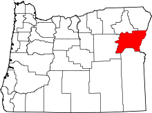 | |
| Unincorporated communities | ||
| Ghost towns | ||
This article is issued from Wikipedia - version of the 11/22/2016. The text is available under the Creative Commons Attribution/Share Alike but additional terms may apply for the media files.