Durbanville
| Durbanville | |
|---|---|
|
Dutch Reformed Church | |
 Durbanville  Durbanville  Durbanville
| |
|
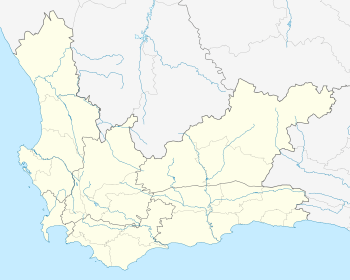
Location within Cape Town 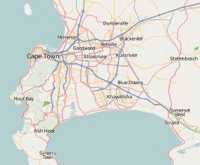 Durbanville | |
| Coordinates: 33°49′57″S 18°38′51″E / 33.83250°S 18.64750°ECoordinates: 33°49′57″S 18°38′51″E / 33.83250°S 18.64750°E | |
| Country | South Africa |
| Province | Western Cape |
| Municipality | City of Cape Town |
| Established | 1825[1] |
| Area[2] | |
| • Total | 27.41 km2 (10.58 sq mi) |
| Population (2011)[2] | |
| • Total | 54,286 |
| • Density | 2,000/km2 (5,100/sq mi) |
| Racial makeup (2011)[2] | |
| • Black African | 5.5% |
| • Coloured | 10.1% |
| • Indian/Asian | 1.0% |
| • White | 82.2% |
| • Other | 1.2% |
| First languages (2011)[2] | |
| • Afrikaans | 58.9% |
| • English | 37.2% |
| • Other | 3.8% |
| Postal code (street) | 7550 |
| PO box | 7551 |
.jpg)
Durbanville is a town in the Western Cape province of South Africa, part of the greater City of Cape Town metropolitan area. Durbanville is a rural residential suburb on the northern outskirts of the metropolis and is surrounded by farms producing wine and wheat.
History
Durbanville was founded in the early 19th century around a fresh water spring and was primarily a watering station for travellers between Cape Town and the interior. Durbanville was originally known as Pampoenkraal (from the Afrikaans words pampoen meaning pumpkin, and kraal meaning corral - an enclosure for livestock).
In 1825 a group of local farmers requested permission from Lord Charles Somerset (governor of the Cape Colony at that time) to build their own church. The Dutch Reformed Church was commenced in 1825 and inaugurated a year later on 6 August 1826. A small village grew between the church and the outspan (overnight stop). During 1836 the inhabitants of Pampoenkraal petitioned the Governor of the Cape Colony, Sir Benjamin d'Urban, for permission to rename the village D'Urban in his honour. Permission was duly granted and the new name persisted until 1886 when it was renamed to Durbanville in order to avoid confusion with Durban - a major port city in the east of South Africa.
Durbanville had its own court house, jail and magistrate from the 1870s and became a Magisterial District of Bellville. The court house complex still exists in altered form within the Rust-en-Vrede complex, originally erected in 1850. A village management board was established in 1897 and a municipality in 1901. The first mayor elected was John King.
The village grew rapidly after the turn of 19th century and a local wagon industry developed. The King Brothers Wagon Works' used to be South Africa's biggest wagon works. At the turn of the century, it employed more than 200 men, which just about accounted for the entire village.
Geography
Durbanville is located around 33°49′57″S 18°38′51″E / 33.83250°S 18.64750°E (-33.83056, 18.65056).
Culture
Afrikaans and English are the main languages spoken in Durbanville. In the past Afrikaans predominated culturally, but this has changed with the rapid development of the town. However the majority (59%) of the town still speaks Afrikaans as a first language. The principal religion of the population is Christianity with a wide variety of churches in the community.
Demographics
According to the 2011 Census, the population of Durbanville was 54,286. The following tables show various demographic data about Durbanville from that census.[3]
- Gender
| Gender | Population | % |
|---|---|---|
| Female | 28 615 | 52.71% |
| Male | 25 671 | 47.29% |
- Ethnic Group
| Group | Population | % |
|---|---|---|
| White | 44 607 | 82.17% |
| Coloured | 5 491 | 10.11% |
| Black African | 2 995 | 5.52% |
| Indian/Asian | 560 | 1.03% |
- Home Language
| Language | Population | % |
|---|---|---|
| Afrikaans | 31 346 | 58.94% |
| English | 19 803 | 37.24% |
| Xhosa | 491 | 0.92% |
| Other African languages | 752 | 1.39% |
| Other languages | 732 | 1.38% |
Education
The town has the following public high schools:
- Durbanville High (an Afrikaans medium school),
- Fairmont High (an English medium school),
- Stellenberg High (an Afrikaans and English medium school).
There are numerous primary schools including:
- Durbanville Preparatory,
- Durbanville Primary,
- Eversdal Primary,
- Gene Louw Primary,
- Kenridge Primary.
The area also has a number of private schools:
Suburban Areas
- Alphen Rise (Residential)
- Amanda Glen (Residential)
- Aurora (Residential)
- Aurora Estate (Residential)
- Avalon Estate (Residential)
- Avenue Heights (Residential)
- Bergsig (Residential)
- Brentwood Park (Residential)
- Durban Villas (Residential)
- D'urbanvale (Residential)
- Durbanville Country Estate (Residential)
- Durbanville Hills (Residential)
- Durbanville Industria (Industrial)
- Durbanville Meadows (Residential)
- Durbell (Residential)
- Durmonte (Residential)
- East Rock (Residential)
- Everglen (Residential)
- Eversdal (Residential)
- Eversdal Heights (Residential)
- Fairtrees (Residential)
- Fisantekraal (Residential)
- Goedemoed (Residential)
- Graanendal (Residential)
- Kenridge (Residential)
- Kenridge Heights (Residential)
- Langeberg Hills (Residential)
- Langeberg Village (Residential)
- Morgenster (Residential)
- Nerina (Residential)
- O'kennedyville (Residential)
- Onze Molen (Residential)
- Parkview village (Residential)
- Pinehurst (Residential)
- Proteaville East (Residential)
- Protea Heights (Residential)
- Rosendal (Residential)
- Rosenpark (Residential)
- Schoongezicht (Residential)
- Sonsig (Residential)
- Sonstraal (Residential)
- Sonstraal Heights (Residential)
- Stellenberg (Residential)
- Stellenryk (Residential)
- Tara (Residential)
- The Crest (Residential)
- Uitzicht (Residential)
- Valmary Park (Residential)
- Vergesig (Residential)
- Vierlanden (Residential)
- Vygeboom (Residential)
- Welgevonden Estate (Residential)
- Wellway Park (Residential)
- Wellway Park East (Residential)
Airfield
Fisantekraal Airfield is located approximately 13 km NE of Durbanville. It is an ex-airforce airfield built circa 1943, where the airforce used to operate Ventura bombers from. It is now in private ownership since 1993. It serves as a general flying airfield, and is a favourite for flight training. Operators at the airfield are Cape Town Flight Training Center and Aerosport Training. The Fighting on Fire organisation also has a summer base at Fisantekraal. The ICAO designator is FAFK and radio frequency is 131.1 MHz, Coord S33 46';E018 44'. Elevation: 400 ft. Runway: 05/23 and 14/32. Avgas fuel is available.
Famous residents
- Mark Shuttleworth, founder of Thawte and second self-funded space tourist.
- Amore Bekker, radio personality, author, MC and columnist.
- Jody Williams, winner of Idols season 4
- Daniele Pascal, French Chanteuse, Actor and Playwright, and owner of Villa Pascal Guest House (B+B) and Theatre
- Duane Vermeulen, rugby union player for Western Province, Stormers and the Springboks.
Coat of arms
The Durbanville municipal council assumed a coat of arms, designed by Ivan Mitford-Barberton and H. Ellis Tomlinson, in April 1948,[4] and registered them at the Bureau of Heraldry in February 1981.[5]
The arms, derived from those of Sir Benjamin d'Urban, were : Or, on a chevron between in chief two six-pointed stars Sable and in base a bunch of grapes proper, three garbs Or. In layman's term, the shield is gold and depicts, from top to bottom, two black six-pointed stars, a blue chevron bearing three golden sheaves of wheat, and a bunch of grapes.
The crest was a red sphinx charged with three golden rings, and the motto Sit nomine digna.
References
- ↑ "Chronological order of town establishment in South Africa based on Floyd (1960:20-26)" (PDF). pp. xlv–lii.
- 1 2 3 4 "Main Place Durbanville". Census 2011.
- ↑ "Durbanville". City of Cape Town - Census 2001. City of Cape Town. Retrieved 10 March 2010.
- ↑ Western Cape Archives : Durbanville Municipal Minutes (12 April 1948).
- ↑ http://www.national.archsrch.gov.za
| Wikimedia Commons has media related to Durbanville. |
.svg.png)