Duerne
| Duerne | |
|---|---|
|
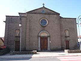
The church of Saint-Jean-Apôtre, in Duerne | |
 Duerne | |
|
Location within Auvergne-Rhône-Alpes region  Duerne | |
| Coordinates: 45°41′07″N 4°31′41″E / 45.6853°N 4.5281°ECoordinates: 45°41′07″N 4°31′41″E / 45.6853°N 4.5281°E | |
| Country | France |
| Region | Auvergne-Rhône-Alpes |
| Department | Rhône |
| Arrondissement | Villefranche-sur-Saône |
| Canton | Vaugneray |
| Intercommunality | Communauté de communes des Hauts du Lyonnais |
| Government | |
| • Mayor (2008–2014) | Jean-Claude Picard |
| Area1 | 11.41 km2 (4.41 sq mi) |
| Population (2006)2 | 728 |
| • Density | 64/km2 (170/sq mi) |
| Time zone | CET (UTC+1) |
| • Summer (DST) | CEST (UTC+2) |
| INSEE/Postal code | 69078 / 69850 |
| Elevation |
516–892 m (1,693–2,927 ft) (avg. 800 m or 2,600 ft) |
|
1 French Land Register data, which excludes lakes, ponds, glaciers > 1 km² (0.386 sq mi or 247 acres) and river estuaries. 2 Population without double counting: residents of multiple communes (e.g., students and military personnel) only counted once. | |
Duerne is a commune in the Rhône department in eastern France.
See also
References
| Wikimedia Commons has media related to Duerne. |
This article is issued from Wikipedia - version of the 10/28/2016. The text is available under the Creative Commons Attribution/Share Alike but additional terms may apply for the media files.