Dublin, Indiana
| Dublin, Indiana | |
|---|---|
| Town | |
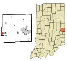 Location in the state of Indiana | |
| Coordinates: 39°48′43″N 85°12′22″W / 39.81194°N 85.20611°WCoordinates: 39°48′43″N 85°12′22″W / 39.81194°N 85.20611°W | |
| Country | United States |
| State | Indiana |
| County | Wayne |
| Township | Jackson |
| Area[1] | |
| • Total | 0.54 sq mi (1.40 km2) |
| • Land | 0.53 sq mi (1.37 km2) |
| • Water | 0.01 sq mi (0.03 km2) |
| Elevation[2] | 1,050 ft (320 m) |
| Population (2010)[3] | |
| • Total | 790 |
| • Estimate (2012[4]) | 782 |
| • Density | 1,490.6/sq mi (575.5/km2) |
| Time zone | EST (UTC-5) |
| • Summer (DST) | EST (UTC-5) |
| ZIP code | 47335 |
| Area code(s) | 765 |
| FIPS code | 18-18766[5] |
| GNIS feature ID | 452038 |
Dublin is a town in Jackson Township, Wayne County, Indiana, United States.[6] The population was 790 at the 2010 census.
History
Dublin was laid out and platted in 1830.[7] It is named after the city of Dublin, Ireland.[8]
The Dublin post office has been in operation since 1833.[9]
The Witt-Champe-Myers House was added to the National Register of Historic Places in 1995.[10]
Geography
Dublin is located at 39°48′43″N 85°12′22″W / 39.81194°N 85.20611°W (39.811806, -85.206166).[11]
According to the 2010 census, Dublin has a total area of 0.54 square miles (1.40 km2), of which 0.53 square miles (1.37 km2) (or 98.15%) is land and 0.01 square miles (0.03 km2) (or 1.85%) is water.[1]
Demographics
| Historical population | |||
|---|---|---|---|
| Census | Pop. | %± | |
| 1850 | 713 | — | |
| 1860 | 967 | 35.6% | |
| 1870 | 1,076 | 11.3% | |
| 1880 | 1,070 | −0.6% | |
| 1890 | 806 | −24.7% | |
| 1900 | 698 | −13.4% | |
| 1910 | 704 | 0.9% | |
| 1920 | 630 | −10.5% | |
| 1930 | 727 | 15.4% | |
| 1940 | 751 | 3.3% | |
| 1950 | 993 | 32.2% | |
| 1960 | 1,021 | 2.8% | |
| 1970 | 1,021 | 0.0% | |
| 1980 | 979 | −4.1% | |
| 1990 | 805 | −17.8% | |
| 2000 | 697 | −13.4% | |
| 2010 | 790 | 13.3% | |
| Est. 2015 | 769 | [12] | −2.7% |

2010 census
As of the census[3] of 2010, there were 790 people, 325 households, and 210 families residing in the town. The population density was 1,490.6 inhabitants per square mile (575.5/km2). There were 367 housing units at an average density of 692.5 per square mile (267.4/km2). The racial makeup of the town was 98.0% White, 0.3% African American, 0.5% Asian, and 1.3% from two or more races. Hispanic or Latino of any race were 0.9% of the population.
There were 325 households of which 31.1% had children under the age of 18 living with them, 52.0% were married couples living together, 9.2% had a female householder with no husband present, 3.4% had a male householder with no wife present, and 35.4% were non-families. 30.8% of all households were made up of individuals and 17.6% had someone living alone who was 65 years of age or older. The average household size was 2.43 and the average family size was 3.05.
The median age in the town was 42.1 years. 22.9% of residents were under the age of 18; 7.3% were between the ages of 18 and 24; 23.3% were from 25 to 44; 27.7% were from 45 to 64; and 18.7% were 65 years of age or older. The gender makeup of the town was 47.2% male and 52.8% female.
2000 census
As of the census[5] of 2000, there were 697 people, 263 households, and 203 families residing in the town. The population density was 1,295.0 people per square mile (498.4/km²). There were 283 housing units at an average density of 525.8 per square mile (202.3/km²). The racial makeup of the town was 99.28% White, 0.14% Asian, and 0.57% from two or more races. Hispanic or Latino of any race were 0.57% of the population.
There were 263 households out of which 37.6% had children under the age of 18 living with them, 61.2% were married couples living together, 9.9% had a female householder with no husband present, and 22.8% were non-families. 20.2% of all households were made up of individuals and 12.5% had someone living alone who was 65 years of age or older. The average household size was 2.65 and the average family size was 3.03.
In the town the population was spread out with 28.1% under the age of 18, 7.2% from 18 to 24, 27.7% from 25 to 44, 23.2% from 45 to 64, and 13.8% who were 65 years of age or older. The median age was 36 years. For every 100 females there were 90.4 males. For every 100 females age 18 and over, there were 86.2 males.
The median income for a household in the town was $31,111, and the median income for a family was $31,488. Males had a median income of $29,028 versus $17,500 for females. The per capita income for the town was $13,656. About 8.6% of families and 13.9% of the population were below the poverty line, including 23.9% of those under age 18 and 5.7% of those age 65 or over.
References
- 1 2 "G001 - Geographic Identifiers - 2010 Census Summary File 1". United States Census Bureau. Retrieved 2015-07-16.
- ↑ "US Board on Geographic Names". United States Geological Survey. October 25, 2007. Retrieved 2016-07-07.
- 1 2 "American FactFinder". United States Census Bureau. Retrieved 2012-12-11.
- ↑ "Population Estimates". United States Census Bureau. Retrieved 2013-06-25.
- 1 2 "American FactFinder". United States Census Bureau. Retrieved 2008-01-31.
- ↑ "Dublin, Indiana". Geographic Names Information System. United States Geological Survey. Retrieved 2016-07-07.
- ↑ Young, Andrew White (1872). History of Wayne County, Indiana, from Its First Settlement to the Present Time. R. Clarke & Company. p. 262.
- ↑ "Profile for Dublin, IN". ePodunk. Retrieved July 7, 2016.
- ↑ "Wayne County". Jim Forte Postal History. Retrieved July 7, 2016.
- ↑ National Park Service (2010-07-09). "National Register Information System". National Register of Historic Places. National Park Service.
- ↑ "US Gazetteer files: 2010, 2000, and 1990". United States Census Bureau. 2011-02-12. Retrieved 2011-04-23.
- ↑ "Annual Estimates of the Resident Population for Incorporated Places: April 1, 2010 to July 1, 2015". Retrieved July 2, 2016.
- ↑ "Census of Population and Housing". Census.gov. Retrieved June 4, 2015.
Municipalities and communities of Wayne County, Indiana, United States | ||
|---|---|---|
| City | ||
| Towns | ||
| Townships | ||
| Unincorporated communities | ||