Downtown East, Minneapolis
| Downtown East | |
|---|---|
| Neighborhood | |
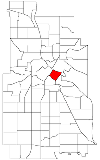 Location of Downtown East within the U.S. city of Minneapolis | |
| Country | United States |
| State | Minnesota |
| County | Hennepin |
| City | Minneapolis |
| Community | Central |
| Area[1] | |
| • Total | 0.384 sq mi (0.99 km2) |
| Population (2010)[2] | |
| • Total | 1,254 |
| • Density | 3,300/sq mi (1,300/km2) |
| Time zone | CST (UTC-6) |
| • Summer (DST) | CDT (UTC-5) |
| ZIP code | 55401, 55415, 55454 |
| Area code(s) | 612 |
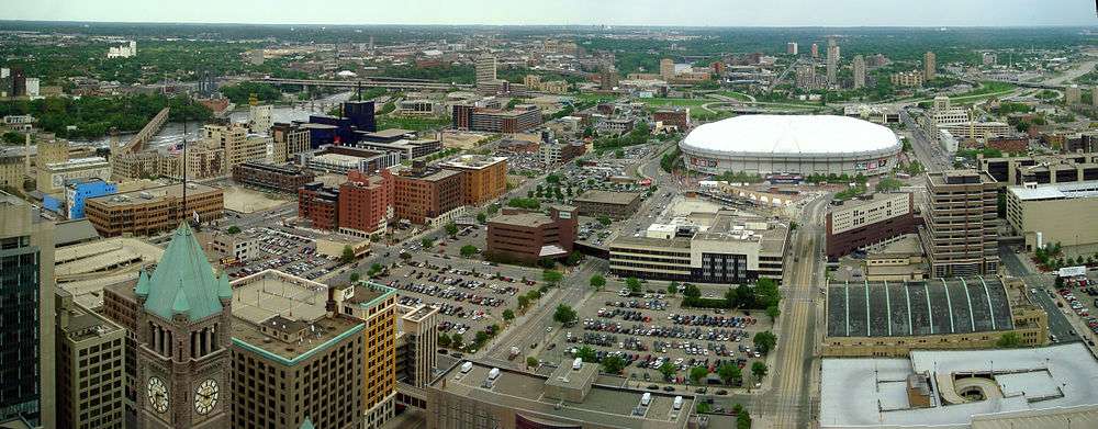
Downtown East is an official neighborhood in Minneapolis, Minnesota, United States part of the larger Central community. Its boundaries are the Mississippi River to the north, Interstate 35W to the east, 5th Street South to the south, and Portland Avenue to the west. It is bounded by the Downtown West, Elliot Park, and Cedar-Riverside neighborhoods. The Marcy-Holmes neighborhood is on the other side of the river, but there is no direct automobile connection between the two neighborhoods. There is a pedestrian and bicycle connection via the Stone Arch Bridge. Downtown East was home to the Hubert H. Humphrey Metrodome, where the Minnesota Twins (MLB baseball), Minnesota Vikings (NFL football), and Minnesota Gophers (NCAA University of Minnesota football) have all played home games. As of 2009, the Minnesota Golden Gophers moved into the new TCF Bank Stadium on the University of Minnesota Campus. Additionally, the Minnesota Twins moved into new Target Field at the start of the 2010 season. In 2016, U.S. Bank Stadium will open on the Metrodome's former site.
Within Downtown East is the Mill District, which contains a number of former industrial properties left over from the days when Minneapolis was the flour milling capital of the world. Many old mills and factories are being converted to housing, bringing a residential population to a neighborhood that beforehand didn't have many residents. The neighborhood is also home to the Mill City Museum, Mill Ruins Park, and the new Guthrie Theater complex, which abandoned its old location near Loring Park during the summer of 2006.
The neighborhood is served by U.S. Bank Stadium Station of the METRO light rail system.
| Historical population | |||
|---|---|---|---|
| Census | Pop. | %± | |
| 1980 | 70 | — | |
| 1990 | 25 | −64.3% | |
| 2000 | 128 | 412.0% | |
| 2010 | 1,254 | 879.7% | |
Coordinates: 44°58′33″N 93°15′16″W / 44.9759°N 93.2545°W[3]
References
- ↑ "Downtown East neighborhood in Minneapolis, Minnesota (MN), 55415 detailed profile". City-Data. 2011. Retrieved 2013-11-12.
- ↑ "Minneapolis Neighborhood Profile: Downtown East" (PDF). Minnesota Compass. October 2011. Retrieved 2013-11-12.
- ↑ Downtown East, Minneapolis, MN. Google Earth. Retrieved 2011-03-09.
External links
- Minneapolis Neighborhood Profile - Downtown East
- 7th Ward, City of Minneapolis
- Downtown Minneapolis Neighborhood Association
 |
Marcy-Holmes | | ||
| Downtown West | |
Cedar-Riverside | ||
| ||||
| | ||||
| Elliot Park | Cedar-Riverside |