Dovras
| Dovras Δοβράς | |
|---|---|
 Dovras | |
|
Location within the regional unit 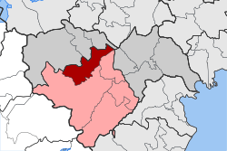 | |
| Coordinates: 40°36′N 22°12′E / 40.600°N 22.200°ECoordinates: 40°36′N 22°12′E / 40.600°N 22.200°E | |
| Country | Greece |
| Administrative region | Central Macedonia |
| Regional unit | Imathia |
| Municipality | Veroia |
| • Municipal unit | 104.1 km2 (40.2 sq mi) |
| Population (2011)[1] | |
| • Municipal unit | 5,313 |
| • Municipal unit density | 51/km2 (130/sq mi) |
| Time zone | EET (UTC+2) |
| • Summer (DST) | EEST (UTC+3) |
| Vehicle registration | ΗΜ |
Dovras (Greek: Δοβράς) is a former municipality in Imathia, Greece. Since the 2011 local government reform it is part of the municipality Veroia, of which it is a municipal unit.[2] In 2011 its population was 5,313. Its area is 104.123 km2.[3] The seat of the municipality was in Agios Georgios. The municipality was created at the 1997 Kapodistrias reform.[4] The road from Veroia to Edessa runs through Dovras. Its main industry is agriculture especially its peach production. In the post-civil war time, there were built houses for young victims of the civil war by the Swiss, as well as founded manufacturies for vocational training (apprenticeship).[5]
Subdivisions
The municipal unit Dovras is subdivided into the following communities (constituent villages in brackets):
- Agios Georgios
- Agia Marina
- Patrida (Patrida, Kali Panagia)
- Trilofo
- Fyteia (Fyteia, Agios Nikolaos, Kostochori, Lianovrochi)
References
- ↑ "Απογραφή Πληθυσμού - Κατοικιών 2011. ΜΟΝΙΜΟΣ Πληθυσμός" (in Greek). Hellenic Statistical Authority.
- ↑ Kallikratis law Greece Ministry of Interior (Greek)
- ↑ "Population & housing census 2001 (incl. area and average elevation)" (PDF) (in Greek). National Statistical Service of Greece.
- ↑ EETAA local government changes
- ↑ http://db.dodis.ch/document/36596