Dover Beaches South, New Jersey
| Dover Beaches South, New Jersey | |
|---|---|
| Census-designated place | |
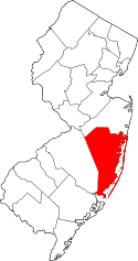
 Map of Dover Beaches South CDP in Ocean County. Inset: Location of Ocean County in New Jersey. | |
| Coordinates: 39°57′19″N 74°04′47″W / 39.955143°N 74.07961°WCoordinates: 39°57′19″N 74°04′47″W / 39.955143°N 74.07961°W | |
| Country |
|
| State |
|
| County | Ocean |
| Township | Toms River |
| Area[1] | |
| • Total | 1.030 sq mi (2.665 km2) |
| • Land | 0.620 sq mi (1.605 km2) |
| • Water | 0.410 sq mi (1.061 km2) 39.80% |
| Elevation[2] | 3 ft (1 m) |
| Population (2010 Census)[3] | |
| • Total | 1,209 |
| • Density | 1,951.5/sq mi (753.5/km2) |
| Time zone | Eastern (EST) (UTC-5) |
| • Summer (DST) | Eastern (EDT) (UTC-4) |
| FIPS code | 3418151[1][4] |
| GNIS feature ID | 02389414[1][5][6] |
Dover Beaches South, more commonly known as Ortley Beach, is an unincorporated community and census-designated place (CDP) located within Toms River, in Ocean County, New Jersey, United States.[7][8][9] As of the 2010 United States Census, the CDP's population was 1,209.[3] Dover Beaches South is situated on the Barnegat Peninsula, a long, narrow barrier peninsula that separates Barnegat Bay from the Atlantic Ocean.
Toms River Township is split by the United States Census Bureau into three CDPs; Toms River CDP on the mainland, comprising over 95% of the township's population, along with the Jersey Shore communities of Dover Beaches North and Dover Beaches South.
Geography
According to the United States Census Bureau, the CDP had a total area of 1.030 square miles (2.665 km2), including 0.620 square miles (1.605 km2) of land and 0.410 square miles (1.061 km2) of water (39.80%).[1][10] The CDP is bordered by the municipalities of Lavallette and Seaside Heights.
Demographics
| Historical population | |||
|---|---|---|---|
| Census | Pop. | %± | |
| 2000 | 1,594 | — | |
| 2010 | 1,209 | −24.2% | |
| Population sources: 2000-2010[9] 2000[11] 2010[3] | |||
Census 2010
At the 2010 United States Census, there were 1,209 people, 664 households, and 330 families residing in the CDP. The population density was 1,951.5 per square mile (753.5/km2). There were 2,658 housing units at an average density of 4,290.3 per square mile (1,656.5/km2). The racial makeup of the CDP was 95.86% (1,159) White, 0.25% (3) Black or African American, 0.00% (0) Native American, 0.17% (2) Asian, 0.00% (0) Pacific Islander, 1.90% (23) from other races, and 1.82% (22) from two or more races. Hispanics or Latinos of any race were 5.87% (71) of the population.[3]
There were 664 households, of which 10.5% had children under the age of 18 living with them, 38.3% were married couples living together, 7.2% had a female householder with no husband present, and 50.3% were non-families. 43.8% of all households were made up of individuals, and 19.9% had someone living alone who was 65 years of age or older. The average household size was 1.82 and the average family size was 2.46.[3]
In the CDP, 9.4% of the population were under the age of 18, 4.5% from 18 to 24, 18.9% from 25 to 44, 34.5% from 45 to 64, and 32.8% who were 65 years of age or older. The median age was 56.3 years. For every 100 females there were 92.2 males. For every 100 females age 18 and over, there were 91.4 males.[3]
Census 2000
As of the 2000 United States Census[4] there were 1,594 people, 862 households, and 422 families residing in the CDP. The population density was 992.7/km² (2,568.6/mi²). There were 2,622 housing units at an average density of 1,632.8/km² (4,225.1/mi²). The racial makeup of the CDP was 92.93% White, 0.46% African American, 0.31% Native American, 0.25% Asian, 0.06% from other races, and 1.38% from two or more races. Hispanic or Latino of any race were 4.13% of the population.[11]
There were 862 households out of which 13.2% had children under the age of 18 living with them, 38.2% were married couples living together, 8.7% had a female householder with no husband present, and 51.0% were non-families. 46.4% of all households were made up of individuals and 18.6% had someone living alone who was 65 years of age or older. The average household size was 1.85 and the average family size was 2.59.[11]
In the CDP the population was spread out with 12.6% under the age of 18, 4.2% from 18 to 24, 26.2% from 25 to 44, 31.2% from 45 to 64, and 25.7% who were 65 years of age or older. The median age was 49 years. For every 100 females there were 94.6 males. For every 100 females age 18 and over, there were 91.6 males.[11]
The median income for a household in the CDP was $38,407, and the median income for a family was $53,811. Males had a median income of $38,984 versus $35,735 for females. The per capita income for the CDP was $26,702. About 5.5% of families and 10.0% of the population were below the poverty line, including 25.9% of those under age 18 and 6.0% of those age 65 or over.[11]
References
- 1 2 3 4 Gazetteer of New Jersey Places, United States Census Bureau. Accessed July 21, 2016.
- ↑ U.S. Geological Survey Geographic Names Information System: Dover Beaches South Census Designated Place, Geographic Names Information System. Accessed January 11, 2013.
- 1 2 3 4 5 6 DP-1 - Profile of General Population and Housing Characteristics: 2010 Demographic Profile Data for Dover Beaches South CDP, New Jersey, United States Census Bureau. Accessed January 12, 2013.
- 1 2 American FactFinder, United States Census Bureau. Accessed September 4, 2014.
- ↑ US Board on Geographic Names, United States Geological Survey. Accessed September 4, 2014.
- ↑ A Cure for the Common Codes: New Jersey, Missouri Census Data Center. Accessed January 11, 2013.
- ↑ GCT-PH1 - Population, Housing Units, Area, and Density: 2010 - County -- County Subdivision and Place from the 2010 Census Summary File 1 for Ocean County, New Jersey, United States Census Bureau. Accessed January 11, 2013.
- ↑ 2006-2010 American Community Survey Geography for New Jersey, United States Census Bureau. Accessed January 11, 2013.
- 1 2 New Jersey: 2010 - Population and Housing Unit Counts - 2010 Census of Population and Housing (CPH-2-32), United States Census Bureau, August 2012. Accessed January 11, 2013.
- ↑ US Gazetteer files: 2010, 2000, and 1990, United States Census Bureau. Accessed September 4, 2014.
- 1 2 3 4 5 DP-1 - Profile of General Demographic Characteristics: 2000 from the Census 2000 Summary File 1 (SF 1) 100-Percent Data for Dover Beaches South CDP, New Jersey, United States Census Bureau. Accessed January 12, 2013.
External links
| Wikivoyage has a travel guide for Ortley Beach. |
| Preceded by Lavallette |
Beaches of New Jersey | Succeeded by Seaside Heights |