Dover, Newfoundland and Labrador
| Dover Shoal Bay, Wellington | |
|---|---|
| Town | |
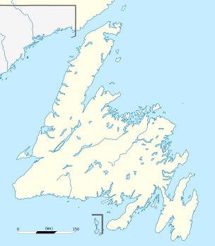 Dover Location of Dover in Newfoundland | |
| Coordinates: 48°52′11″N 53°58′14″W / 48.86972°N 53.97056°W | |
| Country |
|
| Province |
|
| Settled | Early 1890s |
| Population (2011) | |
| • Total | 673 |
| Time zone | Newfoundland Time (UTC-3:30) |
| • Summer (DST) | Newfoundland Daylight (UTC-2:30) |
| Area code(s) | 709 |
Dover is a small incorporated fishing and lumbering village located in a small cove at the head of Freshwater Bay, Bonavista Bay, Newfoundland, Canada. Settled in the early 1890s it was originally known as Shoal Bay, presumably from its many shallow covers and inlets in the area. From the 1950s to the 1970 Shoal Bay was referred to as Wellington (Dover Post Office), whereas the local residents called it Dover.
The first census taken of the community was in 1891 when seventeen people were counted, both lumbermen and fisherman. By 1901 the population had grown to sixty-six people and by 1921 it had grown to 203.
Near Dover is geological feature called the Dover Fault, a major break in the Earth's crust. It is the dividing line for Gondwana and Laurentia that was formed by the Iapetus Ocean.
See also
References
External links
Coordinates: 48°52′11″N 53°58′14″W / 48.86972°N 53.97056°W