Double Springs, Alabama
| Double Springs, Alabama | |
|---|---|
| Town | |
|
Winston County courthouse in Double Springs | |
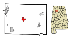 Location in Winston County and the state of Alabama | |
| Coordinates: 34°9′5″N 87°24′15″W / 34.15139°N 87.40417°W | |
| Country | United States |
| State | Alabama |
| County | Winston |
| Area | |
| • Total | 3.9 sq mi (10 km2) |
| • Land | 3.9 sq mi (10 km2) |
| • Water | 0 sq mi (0 km2) |
| Elevation | 823 ft (251 m) |
| Population (2010) | |
| • Total | 1,083 |
| • Density | 257.2/sq mi (100.3/km2) |
| Time zone | Central (CST) (UTC-6) |
| • Summer (DST) | CDT (UTC-5) |
| ZIP code | 35553 |
| Area code(s) | 205 |
| FIPS code | 01-21280 |
| GNIS feature ID | 0159511 |

Double Springs is a town in Winston County, Alabama, United States. The city is the county seat of Winston County.[1] The county seat was initially located at Houston, but by referendum in 1883, Double Springs prevailed and it was removed to there. It was incorporated on May 17, 1943.[2] At the 2010 census the population was 1,083, up from 1,003 in 2000.
Geography
Double Springs is located at 34°9′6″N 87°24′16″W / 34.15167°N 87.40444°W (34.151642, -87.404390).[3]
According to the U.S. Census Bureau, the town has a total area of 3.9 square miles (10 km2), all land.
Demographics
| Historical population | |||
|---|---|---|---|
| Census | Pop. | %± | |
| 1950 | 524 | — | |
| 1960 | 811 | 54.8% | |
| 1970 | 957 | 18.0% | |
| 1980 | 1,057 | 10.4% | |
| 1990 | 1,138 | 7.7% | |
| 2000 | 1,003 | −11.9% | |
| 2010 | 1,083 | 8.0% | |
| Est. 2015 | 1,056 | [4] | −2.5% |
| U.S. Decennial Census[5] 2013 Estimate[6] | |||
As of the census[7] of 2000, there were 1,003 people, 426 households, and 276 families residing in the town. The population density was 259.5 inhabitants per square mile (100.2/km2). There were 486 housing units at an average density of 125.8 per square mile (48.6/km2). The racial makeup of the town was 97.51% White, 0.30% Black or African American, 0.60% Native American, 0.60% from other races, and 1.00% from two or more races. 1.10% of the population were Hispanic or Latino of any race.
There were 426 households out of which 30.3% had children under the age of 18 living with them, 48.6% were married couples living together, 12.7% had a female householder with no husband present, and 35.0% were non-families. 33.6% of all households were made up of individuals and 16.9% had someone living alone who was 65 years of age or older. The average household size was 2.18 and the average family size was 2.75.
In the town the population was spread out with 21.3% under the age of 18, 8.9% from 18 to 24, 28.3% from 25 to 44, 22.9% from 45 to 64, and 18.5% who were 65 years of age or older. The median age was 39 years. For every 100 females there were 93.6 males. For every 100 females age 18 and over, there were 95.8 males.
The median income for a household in the town was $25,865, and the median income for a family was $29,615. Males had a median income of $25,667 versus $20,625 for females. The per capita income for the town was $15,122. About 16.8% of families and 20.3% of the population were below the poverty line, including 29.5% of those under age 18 and 28.2% of those age 65 or over.
2010 census
As of the census[8] of 2010, there were 1,083 people, 412 households, and 260 families residing in the town. The population density was 277.7 people per square mile (108.3/km2). There were 461 housing units at an average density of 118.2 per square mile (46.1/km2). The racial makeup of the town was 97.3% White, 0.6% Black or African American, 0.8% Native American, 0.1% from other races, and .9% from two or more races. .4% of the population were Hispanic or Latino of any race.
There were 412 households out of which 27.2% had children under the age of 18 living with them, 43.4% were married couples living together, 15.5% had a female householder with no husband present, and 36.9% were non-families. 35.0% of all households were made up of individuals and 16.5% had someone living alone who was 65 years of age or older. The average household size was 2.21 and the average family size was 2.82.
In the town the population was spread out with 20.1% under the age of 18, 7.5% from 18 to 24, 22.2% from 25 to 44, 26.2% from 45 to 64, and 24.0% who were 65 years of age or older. The median age was 45.2 years. For every 100 females there were 83.9 males. For every 100 females age 18 and over, there were 89.1 males.
The median income for a household in the town was $30,865, and the median income for a family was $32,232. Males had a median income of $27,450 versus $21,641 for females. The per capita income for the town was $13,973. About 21.1% of families and 25.6% of the population were below the poverty line, including 38.7% of those under age 18 and 11.3% of those age 65 or over.
Travel and entertainment
Double Springs rests inside the William B. Bankhead National Forest, and is near Lewis Smith Lake. The Kinlock Shelter is located near Double Springs.
In 1944, a memorial marker was erected on the courthouse square "To the memory of the Denson Brothers – Seaborn M. Denson (1854-1936) and Thomas J. Denson (1863-1935) who devoted their lives and gifts to composing and teaching American religious folk music as embodied in the Sacred Harp, in most of the Southern States, but mostly in Alabama. This stone is placed in the midst of their field of labor by the loving hands of their families, pupils of their singing schools, and legions of singers and friends in the summer of the year 1944. The One Hundredth Anniversary of the Sacred Harp while 'Uncle Seab' and 'Uncle Tom' sing on – 'way over in the promised land'."
Education
The main offices of the Winston County School System are located in Double Springs. The chief school in Double Springs is Winston County High School, home of the Yellow Jackets. The Winston County Technical Center is also located in Double Springs.
References
- ↑ "Find a County". National Association of Counties. Retrieved 2011-06-07.
- ↑ "Double Springs". Encyclopedia of Alabama. Retrieved 2016-05-27.
- ↑ "US Gazetteer files: 2010, 2000, and 1990". United States Census Bureau. 2011-02-12. Retrieved 2011-04-23.
- ↑ "Annual Estimates of the Resident Population for Incorporated Places: April 1, 2010 to July 1, 2015". Retrieved July 2, 2016.
- ↑ "U.S. Decennial Census". Census.gov. Retrieved June 6, 2013.
- ↑ "Annual Estimates of the Resident Population: April 1, 2010 to July 1, 2013". Retrieved June 3, 2014.
- ↑ "American FactFinder". United States Census Bureau. Retrieved 2008-01-31.
- ↑ "American FactFinder". United States Census Bureau. Retrieved 2015-08-19.
External links
| Wikimedia Commons has media related to Double Springs, Alabama. |
- Double Springs is covered by the Northwest Alabamian Newspaper.
Coordinates: 34°09′06″N 87°24′16″W / 34.151642°N 87.40439°W
Municipalities and communities of Winston County, Alabama, United States | ||
|---|---|---|
| City | 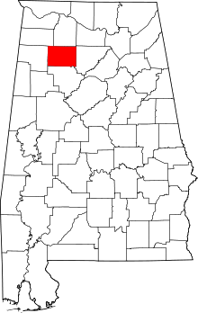 | |
| Towns | ||
| Unincorporated communities | ||
| Ghost town | ||
| Footnotes | ‡This populated place also has portions in an adjacent county or counties | |