Double Mountains (Texas)
| Double Mountains | |
|---|---|
|
Double Mountains, viewed from the south | |
| Highest point | |
| Elevation | 2580+ feet (786+ m) [1][2] |
| Prominence | 540 ft (160 m) [1] |
| Coordinates | 33°03′44″N 100°27′15″W / 33.06222°N 100.45417°WCoordinates: 33°03′44″N 100°27′15″W / 33.06222°N 100.45417°W [3] |
| Geography | |
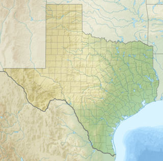 Double Mountains Double Mountains location in Texas | |
| Location | Stonewall County, Texas, U.S. |
| Parent range | Plains of Central Texas[1] |
| Topo map | USGS Double Mountains |
| Geology | |
| Age of rock | Cretaceous (Comanche Series)[4] |
| Mountain type | Erosional remnant |
| Climbing | |
| Easiest route | Drive/hike |

Double Mountains is the name of a pair of flat-topped buttes located 13 miles (21 km) southwest of Aspermont in Stonewall County, Texas.[5] While the Handbook of Texas gives their elevation as either 2,000 ft (610 m)[6] or 2,400 ft (732 m),[5] United States Geological Survey maps give the elevation of the western mountain as 2,523 ft (769 m) [7] and that of the eastern mountain as between 2,580 ft (786 m) and 2,600 ft (792 m).[1][2] Together, the mountains form part of the high ground dividing the watersheds of the Salt Fork and Double Mountain Fork Brazos River.[8]
Rising some 500–800 feet (150–250 m) above the surrounding plains,[2][6] the higher eastern mountain is the highest point in Stonewall County[5] and the most topographically prominent point for almost 160 miles (257 km), the nearest more prominent peak being Mount Scott in Oklahoma.[9] As such an isolated geographical feature, the mountains are visible from a great distance, and feature commanding views from their tops.[2]
Their prominence has long made them important regional landmarks,[6] dating back at least to 1788, when Jose Mares opened a trail from San Antonio to Santa Fe; thereafter, the mountains were waymarkers "for every westward expedition and a rendezvous for buffalo hunters."[8] They were also cited by the surveying party of Randolph B. Marcy in 1849.[6]
Although paved roads do not lead directly to the mountains, they are accessible via paved Farm to Market Roads 2211 and 610 and dirt county roads; a steep dirt road leads up to the summit of each of the pair of mountains. A prominent radio tower stands on the eastern summit.[2]
At one time, Comanche leader Quanah Parker and his band lived on or near the mountains,[10] and according to one source, the mountains were once a sacred place to the Comanches.[11]
Town of Double Mountain
A town of Double Mountain once existed a few miles north of the hills. Established in 1886, the community featured a post office, sheriff, schoolhouse, and Methodist and Baptist churches for several years in the late 19th and early 20th centuries, but had become a ghost town by the 1980s.[6]
See also
References
- 1 2 3 4 "Double Mountains, Texas". Peakbagger.com. Retrieved 2008-08-14.
- 1 2 3 4 5 "Stonewall County High Point Trip Report". Retrieved 2008-08-14.
- ↑ "Double Mountains". Geographic Names Information System. United States Geological Survey.
- ↑ Patton, L.T. 1930. The geology of Stonewall County, Texas. The University of Texas Bulletin No. 3027, 76 pp.
- 1 2 3 "Handbook of Texas Online — Stonewall County". Retrieved 2008-08-14.
- 1 2 3 4 5 "Handbook of Texas Online — Double Mountain". Retrieved 2008-08-14.
- ↑ "Double Mountain (in Stonewall County Texas) Place Profile". Retrieved 2008-08-14.
- 1 2 Hodge, Larry; Syers, Ed (2000). "Backroads of Texas" (4th ed.). Lanham, MD: Lone Star Books.
- ↑ "Prominence Ladder from Double Mountains". Retrieved 2015-01-18.
- ↑ "Quanah Parker - Biography of the Famous Leader". Retrieved 2008-08-22.
- ↑ "Brazos River Canyonlands - Double Mountain". Retrieved 2008-08-22.
External links
- Handbook of Texas Online — Double Mountain
- U.S. Geological Survey Geographic Names Information System: Double Mountains
- Photos of the Llano Estacado and rolling plains of West Texas