Doniphan, Missouri
| Doniphan, Missouri | |
|---|---|
| City | |
 Location of Doniphan, Missouri | |
| Coordinates: 36°37′20″N 90°49′20″W / 36.62222°N 90.82222°WCoordinates: 36°37′20″N 90°49′20″W / 36.62222°N 90.82222°W | |
| Country | United States |
| State | Missouri |
| County | Ripley |
| Area[1] | |
| • Total | 1.38 sq mi (3.57 km2) |
| • Land | 1.38 sq mi (3.57 km2) |
| • Water | 0 sq mi (0 km2) |
| Elevation | 400 ft (122 m) |
| Population (2010)[2] | |
| • Total | 1,997 |
| • Estimate (2012[3]) | 1,994 |
| • Density | 1,447.1/sq mi (558.7/km2) |
| Time zone | Central (CST) (UTC−6) |
| • Summer (DST) | CDT (UTC−5) |
| ZIP code | 63935 |
| Area code(s) | 573 |
| FIPS code | 29-19792[4] |
| GNIS feature ID | 0749678[5] |
Doniphan is a city in Ripley County, Missouri, United States. The population was 1,997 at the 2010 census. It is the county seat of Ripley County.[6]
History
Doniphan was named for Alexander William Doniphan.[7]
Geography
Doniphan is located at 36°37′20″N 90°49′20″W / 36.62222°N 90.82222°W (36.622106, -90.822179).[8] According to the United States Census Bureau, the city has a total area of 1.38 square miles (3.57 km2), all land.[1]
Doniphan is best known for its placement at the heart of the Current River, one of the cleanest rivers in the United States. It draws tourism and is a main attraction of the town. The original town was burned by the Union Army on September 19, 1864, during the American Civil War. The present county courthouse dates to the late 1890s.
Demographics
| Historical population | |||
|---|---|---|---|
| Census | Pop. | %± | |
| 1870 | 146 | — | |
| 1880 | 157 | 7.5% | |
| 1890 | 609 | 287.9% | |
| 1900 | 1,508 | 147.6% | |
| 1910 | 1,225 | −18.8% | |
| 1920 | 1,248 | 1.9% | |
| 1930 | 1,398 | 12.0% | |
| 1940 | 1,604 | 14.7% | |
| 1950 | 1,611 | 0.4% | |
| 1960 | 1,421 | −11.8% | |
| 1970 | 1,850 | 30.2% | |
| 1980 | 1,921 | 3.8% | |
| 1990 | 1,713 | −10.8% | |
| 2000 | 1,932 | 12.8% | |
| 2010 | 1,997 | 3.4% | |
| Est. 2015 | 1,991 | [9] | −0.3% |
2010 census
As of the census[2] of 2010, there were 1,997 people, 852 households, and 485 families residing in the city. The population density was 1,447.1 inhabitants per square mile (558.7/km2). There were 966 housing units at an average density of 700.0 per square mile (270.3/km2). The racial makeup of the city was 96.64% White, 0.15% Black or African American, 0.55% Native American, 0.80% Asian, 0.80% from other races, and 1.05% from two or more races. Hispanic or Latino of any race were 1.70% of the population.
There were 852 households of which 29.8% had children under the age of 18 living with them, 35.9% were married couples living together, 15.1% had a female householder with no husband present, 5.9% had a male householder with no wife present, and 43.1% were non-families. 38.7% of all households were made up of individuals and 22.6% had someone living alone who was 65 years of age or older. The average household size was 2.27 and the average family size was 2.97.
The median age in the city was 39.4 years. 24.5% of residents were under the age of 18; 8.9% were between the ages of 18 and 24; 23.2% were from 25 to 44; 20.9% were from 45 to 64; and 22.7% were 65 years of age or older. The gender makeup of the city was 45.2% male and 54.8% female.
2000 census
As of the census[4] of 2000, there were 1,932 people, 844 households, and 480 families residing in the city. The population density was 1,412.5 people per square mile (544.5/km²). There were 951 housing units at an average density of 695.3 per square mile (268.0/km²). The racial makeup of the city was 98.60% White, 0.36% Native American, 0.47% Asian, 0.05% Pacific Islander, 0.10% from other races, and 0.41% from two or more races. Hispanic or Latino of any race were 0.62% of the population.
There were 844 households out of which 25.5% had children under the age of 18 living with them, 39.6% were married couples living together, 14.3% had a female householder with no husband present, and 43.1% were non-families. 40.9% of all households were made up of individuals and 27.0% had someone living alone who was 65 years of age or older. The average household size was 2.11 and the average family size was 2.83.
In the city the age distribution of the population shows 21.2% under the age of 18, 7.0% from 18 to 24, 21.9% from 25 to 44, 19.3% from 45 to 64, and 30.5% who were 65 years of age or older. The median age was 45 years. For every 100 females there were 71.1 males. For every 100 females age 18 and over, there were 68.7 males.
The median income for a household in the city was $19,696, and the median income for a family was $29,875. Males had a median income of $23,438 versus $18,981 for females. The per capita income for the city was $14,407. About 19.8% of families and 25.9% of the population were below the poverty line, including 32.3% of those under age 18 and 25.8% of those age 65 or over.
Climate
Climate is characterized by relatively high temperatures and evenly distributed precipitation throughout the year. The Köppen climate classification subtype for this climate is "Cfa" (Humid Subtropical Climate).[11]
| Climate data for Doniphan, Missouri | |||||||||||||
|---|---|---|---|---|---|---|---|---|---|---|---|---|---|
| Month | Jan | Feb | Mar | Apr | May | Jun | Jul | Aug | Sep | Oct | Nov | Dec | Year |
| Average high °C (°F) | 8 (46) |
10 (50) |
15 (59) |
22 (71) |
26 (78) |
31 (87) |
33 (91) |
32 (89) |
28 (82) |
22 (71) |
15 (59) |
9 (48) |
20 (68) |
| Average low °C (°F) | −4 (24) |
−2 (28) |
1 (33) |
7 (44) |
11 (51) |
16 (60) |
18 (64) |
18 (64) |
13 (55) |
6 (42) |
1 (33) |
−3 (26) |
6 (42) |
| Average precipitation mm (inches) | 94 (3.7) |
86 (3.4) |
117 (4.6) |
130 (5) |
122 (4.8) |
100 (4) |
97 (3.8) |
99 (3.9) |
97 (3.8) |
81 (3.2) |
107 (4.2) |
94 (3.7) |
1,220 (48) |
| Source: Weatherbase [12] | |||||||||||||
Notable person
- Larry Dale Lee, foreign correspondent, grew up in Doniphan. He began his career at The Prospect-News.
- Billy Yates, An American country singer, born and raised in Doniphan, MO. He has released 10 studio albums and has charted 4 singles including "Flowers" in 1997, which ranked 36 on the Billboard country charts.
References
- 1 2 "US Gazetteer files 2010". United States Census Bureau. Retrieved 2012-07-08.
- 1 2 "American FactFinder". United States Census Bureau. Retrieved 2012-07-08.
- ↑ "Population Estimates". United States Census Bureau. Retrieved 2013-05-30.
- 1 2 "American FactFinder". United States Census Bureau. Retrieved 2008-01-31.
- ↑ "US Board on Geographic Names". United States Geological Survey. 2007-10-25. Retrieved 2008-01-31.
- ↑ "Find a County". National Association of Counties. Retrieved 2011-06-07.
- ↑ Gannett, Henry (1905). The Origin of Certain Place Names in the United States. Govt. Print. Off. p. 107.
- ↑ "US Gazetteer files: 2010, 2000, and 1990". United States Census Bureau. 2011-02-12. Retrieved 2011-04-23.
- ↑ "Annual Estimates of the Resident Population for Incorporated Places: April 1, 2010 to July 1, 2015". Retrieved July 2, 2016.
- ↑ "Census of Population and Housing". Census.gov. Retrieved June 4, 2015.
- ↑ Climate Summary for Doniphan, Missouri
- ↑ "Weatherbase.com". Weatherbase. 2013. Retrieved on August 6, 2013.
External links
- 2008 Doniphan, Missouri
- Historic maps of Doniphan in the Sanborn Maps of Missouri Collection at the University of Missouri
Municipalities and communities of Ripley County, Missouri, United States | ||
|---|---|---|
| Cities | 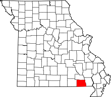 | |
| Townships |
| |
| CDPs | ||
| Other unincorporated communities | ||
| Footnotes | ‡This populated place also has portions in an adjacent county or counties | |