Dolph, Oregon
Dolph (also known as Dolph Junction)[1] is an unincorporated community in Tillamook County, Oregon, United States, near the Yamhill County line.[2] It is currently located at the junction of Oregon Route 22 and Oregon Route 130 between Grande Ronde and Hebo, on the Little Nestucca River. It is within the Siuslaw National Forest in the Northern Oregon Coast Range[2] and is considered ghost town.
Dolph was named for U.S. Senator Joseph N. Dolph.[3][4] The original site of the community was at a toll gate and traveler's rest stop at the summit of the stagecoach road from the Willamette Valley to the Oregon Coast on the Tillamook-Yamhill county line.[5] The county line was later moved west, so that the old town was in Yamhill County.[6] The Dolph Toll Road, built by Jordan Fuqua between 1878 and 1882, went from Grand Ronde to Woods.[5] Dolph post office opened there in 1886, and a school was started in 1889.[3][5] At one time the community at the summit also had a hotel, a store, a sawmill, a barrel and stave factory, a livery stable, a blacksmith shop, and a campground.[3]
About a half mile from the current site of Dolph at the junction of OR 22 and OR 130, there was another toll gate and the blacksmith shop of George Baxter, who maintained the road that followed the Little Nestucca River.[5] Baxter also was the proprietor of a sulphur springs resort there.[5] Soaking in mineral springs for one's health was a popular pastime in the late 19th to mid-20th century.
In 1916–1917, a new public road was built from the Little Nestucca road over Sourgrass Summit to join the old road at the summit at Dolph.[5] Because the new route to the coast was free, there was no longer a need to collect tolls and the town no longer had a reason to exist.[5] As a result, the school was moved to west of OR 22 near Baxter's hot springs resort.[5] The post office closed in 1921.[3] Dolph school closed in 1930 when it was combined with the Castle Rock school to form Hebo School District.[5] By the 1970s, nothing remained at the old town site but an apple orchard and a small cemetery on a hilltop a half a mile away.[5]
Today there is also nothing left at the new town site at the junction, although as of 1940, there was still a hot springs resort near there.[5][7] Photos show a store and hotel building at the highway junction as recently as the mid-1960s; it is now demolished.
Polk County
There is also a historic locale named Dolph in Polk County; it was a station on the Southern Pacific Railroad.[8] The station was also known as "Brown".[8]
References
- ↑ "Sinkhole Closes Highway 22". Tillamook Headlight-Herald. December 9, 2015. Retrieved December 9, 2015.
- 1 2 "Dolph". Geographic Names Information System. United States Geological Survey. November 28, 1980. Retrieved 2010-01-07.
- 1 2 3 4 McArthur, Lewis A.; McArthur, Lewis L. (2003) [1928]. Oregon Geographic Names (7th ed.). Portland, Oregon: Oregon Historical Society Press. ISBN 978-0875952772.
- ↑ Gannett, Henry (1905). The Origin of Certain Place Names in the United States. Govt. Print. Off. p. 107.
- 1 2 3 4 5 6 7 8 9 10 11 McKillip, Lloyd. "History: Dolph, Oregon". southtillamookcounty.com. Retrieved 2010-01-07.
- ↑ "Interactive Map of Oregon County Formation History". Maps of Oregon. Retrieved January 23, 2016.
- ↑ Writers' Program of the Work Projects Administration in the State of Oregon (1940). Oregon: End of the Trail. American Guide Series. Portland, Oregon: Binfords & Mort. p. 494. OCLC 4874569.
- 1 2 "Dolph". Geographic Names Information System. United States Geological Survey. August 1, 1994. Retrieved 2010-01-07.
External links
- 1909 image of Dolph from the Oregon Postcard Index
- Historic images of Dolph from Salem Public Library
- Images of the former Dolph Toll Road from the Historic American Engineering Record
- Historic images of South Tillamook County from the Headlight Herald; the first three images are of Dolph
- Location of Dolph in Polk County: 44°56′38″N 123°17′40″W / 44.9440066°N 123.2945470°W
Municipalities and communities of Tillamook County, Oregon, United States | ||
|---|---|---|
| Cities | 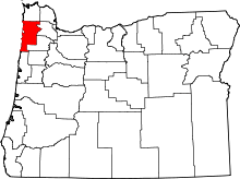 | |
| CDPs |
| |
| Unincorporated communities | ||
Coordinates: 45°06′20″N 123°47′23″W / 45.1056653°N 123.7898358°W