Dogtown, Massachusetts

Dogtown (also Dogtown Commons or Dogtown Common or Dogtown Village) is an abandoned inland settlement on Cape Ann in Massachusetts.
History
Once known as the Common Settlement and populated by respectable citizens, the area later known as Dogtown is divided between the city of Gloucester and the town of Rockport. It is in an area not particularly suited to agriculture, due to poor and very rocky soil. Nevertheless it was settled, beginning in 1693, because its inland location afforded protection from pirates and from enemy natives. Another attraction was that the area lay on what was originally the only direct land route between Sandy Bay (Rockport's original name) and Gloucester. The peak of population, from 1750-1800, is estimated at around 100 families.
After new coastal roads were opened and, especially after the conclusion of the War of 1812 and its attendant risk of coastal bombardment, most farmers moved away from Dogtown. For a few decades their abandoned houses were occupied by itinerants and vagabonds, giving the area its bad reputation. Many of the widows of sea-goers and soldiers who never returned kept dogs for protection and company. As these last inhabitants died their pets became feral, roaming the moors and howling, possibly giving rise to the nickname "Dogtown."
Some of the last occupants were suspected of practicing witchcraft, including Thomazine "Tammy" Younger, whom some knew as the "Queen of the Witches." Tammy lived on Fox Hill, by Alewife Brook, and would reputedly place a curse on teams of oxen carrying fish from the harbor as they crossed the bridge there, unless their driver paid her a "toll". A reputed witch often associated with Dogtown was Peg Wesson, but she lived in Gloucester. The last resident of Dogtown, a freedman named Cornelius "Black Neil" Finson, was found half-dead living in a cellar-hole in the winter, and was removed to the poorhouse in Gloucester in 1830; he died shortly afterward.

Most of the area of Dogtown is now a dense woodland, criss-crossed and bisected by trails and old roads. Dogtown Road off of Cherry Street in the western section (the Gloucester side) is lined with the remains of the cellar holes of the settlers, many of which are numbered in correspondence with names from John J. Babson's book of the history of Gloucester. Babson's grandson, Roger Babson, is known for, among other things, his commissioning of unemployed stonecutters to carve inspirational inscriptions on approximately three dozen boulders in Dogtown during the Great Depression. Babson also mapped and numbered the cellar holes left from the homes of Dogtown's former residents.
Most of the land is held in trust by Gloucester and Rockport and is therefore protected in perpetuity. The current state of Dogtown affords rich recreation opportunities to hikers and bikers, dog-walkers, nature lovers, cross-country skiers, geologists and historians. The area is peppered with house-sized boulders, including one named "The Whale's Jaw," which it resembled before collapsing after a picnic campfire got out of control in 1989. The northwest corner of Dogtown is known as the Norton Memorial forest and covers 121 acres. This land is named for Frederick Norton, a NASA physicist and MIT professor whose family owned land on the outskirts of Dogtown. Beginning in the 1930s, Norton planted more than a 100,000 trees and forty different species of ferns there, and also forged and maintained trails nearby. [1]
-

Cellar Hole #15 in Dogtown Common
-

Carved Boulder at Dogtown Square
-

Babson Boulder near Dogtown Square
-

Another Babson Boulder farther up Dogtown Road from the Square
-

Babson Boulder near the MBTA tracks indicating the direction of Rockport
Reference in popular culture
- In a novel from French-Canadian writer Sylvain Johnson named "La Mémoire du Tueur" - The Memory of a killer. Action taking place in Dogtown for most of the novel.
- In a novel by Anita Diamant "The Last Days of Dogtown".
- "Dogtown", a song by Harry Chapin[2]
References
- ↑ East, Elyssa. Dogtown: Death and Enchantment in a New England Ghost Town. New York: Free Press, 2009. Print. p. 17, 199
- ↑ "Harry Chapin Lyrics – Dogtown Lyrics". MetroLyrics. Retrieved November 24, 2016.
Sources
- In the Heart of Cape Ann, or The Story of Dogtown by Charles E. Mann (Proctor Brothers, Publishers; Gloucester, Mass.), 1897
Further reading
- Dogtown Days by Eileen Day McGrath (2009), JLH Publishing. A novel set in Dogtown.
- "The Last Days of Dogtown: A Novel" by Anita Diamant (2005), Scribner. A novel set in Dogtown
- East, Elyssa (2009). Dogtown: Death and Enchantment in a New England Ghost Town. New York, New York: Free Press. p. 291. ISBN 9781416587057.
- Carlotto, Mark (2012). The Island Woods: Abandoned Settlement, Granite Quarries, and Enigmatic Boulders of Cape Ann, Massachusetts. CreateSpace. p. 82. ISBN 9781466492875.
- Gage, Mary (2012). The Stones of Dogtown & Beyond: Dogtown to Poole Hill. Amesbury, MA: Powwow River Books. p. 48. ISBN 9780981614151.
External links
- Dogtown: Location, History and Legends
- Babson Boulders at Dogtown
- Babson Boulders Trail Map (w photos & GPS)
- http://www.dogtownecologywalks.com Ecological guide to some Dogtown trails
Coordinates: 42°38′11″N 70°39′40″W / 42.636492°N 70.661023°W
Municipalities and communities of Essex County, Massachusetts, United States | ||
|---|---|---|
| Cities | 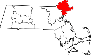 | |
| Towns | ||
| CDPs | ||
| Other villages | ||
Subject of song by Harry Chapin
Boston (capital) | |
| Topics |
|
| Society | |
| Regions | |
| Counties | |
| Cities |
|