Dodington Park
Dodington Park is a country house and estate in Dodington, Gloucestershire, England. Various buildings on the estate are Grade I listed buildings.
It was bought in 2003 by Sir James Dyson for £15 million.
History
The Codrington family acquired the estate in the late 16th century, when there was a large gabled Elizabethan house and adjoining church. In the 18th century the family became wealthy from sugar plantations in the West Indies (see History of the British West Indies) and undertook work on the estate. The grounds of 240 ha were laid out around 1764 by Capability Brown and were modified in 1793 by William Emes and John Webb.[1]
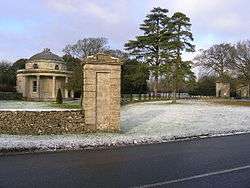
The current house was built by James Wyatt between 1798 and 1813 for Christopher Bethell Codrington. It is built in the Roman classical style from Bath stone and has a slate roof. Each facade is different, the south front having seven bays separated by Corinthian pilasters. From the north west corner of the house, a curving conservatory acts as a covered approach to the church, which was also rebuilt by Wyatt. A formal garden was added in 1930. The house, the church and Bath Lodge by the southern entrance in Tormarton are all grade I listed buildings.[1]
The estate remained in the Codrington family until 1980 when it was sold along with the family papers during divorce proceedings. These amazing documents recorded the activities of three generations of Codrington, each called Christopher, who owned estates in Barbados, Antigua and the whole island of Barbuda for two centuries. The papers provided a record of the history of slavery and the history of the West Indies over the course of three hundred years.[2]
References
- 1 2 "Name: Dodington House List entry Number: 1211169". English Heritage. Retrieved 9 August 2014.
- ↑ Michael Wood (2001). In Search of England: Journeys Into the English Past. University of California Press. pp. 292–293. ISBN 978-0-520-23218-1.
Further reading
- "Footsteps into History - Dodington" in the Bristol Post
- Legacies of British Slave-ownership: Sir Christopher Bethell-Codrington Bart.
- English Heritage listing for Dodington Park
- "The Building of Dodington Park" by Anne Warren. In Architectural History, Vol. 34, (1991), pp. 171–195.
Coordinates: 51°31′1.5″N 2°21′29″W / 51.517083°N 2.35806°W