Doddridge County, West Virginia
| Doddridge County, West Virginia | |
|---|---|
 | |
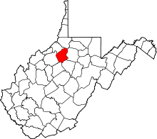 Location in the U.S. state of West Virginia | |
 West Virginia's location in the U.S. | |
| Founded | February 4, 1845 |
| Named for | Philip Doddridge |
| Seat | West Union |
| Largest town | West Union |
| Area | |
| • Total | 320 sq mi (829 km2) |
| • Land | 320 sq mi (829 km2) |
| • Water | 0.8 sq mi (2 km2), 0.2% |
| Population (est.) | |
| • (2015) | 8,176 |
| • Density | 26/sq mi (10/km²) |
| Congressional district | 1st |
| Time zone | Eastern: UTC-5/-4 |
| Website |
www |

Doddridge County is a county located in the U.S. state of West Virginia. Its county seat is West Union.[1]
Doddridge County is included in the Clarksburg, WV Micropolitan Statistical Area.
History
The area that became Doddridge County, Virginia — now West Virginia — was first settled in the late 1780s by James Caldwell, who owned 20,000 acres (81 km2) of land that included present West Union. Caldwell sold this land to Nathan Davis, Jr (1772-1866) and his brothers about 1807. They in turn sold 16,000 acres (65 km2) to Lewis Maxwell (1790-1862), a Virginia Assembly delegate in the 1820s who later became a U.S. Congressman. In 1828 Ephraim Bee, Sr (1802–1888) and his wife Catherine established a log home on Meathouse Fork of Middle Island Creek, now part of West Union. They built an Inn across the "Creek" (really a river) at what was then being called Lewisport (Congressman Maxwell's namesake), below a blockhouse on the Northwestern Turnpike. The "Beehive Inn" became a very popular place for travelers and locals to meet, refresh themselves and re-provision. Bee operated the first local blacksmith shop; a farm, stables, tannery and horse-racing track soon followed.
According to Ephraim's father, A.A. Bee: "The first bridge across Middle Island Creek [at West Union] was of hewed logs with a center abutment of stones. In the great flood of 1835 it was washed away". In 1842, a contract was awarded to the well-known civil engineer Claudius Crozet to build a new covered bridge at West Union, as part of a series of public works along the Turnpike. Ephraim Bee was by this time a district officer, magistrate, state legislator, hotelier, and postmaster. As blacksmith, he made all the bolts and bands for the West Union Covered Bridge, completed in 1843.
When it was announced that Doddridge County would be formed, Ephraim Bee rallied to locate the county seat at Lewisport. But Nathan Davis, Jr (who was Ephraim's wife's uncle), Randolph, and others, won out in favor of West Union, across the river. Doddridge County was officially created in 1845 from parts of Harrison, Tyler, Ritchie, and Lewis Counties of what was then still Virginia. It was named for Philip Doddridge (1773–1832), the late distinguished statesman of western Virginia,[2][3] who had actually spent the greater part of his life in Brooke County.
On the night of March 27, 1858, a fire utterly devastated the town of West Union.
Maxwell Ridge — named for the Congressman's family — is said to have a cave (Gatrell Cave) that was used by the Underground Railroad in the years leading up to the Civil War.[4] Another nearby grotto, Jaco Cave, is said to have been used for the same purpose.
The county seat of West Union was incorporated on 20 July 1881.
Doddridge County’s oil and gas industry was an enormous boon to residents. The first oil pool in the county, at Center Point, was discovered ("brought in" as it was then termed) and drilled in 1892. This was an extension of the technology and boom of the western Pennsylvania oil and gas fields into Tyler and Doddridge Counties. Many farm owners, and sons of farm owners, split their time between their farmwork and the petroleum operations. Almost every local farm benefited from this as free gas was piped to the farmhouses of many landowners. Gas was very quickly being used locally for heating, lighting, and cooking, which replaced the wood stoves and kerosene and candles of previous generations. By 1906, the Ideal Glass Factory opened to take advantage of the abundant natural gas. It was followed by the Doddridge County Window Glass Company. The two plants employed about 300 people. In later years a garment factory opened, but closed in the 1970s.
A long-remembered flood devastated West Union in June 1950, destroying homes and businesses and killing more than 20 people throughout the county. (One casualty was the 107-year-old covered bridge.)
Today farming, timbering, oil and gas, and the business of county government and public education support the area, and many people commute to jobs in Salem, Clarksburg, and Parkersburg, or to the North Central Regional Jail in Greenwood.[4]
The Lathrop Russell Charter House, Doddridge County Courthouse, Silas P. Smith Opera House, and W. Scott Stuart House are individually listed on the National Register of Historic Places.[5] West Union is also home to two nationally recognized historic districts: West Union Downtown Historic District and West Union Residential Historic District.
Geography
According to the U.S. Census Bureau, the county has a total area of 320 square miles (830 km2), of which 320 square miles (830 km2) is land and 0.8 square miles (2.1 km2) (0.2%) is water.[6]
Major highways
Adjacent counties
- Wetzel County (north)
- Harrison County (east)
- Lewis County (southeast)
- Gilmer County (south)
- Ritchie County (west)
- Tyler County (northwest)
Demographics
| Historical population | |||
|---|---|---|---|
| Census | Pop. | %± | |
| 1850 | 2,750 | — | |
| 1860 | 5,203 | 89.2% | |
| 1870 | 7,076 | 36.0% | |
| 1880 | 10,552 | 49.1% | |
| 1890 | 12,183 | 15.5% | |
| 1900 | 13,689 | 12.4% | |
| 1910 | 12,672 | −7.4% | |
| 1920 | 11,976 | −5.5% | |
| 1930 | 10,488 | −12.4% | |
| 1940 | 10,923 | 4.1% | |
| 1950 | 9,026 | −17.4% | |
| 1960 | 6,970 | −22.8% | |
| 1970 | 6,389 | −8.3% | |
| 1980 | 7,433 | 16.3% | |
| 1990 | 6,994 | −5.9% | |
| 2000 | 7,403 | 5.8% | |
| 2010 | 8,202 | 10.8% | |
| Est. 2015 | 8,176 | [7] | −0.3% |
| U.S. Decennial Census[8] 1790–1960[9] 1900–1990[10] 1990–2000[11] 2010–2015[12] | |||
2000 census
As of the 2010 census, the population was 8,202.[12]
As of the census[13] of 2000, there were 7,403 people, 2,845 households, and 2,102 families residing in the county. The population density was 23 people per square mile (9/km²). There were 3,661 housing units at an average density of 11 per square mile (4/km²). The racial makeup of the county was 98.31% White, 0.27% Black or African American, 0.31% Native American, 0.15% Asian, 0.14% from other races, and 0.82% from two or more races. 0.57% of the population were Hispanic or Latino of any race.
There were 2,845 households out of which 32.50% had children under the age of 18 living with them, 59.30% were married couples living together, 10.30% had a female householder with no husband present, and 26.10% were non-families. 22.50% of all households were made up of individuals and 10.90% had someone living alone who was 65 years of age or older. The average household size was 2.56 and the average family size was 2.98.
In the county, the population was spread out with 25.00% under the age of 18, 8.40% from 18 to 24, 26.60% from 25 to 44, 25.10% from 45 to 64, and 14.80% who were 65 years of age or older. The median age was 39 years. For every 100 females there were 101.90 males. For every 100 females age 18 and over, there were 98.10 males.
The median income for a household in the county was $26,744, and the median income for a family was $30,502. Males had a median income of $26,902 versus $20,250 for females. The per capita income for the county was $13,507. About 15.30% of families and 19.80% of the population were below the poverty line, including 23.00% of those under age 18 and 13.60% of those age 65 or over.
2010 census
As of the 2010 United States Census, there were 8,202 people, 3,099 households, and 2,169 families residing in the county.[14] The population density was 25.7 inhabitants per square mile (9.9/km2). There were 3,946 housing units at an average density of 12.3 per square mile (4.7/km2).[15] The racial makeup of the county was 97.0% white, 1.4% black or African American, 0.3% American Indian, 0.2% Asian, 0.1% from other races, and 1.1% from two or more races. Those of Hispanic or Latino origin made up 0.5% of the population.[14] In terms of ancestry, 24.3% were German, 16.8% were Irish, 11.7% were English, 10.3% were American, and 6.1% were French Canadian.[16]
Of the 3,099 households, 28.6% had children under the age of 18 living with them, 55.7% were married couples living together, 9.1% had a female householder with no husband present, 30.0% were non-families, and 26.1% of all households were made up of individuals. The average household size was 2.41 and the average family size was 2.87. The median age was 42.4 years.[14]
The median income for a household in the county was $30,019 and the median income for a family was $34,016. Males had a median income of $30,219 versus $21,121 for females. The per capita income for the county was $14,658. About 15.4% of families and 25.1% of the population were below the poverty line, including 36.7% of those under age 18 and 20.2% of those age 65 or over.[17]
Politics
| Year | Republican | Democrat |
|---|---|---|
| 2016 | 82.38% 2,347 | 12.64% 360 |
| 2012 | 76.78% 2,130 | 20.73% 575 |
| 2008 | 73.49% 2,218 | 24.35% 735 |
| 2004 | 74.30% 2,362 | 25.17% 800 |
| 2000 | 69.42% 1,955 | 27.45% 773 |
Communities
Town
- West Union (county seat)
Unincorporated communities
Notable natives and residents
- Matthew M. Neely, only West Virginian to serve in both houses of the US Congress and as governor.
- J. H. Diss DeBar, designed the Great Seal and Coat of Arms of West Virginia.
- Bantz J. Craddock, four-star U.S. Army general.
- Ephraim Bee, founder of the Ancient and Honorable Order of E Clampus Vitus.
- Lewis Maxwell (1790 - 1862), U.S. Representative from Virginia
- Clyde Ware, novelist (The Eden Tree) and television and motion picture director and screenwriter (No Drums, No Bugles).
See also
- List of Places on the National Historic Register in Doddridge County West Virginia
- North Bend Rail Trail
References
Citations
- ↑ "Find a County". National Association of Counties. Retrieved 2011-06-07.
- ↑ Gannett, Henry (1905). The Origin of Certain Place Names in the United States. Govt. Print. Off. p. 107.
- ↑ http://www.wvculture.org/history/counties/doddridge.html
- 1 2 Frank Engle McCallum (November 12, 2010). "The West Virginia Encyclopedia: West Union". West Virginia Humanities Council. Retrieved 2011-07-23.
- ↑ National Park Service (2009-03-13). "National Register Information System". National Register of Historic Places. National Park Service.
- ↑ "2010 Census Gazetteer Files". United States Census Bureau. August 22, 2012. Retrieved July 24, 2015.
- ↑ "County Totals Dataset: Population, Population Change and Estimated Components of Population Change: April 1, 2010 to July 1, 2015". Retrieved July 2, 2016.
- ↑ "U.S. Decennial Census". United States Census Bureau. Retrieved January 9, 2014.
- ↑ "Historical Census Browser". University of Virginia Library. Retrieved January 9, 2014.
- ↑ "Population of Counties by Decennial Census: 1900 to 1990". United States Census Bureau. Retrieved January 9, 2014.
- ↑ "Census 2000 PHC-T-4. Ranking Tables for Counties: 1990 and 2000" (PDF). United States Census Bureau. Retrieved January 9, 2014.
- 1 2 "State & County QuickFacts". United States Census Bureau. Retrieved January 9, 2014.
- ↑ "American FactFinder". United States Census Bureau. Retrieved 2011-05-14.
- 1 2 3 "DP-1 Profile of General Population and Housing Characteristics: 2010 Demographic Profile Data". United States Census Bureau. Retrieved 2016-04-03.
- ↑ "Population, Housing Units, Area, and Density: 2010 - County". United States Census Bureau. Retrieved 2016-04-03.
- ↑ "DP02 SELECTED SOCIAL CHARACTERISTICS IN THE UNITED STATES – 2006-2010 American Community Survey 5-Year Estimates". United States Census Bureau. Retrieved 2016-04-03.
- ↑ "DP03 SELECTED ECONOMIC CHARACTERISTICS – 2006-2010 American Community Survey 5-Year Estimates". United States Census Bureau. Retrieved 2016-04-03.
- ↑ "Dave Leip's Atlas of U.S. Presidential Elections". Retrieved 2016-11-18.
Other sources
- Corathers, Lily Smith (1927), History of Nutter's Fork Community; Doddridge County Agricultural Extension Division.
External links
| Wikimedia Commons has media related to Doddridge County, West Virginia. |
- Doddridge County Public Library
- Doddridge County Fair Commission, Inc.
- Doddridge County Community Foundation
- WVGenWeb Doddridge County
- WVU Doddridge County Extension Service
 |
Tyler County | Wetzel County | | |
| Ritchie County | |
Harrison County | ||
| ||||
| | ||||
| Gilmer County | Lewis County |
Municipalities and communities of Doddridge County, West Virginia, United States | ||
|---|---|---|
| Town | | |
| Unincorporated communities | ||
Coordinates: 39°16′N 80°42′W / 39.26°N 80.70°W