Dobrova, Krško
| Dobrova | |
|---|---|
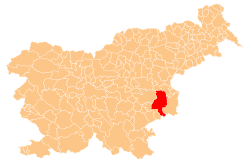
 Dobrova Location in Slovenia | |
| Coordinates: 46°3′8.4″N 15°27′32.94″E / 46.052333°N 15.4591500°ECoordinates: 46°3′8.4″N 15°27′32.94″E / 46.052333°N 15.4591500°E | |
| Country |
|
| Traditional region | Styria |
| Statistical region | Lower Sava |
| Municipality | Krško |
| Area | |
| • Total | 9.45 km2 (3.65 sq mi) |
| Elevation | 581.4 m (1,907.5 ft) |
| Population (2002) | |
| • Total | 200 |
| [1] | |
Dobrova (pronounced [ˈdoːbɾɔʋa]) is a settlement in the hills north of Senovo in the Municipality of Krško in eastern Slovenia. It is a dispersed settlement made up of smaller hamlets such as Bukovšica, Dobrova, Na Terogu, Prebkovje, Puste Ložice, and Plešivec, as well as isolated farms. The area was traditionally part of Styria. It is now included with the rest of the municipality in the Lower Sava Statistical Region.[2]
References
External links
This article is issued from Wikipedia - version of the 1/4/2016. The text is available under the Creative Commons Attribution/Share Alike but additional terms may apply for the media files.