Dobrava pod Rako
| Dobrava pod Rako | |
|---|---|
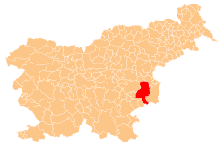
 Dobrava pod Rako Location in Slovenia | |
| Coordinates: 45°54′43.6″N 15°22′14.12″E / 45.912111°N 15.3705889°ECoordinates: 45°54′43.6″N 15°22′14.12″E / 45.912111°N 15.3705889°E | |
| Country |
|
| Traditional region | Lower Carniola |
| Statistical region | Lower Sava |
| Municipality | Krško |
| Area | |
| • Total | 0.2 km2 (0.08 sq mi) |
| Elevation | 163.7 m (537.1 ft) |
| Population (2002) | |
| • Total | 19 |
| [1] | |
Dobrava pod Rako (pronounced [dɔˈbɾaːʋa pɔd ˈɾaːkɔ]) is a small settlement to the south of Raka in the Municipality of Krško in eastern Slovenia. The area was traditionally part of Lower Carniola. It is now included in the Lower Sava Statistical Region.[2]
Name
The name of the settlement was changed from Dobrava to Dobrava pod Rako in 1953.[3]
References
- ↑ Statistical Office of the Republic of Slovenia
- ↑ Krško municipal site
- ↑ Spremembe naselij 1948–95. 1996. Database. Ljubljana: Geografski inštitut ZRC SAZU, DZS.
External links
This article is issued from Wikipedia - version of the 1/4/2016. The text is available under the Creative Commons Attribution/Share Alike but additional terms may apply for the media files.