Dno
| Dno (English) Дно (Russian) | |
|---|---|
| - Town[1] - | |
|
| |
.svg.png) Location of Pskov Oblast in Russia | |
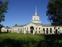
 Dno | |
|
| |
.png) | |
|
| |
| Administrative status (as of February 2013) | |
| Country | Russia |
| Federal subject | Pskov Oblast[1] |
| Administrative district | Dnovsky District[1] |
| Administrative center of | Dnovsky District[2] |
| Municipal status (as of February 2013) | |
| Municipal district | Dnovsky Municipal District[3] |
| Urban settlement | Dno Urban Settlement[3] |
| Administrative center of | Dnovsky Municipal District,[4] Dno Urban Settlement[3] |
| Statistics | |
| Population (2010 Census) | 9,061 inhabitants[5] |
| Time zone | MSK (UTC+03:00)[6] |
| Founded | 1897 |
| Town status since | 1925 |
| Postal code(s)[7] | 182670, 182671 |
| Dno on Wikimedia Commons | |
Dno (Russian: Дно) is a town and the administrative center of Dnovsky District in Pskov Oblast, Russia, located at the intersection of the Pskov–Bologoye and St. Petersburg–Kiev railways, 113 kilometers (70 mi) east of Pskov, the administrative center of the oblast. Population: 9,061 (2010 Census);[5] 10,049 (2002 Census);[8] 12,406 (1989 Census).[9]
History
Founded as a railway center in 1897, it was granted town status in 1925. The territory used to be a part of Porkhovsky Uyezd of Pskov Governorate, and Dno was the seat of Dnovskaya Volost.
On August 1, 1927, the uyezds and governorates were abolished and Dnovsky District, with the administrative center in Dno, was established as a part of Pskov Okrug of Leningrad Oblast.[10][11] It included parts of former Porkhovsky Uyezd.[11] On July 23, 1930, the okrugs were also abolished and the districts were directly subordinated to the oblast.[10] Between July 18, 1941 and February 24, 1944, Dno was occupied by German troops. On August 23, 1944, the district was transferred to newly established Pskov Oblast.[11]
Administrative and municipal status
Within the framework of administrative divisions, Dno serves as the administrative center of Dnovsky District,[2] to which it is directly subordinated.[1] As a municipal division, the town of Dno, together with three rural localities, is incorporated within Dnovsky Municipal District as Dno Urban Settlement.[3]
Economy
The town remains to a large degree economically dependent upon rail-related activities. It was home to the Dno air base during the Cold War.
Industry
The industrial enterprises in Dno include two metalworking plants, a ceramic production plant, and a bakery.[12]
Transportation
Dno is an important railway station where two railways cross. One connects Bologoye and Pskov via Staraya Russa and runs from east to west. Another one connects St. Petersburg and Vitebsk and runs from north to south.
Dno is connected by roads with Soltsy, with Porkhov, and with Dedovichi. There are also local roads with bus traffic.
Culture and recreation
Dno contains five cultural heritage monuments of local significance.[13] These are monuments commemorating Revolution of 1905 and soldiers fallen in World War II.
References
Notes
- 1 2 3 4 Law #833-oz stipulates that the borders of the administrative districts are identical to the borders of the municipal districts. The Law #420-oz, which describes the borders and the composition of the municipal districts, lists the town of Dno as a part of Dnovsky District.
- 1 2 Государственный комитет Российской Федерации по статистике. Комитет Российской Федерации по стандартизации, метрологии и сертификации. №ОК 019-95 1 января 1997 г. «Общероссийский классификатор объектов административно-территориального деления. Код 58 212», в ред. изменения №259/2014 от 12 декабря 2014 г.. (State Statistics Committee of the Russian Federation. Committee of the Russian Federation on Standardization, Metrology, and Certification. #OK 019-95 January 1, 1997 Russian Classification of Objects of Administrative Division . Code 58 212, as amended by the Amendment #259/2014 of December 12, 2014. ).
- 1 2 3 4 Law #420-oz
- ↑ Федеральная служба государственной статистики. Федеральное агентство по технологическому регулированию и метрологии. №ОК 033-2013 1 января 2014 г. «Общероссийский классификатор территорий муниципальных образований. Код 58 612». (Federal State Statistics Service. Federal Agency on Technological Regulation and Metrology. #OK 033-2013 January 1, 2014 Russian Classification of Territories of Municipal Formations. Code 58 612. ).
- 1 2 Russian Federal State Statistics Service (2011). "Всероссийская перепись населения 2010 года. Том 1" [2010 All-Russian Population Census, vol. 1]. Всероссийская перепись населения 2010 года (2010 All-Russia Population Census) (in Russian). Federal State Statistics Service. Retrieved June 29, 2012.
- ↑ Правительство Российской Федерации. Федеральный закон №107-ФЗ от 3 июня 2011 г. «Об исчислении времени», в ред. Федерального закона №271-ФЗ от 03 июля 2016 г. «О внесении изменений в Федеральный закон "Об исчислении времени"». Вступил в силу по истечении шестидесяти дней после дня официального опубликования (6 августа 2011 г.). Опубликован: "Российская газета", №120, 6 июня 2011 г. (Government of the Russian Federation. Federal Law #107-FZ of June 31, 2011 On Calculating Time, as amended by the Federal Law #271-FZ of July 03, 2016 On Amending Federal Law "On Calculating Time". Effective as of after sixty days following the day of the official publication.).
- ↑ Почта России. Информационно-вычислительный центр ОАСУ РПО. (Russian Post). Поиск объектов почтовой связи (Postal Objects Search) (Russian)
- ↑ Russian Federal State Statistics Service (May 21, 2004). "Численность населения России, субъектов Российской Федерации в составе федеральных округов, районов, городских поселений, сельских населённых пунктов – районных центров и сельских населённых пунктов с населением 3 тысячи и более человек" [Population of Russia, Its Federal Districts, Federal Subjects, Districts, Urban Localities, Rural Localities—Administrative Centers, and Rural Localities with Population of Over 3,000] (XLS). Всероссийская перепись населения 2002 года [All-Russia Population Census of 2002] (in Russian). Retrieved August 9, 2014.
- ↑ Demoscope Weekly (1989). "Всесоюзная перепись населения 1989 г. Численность наличного населения союзных и автономных республик, автономных областей и округов, краёв, областей, районов, городских поселений и сёл-райцентров" [All Union Population Census of 1989: Present Population of Union and Autonomous Republics, Autonomous Oblasts and Okrugs, Krais, Oblasts, Districts, Urban Settlements, and Villages Serving as District Administrative Centers]. Всесоюзная перепись населения 1989 года [All-Union Population Census of 1989] (in Russian). Институт демографии Национального исследовательского университета: Высшая школа экономики [Institute of Demography at the National Research University: Higher School of Economics]. Retrieved August 9, 2014.
- 1 2 Administrative-Territorial Structure of Pskov Oblast, pp. 11–12
- 1 2 3 Дновский район (август 1927 г. - август 1944 г.) (in Russian). Справочник истории административно-территориального деления Ленинградской области. Retrieved June 20, 2014.
- ↑ Промышленность (in Russian). Портал муниципальных образований Псковской области. Retrieved June 18, 2012.
- ↑ Памятники истории и культуры народов Российской Федерации (in Russian). Russian Ministry of Culture. Retrieved 2 June 2016.
Sources
- Псковское областное Собрание депутатов. Закон №833-оз от 5 февраля 2009 г. «Об административно-территориальном устройстве Псковской области». Вступил в силу со дня официального опубликования. Опубликован: "Псковская правда", №20, 10 февраля 2009 г. (Pskov Oblast Council of Deputies. Law #833-oz of February 5, 2009 On the Administrative-Territorial Structure of Pskov Oblast. Effective as of the official publication date.).
- Псковское областное Собрание депутатов. Закон №420-оз от 28 февраля 2005 г. «Об установлении границ и статусе вновь образуемых муниципальных образований на территории Псковской области», в ред. Закона №1542-ОЗ от 5 июня 2015 г. «О внесении изменений в Закон Псковской области "Об установлении границ и статусе вновь образуемых муниципальных образований на территории Псковской области"». Вступил в силу со дня официального опубликования. Опубликован: "Псковская правда", №41–43, №44–46, №49–51, 4 марта 2005 г., 5 марта 2005 г., 11 марта 2005 г. (Pskov Oblast Council of Deputies. Law #420-oz of February 28, 2005 On Establishing the Borders and the Status of the Newly Formed Municipal Formations on the Territory of Pskov Oblast, as amended by the Law #1542-OZ of June 5, 2015 On Amending the Law of Pskov Oblast "On Establishing the Borders and the Status of the Newly Formed Municipal Formations on the Territory of Pskov Oblast". Effective as of the official publication date.).
- Архивный отдел Псковского облисполкома. Государственный архив Псковской области. "Административно-территориальное деление Псковской области (1917–1988 гг.). Справочник". (Administrative-Territorial Structure of Pskov Oblast (1917–1988). Reference.) Книга I. Лениздат, 1988
| Cities and towns | ||
|---|---|---|
| Districts | ||