Division of Canning
| Canning Australian House of Representatives Division | |
|---|---|
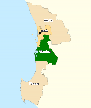
|
Division of Canning in Western Australia, as of the 2016 federal election. | |
| Created | 1949 |
| MP | Andrew Hastie |
| Party | Liberal Party |
| Namesake | Alfred Canning |
| Electors | 99,006 (2016) |
| Area | 6,304 km2 (2,434.0 sq mi) |
| Demographic | Outer Metropolitan |
The Division of Canning is an Australian Electoral Division in Western Australia. The division was created in 1949 and is named for Alfred Canning, the Western Australian government surveyor who surveyed the Canning Stock Route. It was originally a country seat that traded hands between the two main centre-right parties, the Liberal and Country parties.
Since 1980 it has been located in the southern suburbs of the two largest cities in Western Australia, Perth and Mandurah. For most of its last three decades, it has been a highly marginal seat due to the balanced proportion of the urban north and the rural south, changing hands between the Australian Labor Party and the Liberal Party. Canning had a Liberal margin of 4.3 percent leading into the 2010 election,[1] and was targeted by Labor, who stood high-profile candidate and former state Labor MP Alannah MacTiernan.[2] The Liberals retained the seat; however, Canning was the only Western Australian seat to see a two-party preferred swing toward the Australian Labor Party.
A 2015 Canning by-election, triggered on 21 July following the death of Liberal Don Randall, was held on 19 September. Though the Turnbull Government was just four days old, their candidate Andrew Hastie retained the seat for the Liberals, despite having to rely on preferences after a substantial, though dampened, primary (−4.15%) and two-party (−6.55%) swing away from the Liberals − solidly less than the double-digit swings polls had predicted under an Abbott Government − however, some double-digit swings did eventuate among the northern suburban booths. The Canning Liberal margin was reduced from safe to marginal status. Political analysts agreed the by-election was a "good outcome for both major parties".[3]
In 2016 the southern suburbs of Canning in the City of Armadale were redistributed to create the new Division of Burt.[4]
Geography
The division of Canning stretches from Byford and Carmel in the north to Wagerup in the south, and broadly correlates with the Peel region of Western Australia to the south of Perth including the City of Mandurah, and the suburbs in the Darling Scarp east of Gosnells. It includes the Shires of Murray (including Pinjarra, Yunderup and Dwellingup), Waroona (including Waroona and Preston Beach) and Boddington.
Members
| Member | Party | Term | |
|---|---|---|---|
| Len Hamilton | Country | 1949–1961 | |
| Neil McNeill | Liberal | 1961–1963 | |
| John Hallett | Country | 1963–1974 | |
| Mel Bungey | Liberal | 1974–1983 | |
| Wendy Fatin | Labor | 1983–1984 | |
| George Gear | Labor | 1984–1996 | |
| Ricky Johnston | Liberal | 1996–1998 | |
| Jane Gerick | Labor | 1998–2001 | |
| Don Randall | Liberal | 2001–2015 | |
| Andrew Hastie | Liberal | 2015–present | |
Election results
| Party | Candidate | Votes | % | ± | |
|---|---|---|---|---|---|
| Liberal | Andrew Hastie | 42,497 | 50.30 | −1.53 | |
| Labor | Barry Winmar | 27,918 | 33.04 | +5.61 | |
| Greens | Aeron Blundell-Camden | 7,388 | 8.74 | +1.63 | |
| National | Jason Turner | 3,581 | 4.24 | +2.54 | |
| Christians | Janine Vander Ven | 3,110 | 3.68 | +1.53 | |
| Total formal votes | 84,494 | 95.76 | +1.09 | ||
| Informal votes | 3,743 | 4.24 | −1.09 | ||
| Turnout | 88,237 | 89.12 | +2.68 | ||
| Two-party-preferred result | |||||
| Liberal | Andrew Hastie | 47,987 | 56.79 | −4.56 | |
| Labor | Barry Winmar | 36,507 | 43.21 | +4.56 | |
| Liberal hold | Swing | −4.56 | |||
See also
References
- ↑ http://blogs.abc.net.au/antonygreen/2009/02/final-federal-e.html
- ↑ http://www.mandurahmail.com.au/news/local/news/general/canning-battle-looms/1594525.aspx?storypage=2
- ↑ Liberal and Labor parties hail success of campaigns: ABC 20 September 2015
- ↑ "2015 Western Australian Federal redistribution - ABC News (Australian Broadcasting Corporation)". ABC News.
- ↑ Canning, WA, Virtual Tally Room 2016, Australian Electoral Commission.
External links
Coordinates: 32°38′02″S 116°06′47″E / 32.634°S 116.113°E