Dickeyville, Wisconsin
| Dickeyville, Wisconsin | |
|---|---|
| Village | |
.jpg) | |
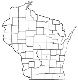 Location of Dickeyville, Wisconsin | |
| Coordinates: 42°37′39″N 90°35′34″W / 42.62750°N 90.59278°WCoordinates: 42°37′39″N 90°35′34″W / 42.62750°N 90.59278°W | |
| Country | United States |
| State | Wisconsin |
| County | Grant |
| Area[1] | |
| • Total | 0.88 sq mi (2.28 km2) |
| • Land | 0.88 sq mi (2.28 km2) |
| • Water | 0 sq mi (0 km2) |
| Elevation[2] | 958 ft (292 m) |
| Population (2010)[3] | |
| • Total | 1,061 |
| • Estimate (2012[4]) | 1,051 |
| • Density | 1,205.7/sq mi (465.5/km2) |
| Time zone | Central (CST) (UTC-6) |
| • Summer (DST) | CDT (UTC-5) |
| Area code(s) | 608 |
| FIPS code | 55-20175[5] |
| GNIS feature ID | 1563972[6] |
Dickeyville is a village in Grant County, Wisconsin, United States. The population was 1,061 at the 2010 census.
The Dickeyville Grotto is located in the heart of the village.[7]
History
Dickeyville was not formally platted.[8] A post office was established as Dickeysville in 1849.[9]
Geography
According to the United States Census Bureau, the village has a total area of 0.88 square miles (2.28 km2), all of it land.[1]
Demographics
| Historical population | |||
|---|---|---|---|
| Census | Pop. | %± | |
| 1950 | 269 | — | |
| 1960 | 671 | 149.4% | |
| 1970 | 1,057 | 57.5% | |
| 1980 | 1,156 | 9.4% | |
| 1990 | 862 | −25.4% | |
| 2000 | 1,043 | 21.0% | |
| 2010 | 1,061 | 1.7% | |
| Est. 2015 | 1,039 | [10] | −2.1% |
2010 census
As of the census[3] of 2010, there were 1,061 people, 459 households, and 289 families residing in the village. The population density was 1,205.7 inhabitants per square mile (465.5/km2). There were 471 housing units at an average density of 535.2 per square mile (206.6/km2). The racial makeup of the village was 99.1% White, 0.2% African American, 0.4% from other races, and 0.4% from two or more races. Hispanic or Latino of any race were 1.1% of the population.
There were 459 households of which 28.5% had children under the age of 18 living with them, 54.5% were married couples living together, 6.5% had a female householder with no husband present, 2.0% had a male householder with no wife present, and 37.0% were non-families. 31.8% of all households were made up of individuals and 12.9% had someone living alone who was 65 years of age or older. The average household size was 2.31 and the average family size was 2.93.
The median age in the village was 40.7 years. 24% of residents were under the age of 18; 5.5% were between the ages of 18 and 24; 25.6% were from 25 to 44; 24.8% were from 45 to 64; and 20.1% were 65 years of age or older. The gender makeup of the village was 49.6% male and 50.4% female.
2000 census
As of the census[5] of 2000, there were 1,043 people, 420 households, and 299 families residing in the village. The population density was 1,197.3 people per square mile (462.9/km²). There were 431 housing units at an average density of 494.8 per square mile (191.3/km²). The racial makeup of the village was 99.52% White, 0.29% Asian, and 0.19% from two or more races. Hispanic or Latino of any race were 0.29% of the population.
There were 420 households out of which 28.1% had children under the age of 18 living with them, 62.9% were married couples living together, 6.9% had a female householder with no husband present, and 28.8% were non-families. 25.5% of all households were made up of individuals and 10.7% had someone living alone who was 65 years of age or older. The average household size was 2.48 and the average family size was 2.96.
In the village the population was spread out with 24.6% under the age of 18, 8.1% from 18 to 24, 26.8% from 25 to 44, 24.8% from 45 to 64, and 15.5% who were 65 years of age or older. The median age was 38 years. For every 100 females there were 97.2 males. For every 100 females age 18 and over, there were 96.0 males.
The median income for a household in the village was $47,353, and the median income for a family was $56,875. Males had a median income of $32,625 versus $26,944 for females. The per capita income for the village was $23,147. About 6.9% of families and 11.7% of the population were below the poverty line, including 20.4% of those under age 18 and 3.8% of those age 65 or over.
References
- 1 2 "US Gazetteer files 2010". United States Census Bureau. Retrieved 2012-11-18.
- ↑ "US Board on Geographic Names". United States Geological Survey. 2007-10-25. Retrieved 2008-01-31.
- 1 2 "American FactFinder". United States Census Bureau. Retrieved 2012-11-18.
- ↑ "Population Estimates". United States Census Bureau. Retrieved 2013-06-24.
- 1 2 "American FactFinder". United States Census Bureau. Retrieved 2008-01-31.
- ↑ "Dickeyville". Geographic Names Information System. United States Geological Survey.
- ↑ Hintz, Martin (19 June 2012). Wisconsin Off the Beaten Path: A Guide to Unique Places. Rowman & Littlefield. p. 18. ISBN 978-0-7627-8619-0.
- ↑ Holford, Castello N (1900). History of Grant County, Wisconsin: Including Its Civil, Political, Geological, Mineralogical, Archaeological and Military History, and a History of the Several Towns. Walsworth Publishing Company. p. 766.
- ↑ "Grant County". Jim Forte Postal History. Retrieved 2 October 2014.
- ↑ "Annual Estimates of the Resident Population for Incorporated Places: April 1, 2010 to July 1, 2015". Retrieved July 2, 2016.
- ↑ "Census of Population and Housing". Census.gov. Retrieved June 4, 2015.
External links
Municipalities and communities of Grant County, Wisconsin, United States | ||
|---|---|---|
| Cities | 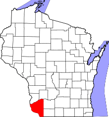 | |
| Villages | ||
| Towns |
| |
| CDPs | ||
| Unincorporated communities |
| |
| Ghost town | ||
| Footnotes | ‡This populated place also has portions in an adjacent county or counties | |