Diamond Bar, California
| Diamond Bar, California | |
|---|---|
| City | |
|
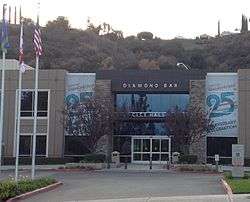
Diamond Bar City Hall | |
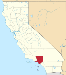
 Location of Diamond Bar in Los Angeles County, California | |
 Diamond Bar, California Location in the United States | |
| Coordinates: 34°0′6″N 117°49′15″W / 34.00167°N 117.82083°WCoordinates: 34°0′6″N 117°49′15″W / 34.00167°N 117.82083°W | |
| Country |
|
| State |
|
| County |
|
| Incorporated | April 18, 1989[1] |
| Government | |
| • Mayor | Nancy Lyons[2] |
| Area[3] | |
| • Total | 14.885 sq mi (38.552 km2) |
| • Land | 14.880 sq mi (38.538 km2) |
| • Water | 0.005 sq mi (0.014 km2) 0.04% |
| Elevation[4] | 696 ft (212 m) |
| Population (April 1, 2010)[5] | |
| • Total | 55,544 |
| • Estimate (2013)[5] | 56,449 |
| • Density | 3,700/sq mi (1,400/km2) |
| Time zone | Pacific (UTC−8) |
| • Summer (DST) | PDT (UTC−7) |
| ZIP code | 91765,[6] 91789 (91789 shares with Walnut, CA) |
| Area code[7] | 909 |
| FIPS code | 06-19192 |
| GNIS feature IDs | 1660549, 2410334 |
| Website |
www |
Diamond Bar is a city in eastern Los Angeles County, California, United States.[8] The 2014 population estimate was 56,784, up from 56,287 at the 2000 census.[9] It is named after the "diamond over a bar" branding iron registered in 1918 by ranch owner Frederick E. Lewis. The city features a public Los Angeles County golf course. It is also home to the Diamond Bar Country Estates, a private guarded community.[8]
Located at the junction of the Pomona and Orange freeways, Diamond Bar is primarily residential with shopping centers interspersed throughout the city. It is surrounded by the suburban communities, such as Brea, Walnut, Chino Hills, and Rowland Heights.
Diamond Bar is a part of the Walnut Valley Unified School District.[10] It also has the first hydrogen fueling station to be built in Southern California,[11] near the South Coast Air Quality Management District (AQMD) building. Moreover, according to the 2010 United States Census – Diamond Bar has a median household income at one of the top earning percentiles in the country at $88,422, with 5.9% of the population living below the federal poverty line.[12]
History
In 1840, Jose de la Luz Linares received the 4,340-acre (1,760 ha) Mexican land grant Rancho Los Nogales (Ranch of the Walnut Trees) from Governor Juan Alvarado. The land grant included Brea Canyon and the eastern Walnut Valley. Linares died in 1847, and his widow sold a part of the ranch to Ricardo Vejar for $100 in merchandise, 100 calves, and the assumption of her late husband's debts. Vejar also owned the Rancho San Jose to the east, and acquired the rest of Rancho Nogales over the next 10 years.
But Vejar's luck did not last that long. As time wore on – and particularly as the United States government took over California – Rancho Los Nogales was divided and sold into multiple land ranches, the largest of which was the Diamond Bar Ranch. At the time, it was one of the largest working cattle ranches in the western U.S. The entire Diamond Bar Ranch was acquired by the Transamerica Corporation in the 1950s for the purpose of developing one of the nation's first master-planned communities. Transamerica gave the Diamond Bar name to its new community and incorporated the ranch's familiar diamond and bar cattle brand into various logos (many of which are still in use today).
The first houses in this development were built in 1960, adjacent to the future location of the Pomona Freeway, which was built through the area ten years later.[13] The town's development and population grew extremely quickly after that.
Transamerica oversaw all development of the community through the 1960s. The Transamerica Corporation divested itself of all its real estate ventures in the 1970s and 1980s. As a result, the Diamond Bar project was sold to multiple developers and much of its initial master plan was not implemented during the latter half of its development in the 1980s.
The City of Diamond Bar was incorporated on April 18, 1989.
Geography
Diamond Bar is located at 34°0′6″N 117°49′15″W / 34.00167°N 117.82083°W (34.001652, -117.820761).[14] The city's main road, Diamond Bar Boulevard, runs along the bottom of the valley that eventually becomes Brea Canyon, and housing developments overlook the boulevard on both sides from surrounding hills. The city lies roughly between the ends of the Chino Fault and the Whittier Fault, both part of the larger Elsinore Fault Zone.
Positioned in the southeastern corner of the San Gabriel Valley in eastern Los Angeles County, Diamond Bar is approximately 27 miles east of Downtown Los Angeles. Neighboring communities include Walnut, Rowland Heights, and Pomona. Diamond Bar is also adjacent to the Inland Empire region, with Chino Hills directly to the east, and to the south of Diamond Bar lie the cities of Brea and La Habra in Orange County.
According to the United States Census Bureau, the city has a total area of 14.9 square miles (39 km2), with no significant bodies of water.
Both the 60 and 57 freeways run through Diamond Bar. I-10 is just north of the city and the 71 is just east of the city. Major thoroughfares include Grand Ave., Diamond Bar Blvd., Pathfinder Rd. and Golden Springs Dr.
Demographics
| Historical population | |||
|---|---|---|---|
| Census | Pop. | %± | |
| 1970 | 10,576 | — | |
| 1980 | 28,045 | 165.2% | |
| 1990 | 53,672 | 91.4% | |
| 2000 | 56,287 | 4.9% | |
| 2010 | 55,544 | −1.3% | |
| Est. 2015 | 56,897 | [15] | 2.4% |
2010
The 2010 United States Census[17] reported that Diamond Bar had a population of 55,544. The population density was 3,731.5 people per square mile (1,440.8/km²). The racial makeup of Diamond Bar was: 29,144 (52.5%) Asian; 18,434 (33.2%) White (21.3% Non-Hispanic White),[5] 2,288 (4.1%) African American; 178 (0.3%) Native American; 106 (0.2%) Pacific Islander; 3,237 (5.8%) from other races; and 2,157 (3.9%) from two or more races. Hispanic or Latino of any race were 11,138 persons (20.1%).
The Census reported that 55,415 people (99.8% of the population) lived in households, 102 (0.2%) lived in non-institutionalized group quarters, and 27 (0%) were institutionalized.
There were 17,880 households, out of which 7,008 (39.2%) had children under the age of 18 living in them, 11,792 (66.0%) were opposite-sex married couples living together, 2,165 (12.1%) had a female householder with no husband present, 886 (5.0%) had a male householder with no wife present. There were 496 (2.8%) unmarried opposite-sex partnerships, and 71 (0.4%) same-sex married couples or partnerships. 2,308 households (12.9%) were made up of individuals and 740 (4.1%) had someone living alone who was 65 years of age or older. The average household size was 3.10. There were 14,843 families (83.0% of all households); the average family size was 3.38.
The age distribution of the population shows 11,895 people (21.4%) under the age of 18, 5,590 people (10.1%) aged 18 to 24, 13,585 people (24.5%) aged 25 to 44, 17,988 people (32.4%) aged 45 to 64, and 6,486 people (11.7%) who were 65 years of age or older. The median age was 41.0 years. For every 100 females there were 95.2 males. For every 100 females age 18 and over, there were 92.3 males.
There were 18,455 housing units at an average density of 1,239.8 per square mile (478.7/km²), of which 14,513 (81.2%) were owner-occupied, and 3,367 (18.8%) were occupied by renters. The homeowner vacancy rate was 0.9%; the rental vacancy rate was 5.2%. 45,080 people (81.2% of the population) lived in owner-occupied housing units and 10,335 people (18.6%) lived in rental housing units.
2000
As of the census[18] of 2000, there were 56,287 people, 17,651 households, and 14,809 families residing in the city. The population density was 3,813.2 inhabitants per square mile (1,472.4/km²). There were 17,959 housing units at an average density of 1,216.7 per square mile (469.8/km²). The racial makeup of the city was 50.4% Asian, 33.3% White, 3.9% Black or African American, 0.33% Native American, 0.12% Pacific Islander, 7.7% from other races, and 4.21% from two or more races. 18.46% of the population were Hispanic or Latino of any race.
There were 17,651 households out of which 44.4% had children under the age of 18 living with them, 68.3% were married couples living together, 11.1% had a female householder with no husband present, and 16.1% were non-families. 12.5% of all households were made up of individuals and 2.7% had someone living alone who was 65 years of age or older. The average household size was 3.18 and the average family size was 3.47.
In the city, the age distribution of the population shows 27.0% under the age of 18, 8.8% from 18 to 24, 29.6% from 25 to 44, 27.2% from 45 to 64, and 7.5% who were 65 years of age or older. The median age was 36 years. For every 100 females there were 96.0 males. For every 100 females age 18 and over, there were 92.0 males.
According to the 2007 estimate, the median income for a household in the city was $87,224, and the median income for a family was $93,185. Males had a median income of $51,059 versus $37,002 for females. The per capita income for the city was $33,540. About 5.0% of families and 6.0% of the population were below the poverty line, including 5.1% of those under age 18 and 6.1% of those age 65 or over.
Government
Diamond Bar City Council is currently headed by Mayor Steve Tye. The other council members are Nancy A. Lyons, Carol Herrera, Jimmy Lin and Jack Tanaka.[2]
Public services
The Los Angeles County Sheriff's Department (LASD) operates the Walnut/Diamond Bar Station in Walnut, serving Diamond Bar.[19]
The Los Angeles County Department of Health Services operates the Pomona Health Center in Pomona, serving Diamond Bar.[20]
County, state, and federal representation
It also pertains to the Fourth District of the Los Angeles County Board of Supervisors.
In the California State Senate, Diamond Bar is in the 29th Senate District, represented by Democrat Josh Newman. In the California State Assembly, it is in the 55th Assembly District, represented by Republican Phillip Chen.[21]
In the United States House of Representatives, Diamond Bar is in California's 39th congressional district, represented by Republican Ed Royce.[22]
Education
Diamond Bar has 9 elementary schools, 3 middle schools, 2 high schools, and 1 continuation high school in the Walnut Valley Unified School District. Diamond Bar also has four elementary schools and one middle school in the northern part of the Pomona Unified School District. The city is divided into two school districts. Those south of the power lines running through the city are part of the Walnut Valley Unified School District and in the northern portion are part of the Pomona Unified School District.
Schools in the Walnut Valley Unified School District:
- Collegewood Elementary School (Walnut)
- Castle Rock Elementary School (Diamond Bar)
- Cyrus J. Morris Elementary School (Diamond Bar)
- Evergreen Elementary School (Diamond Bar)
- Maple Hill Elementary School (Diamond Bar-Near Chaparral Middle School)
- Quail Summit Elementary School (Diamond Bar-Few miles down from Chaparral Middle School)
- Vejar Elementary School (Walnut)
- Walnut Elementary School (Diamond Bar)
- Westhoff Elementary School (Walnut)
- Suzanne Middle School (Walnut)
- Chaparral Middle School (Diamond Bar)
- South Pointe Middle School (Diamond Bar)
- Walnut High School (Walnut-Right across Suzanne Middle School)
- Diamond Bar High School (Diamond Bar-A few blocks down from South Pointe Middle School)
- Ron Hockwalt Academies-Continuation High School- (Walnut)
Schools in the Pomona Unified School District:
- Armstrong Elementary School (Diamond Bar)
- Diamond Point Elementary School (Diamond Bar)
- Golden Springs Elementary School (Diamond Bar)
- Pantera Elementary School (Diamond Bar)
- Lorbeer Middle School (Diamond Bar)
Universities:
- California InterContinental University (Diamond Bar)
Economy
Top employers
According to the City's 2012 Comprehensive Annual Financial Report,[23] the top employers in the city are:
| # | Employer | # of Employees |
|---|---|---|
| 1 | South Coast Air Quality Management District | 786 |
| 2 | Walnut Valley Unified School District | 520 |
| 3 | Transcription Services | 500 |
| 4 | Travelers | 401 |
| 5 | Magan Medical Inc | 300 |
| 6 | Pomona Unified School District | 210 |
| 7 | Carrescia James-First Team Sns | 200 |
| 8 | Diamond Bar High School | 200 |
| 9 | First Team Real Estate | 150 |
| 10 | Baybrook Services Inc | 120 |
Notable people
- Alex Morgan, forward, 2015 Women's World Cup champion, Olympic Gold Medalist, member of the United States women's national soccer team;[24]
- Bert Blyleven, Major League Baseball; retired pitcher, Minnesota Twins, Texas Rangers, Pittsburgh Pirates, Cleveland Indians, California Angels, Hall of Famer
- Rod Carew, retired Major League Baseball player, Hall of Famer – California Angels, Minnesota Twins
- Ling Ling Chang, California state assemblywoman
- Danny Dorn, Major League Baseball player, Arizona Diamondbacks
- Adanna Duru, singer, American Idol season 14 finalist
- Jim Edmonds, retired Major League Baseball player, most notably with the Anaheim Angels and St. Louis Cardinals[25]
- Bob Huff, California state senator[26]
- Tiffany Hwang, Korean-American singer; member of girl group Girls' Generation[27]
- Jay Kim, first Korean-American Congressman[28]
- Larissa Lam, Christian singer-songwriter and music composer; TV host on JCTV
- Natalie Mejia, former member of pop group Girlicious
- Gary Miller, former mayor and Congressman[29]
- Paula Miranda, model and actress
- Teddy Park, South Korean rapper and producer; member of hip hop group 1TYM[30]
- Taebin, South Korean rapper and singer; member of hip hop group 1TYM[30]
- Devyn Puett, former child actress and singer
- Tommy Puett, actor
- Snoop Dogg, rapper[31]
- Keith Van Horn, retired NBA player; played with the Philadelphia 76ers, New Jersey Nets, Milwaukee Bucks, and Dallas Mavericks[32]
- Ryan Wendell, offensive lineman for the New England Patriots[33]
- Jason Wright, running back for the Arizona Cardinals[34]
See also
References
- ↑ "California Cities by Incorporation Date" (Word). California Association of Local Agency Formation Commissions. Retrieved August 25, 2014.
- 1 2 "Council Members". City of Diamond Bar. Retrieved December 16, 2014.
- ↑ "2010 Census U.S. Gazetteer Files – Places – California". United States Census Bureau.
- ↑ "Diamond Bar". Geographic Names Information System. United States Geological Survey. Retrieved February 26, 2015.
- 1 2 3 "Diamond Bar (city) QuickFacts". United States Census Bureau. Retrieved March 15, 2015.
- ↑ "USPS – ZIP Code Lookup – Find a ZIP+ 4 Code By City Results". Retrieved 2007-01-18.
- ↑ "Number Administration System – NPA and City/Town Search Results". Retrieved 2007-01-18.
- 1 2 "Diamond Bar Country". diamonbarcountry.com. Retrieved 2015-07-31.
- ↑ "Annual Estimates of the Resident Population for Incorporated Places: April 1, 2010 to July 1, 2014". Retrieved June 4, 2015.
- ↑ "Best School Districts for Your Buck in Southern California". NerdWallet. Retrieved 2015-07-31.
- ↑ "AQMD Celebrates Grand Opening of the First Hydrogen Highway Network Fueling Station in Southern California" (Press release). South Coast Air Quality Management District. August 13, 2004. Retrieved 2008-05-10.
- ↑ "Diamond Bar (city) QuickFacts". US Census Bureau. Retrieved 2015-07-31.
- ↑ "California State Route 60". AARoads. Retrieved 2015-07-31.
- ↑ "US Gazetteer files: 2010, 2000, and 1990". United States Census Bureau. 2011-02-12. Retrieved 2011-04-23.
- ↑ "Annual Estimates of the Resident Population for Incorporated Places: April 1, 2010 to July 1, 2015". Retrieved July 2, 2016.
- ↑ "Census of Population and Housing". Census.gov. Retrieved June 4, 2015.
- ↑ "2010 Census Interactive Population Search: CA – Diamond Bar city". U.S. Census Bureau. Retrieved July 12, 2014.
- ↑ "American FactFinder". United States Census Bureau. Retrieved 2008-01-31.
- ↑ "Walnut/Diamond Bar Station." Los Angeles County Sheriff's Department. Retrieved on January 21, 2010.
- ↑ "Pomona Health Center." Los Angeles County Department of Health Services. Retrieved on March 27, 2010.
- ↑ "Statewide Database". UC Regents. Retrieved December 16, 2014.
- ↑ "California's 39th Congressional District - Representatives & District Map". Civic Impulse, LLC.
- ↑ City of Diamond Bar CAFR
- ↑ "Morgan named U.S. Soccer's Female Athlete of the Year". Inland Valley Daily Bulletin. December 4, 2012. Retrieved 2012-12-07.
- ↑ "Jim Edmonds Stats". Baseball Almanac. Retrieved 2012-12-03.
- ↑ "SENATOR ROBERT 'BOB' S. HUFF'S BIOGRAPHY". Project Vote Smart. Retrieved 2012-12-03.. Huff was born in Calexico, then moved to Diamond Bar in 1983, at age 30, and as of 2013 still resides there.
- ↑ "TIFFANY PROFILE". Retrieved 2013-06-28.
- ↑ "KIM, Jay, (1939–)". Biographical Directory of the United States Congress. Retrieved 2012-12-07.
- ↑ "About Gary". House of Representatives web site. Retrieved 2008-06-29.
- 1 2 "1TYM YG BOUNCE". Retrieved 2012-12-12.
- ↑ Toure (2006-12-14). "America's Most Lovable Pimp". Rolling Stone. Retrieved 2008-06-29.
- ↑ "Keith Adam Van Horn". Basketball-Reference.com. Retrieved 2012-12-03.
- ↑ "Ryan Wendell". Fresno State. Retrieved 2012-12-03.
- ↑ "Jason Gomillion Wright". databaseFootball.com. Retrieved 2012-12-03.
External links
| Wikimedia Commons has media related to Diamond Bar, California. |
- Official website
- Regional Chamber of Commerce – San Gabriel Valley
- LA County Disaster Communications Service ( DCS ) Walnut Sheriff Station
- The Country Estates, Diamond Bar
- City-Data.com