Devegeçidi Dam
| Devegeçidi Dam | |
|---|---|
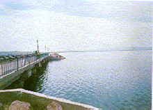 | |
 Location of Devegeçidi Dam in Turkey | |
| Official name | Devegeçidi Baraji |
| Location | Diyarbakır, Turkey |
| Coordinates | 38°03′25″N 39°59′10″E / 38.05694°N 39.98611°ECoordinates: 38°03′25″N 39°59′10″E / 38.05694°N 39.98611°E |
| Purpose | Irrigation |
| Status | Operational |
| Construction began | 1965 |
| Opening date | 1972 |
| Owner(s) | State Hydraulic Works |
| Dam and spillways | |
| Type of dam | Embankment, rock-fill |
| Impounds | Furtaksa River |
| Height | 33 m (108 ft) |
| Length | 6,690 m (21,949 ft) |
| Elevation at crest | 759 m (2,490 ft) |
| Width (crest) | 8 m (26 ft) |
| Width (base) | 135 m (443 ft) |
| Dam volume | 3,200,000 m3 (2,594 acre·ft) |
| Spillway type | Service overflow, controlled-chute |
| Spillway capacity | 2,600 m3/s (91,818 cu ft/s) |
| Reservoir | |
| Creates | Devegeçidi Reservoir |
| Total capacity | 219,000,000 m3 (178,000 acre·ft) |
| Active capacity | 212,000,000 m3 (172,000 acre·ft) |
| Inactive capacity | 7,000,000 m3 (5,700 acre·ft) |
| Catchment area | 1,578 km2 (609 sq mi) |
| Surface area | 30 km2 (12 sq mi)[1] |
| Max. length | 13 km (8.1 mi) |
| Normal elevation | 757 m (2,484 ft) |
Devegeçidi Dam is one of the 22 dams of the Southeastern Anatolia Project of Turkey, Diyarbakır. It is near Diyarbakır on a branch of the Tigris river.[2] It was constructed for irrigation purposes between 1965 and 1972.
Notes
- ↑ "Ilisu Dam Environmental Impact Assessment" (PDF). State Hydraulic Works. 2005. pp. TABLE 2–5 (PDF pgs. 116–117). Retrieved 21 May 2013.
- ↑ SpringerLink - Sinodiaptomus sarsi (Rylov, 1923) (Copepoda, Calanoida) in Turkey
References
- State Hydraulic Works (DSİ), Turkey. "General information on Devegeçidi Dam, Turkey". Retrieved 2009-03-04.
External links
This article is issued from Wikipedia - version of the 9/15/2015. The text is available under the Creative Commons Attribution/Share Alike but additional terms may apply for the media files.