Dethala
| Dethala देथला | |
|---|---|
| Village development committee | |
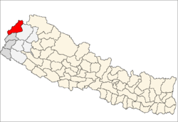
 Dethala Location in Nepal | |
| Coordinates: 29°43′N 80°37′E / 29.71°N 80.62°ECoordinates: 29°43′N 80°37′E / 29.71°N 80.62°E | |
| Country |
|
| Zone | Mahakali Zone |
| District | Darchula District |
| Population (1991) | |
| • Total | 3,155 |
| Time zone | Nepal Time (UTC+5:45) |
Dethala is a village development committee in Darchula District in the Mahakali Zone of western Nepal. At the time of the 1991 Nepal census it had a population of 3155 people living in 507 individual households. It is a Historical place being an ancient kingdom of kings of Pal dynasty. [1]
References
- ↑ "Nepal Census 2001". Nepal's Village Development Committees. Digital Himalaya. Retrieved 19 November 2008.
External links
This article is issued from Wikipedia - version of the 12/27/2015. The text is available under the Creative Commons Attribution/Share Alike but additional terms may apply for the media files.