Derry Township, Westmoreland County, Pennsylvania
| Derry Township, Westmoreland County, Pennsylvania | |
|---|---|
| Township | |
|
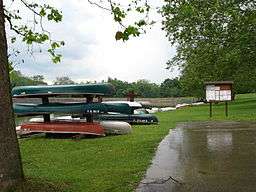
Keystone State Park is in Derry Township | |
 Map of Westmoreland County, Pennsylvania Highlighting Derry Township | |
 Map of Pennsylvania highlighting Westmoreland County | |
| Country | United States |
| State | Pennsylvania |
| County | Westmoreland |
| Settled | 1763 |
| Incorporated | 1775 |
| Named for | Derry |
| Area | |
| • Total | 97.4 sq mi (252 km2) |
| • Land | 95.8 sq mi (248 km2) |
| • Water | 1.6 sq mi (4 km2) |
| Population (2000) | |
| • Total | 14,726 |
| • Density | 153.6/sq mi (59.3/km2) |
| Time zone | Eastern (EST) (UTC-5) |
| • Summer (DST) | EDT (UTC-4) |
| Website | http://www.derrytownship.com |
Derry Township is a township in Westmoreland County, Pennsylvania, in the United States. It surrounds the Borough of Derry, which is a separate municipality. As of the 2000 census, the township population was 14,726.
It was named after the city of Derry by Scotch-Irish settlers.
History
Keystone State Park was established in 1945.
The Samuel Patterson House was added to the National Register of Historic Places in 1985.[1]
Geography
According to the United States Census Bureau, the township has a total area of 97.4 square miles (252 km2), of which, 95.8 square miles (248 km2) of it is land and 1.5 square miles (3.9 km2) of it (1.56%) is water.
The township contains the following communities: Andrico, Andrico No. 2, Atlantic, Bairdstown, Bradenville, Brenizer, Hillside, Loyalhanna, Cokeville Heights, Cooperstown, Kingston, Mannitto Haven, McChesneytown, Millwood, New Derry, Osburn, Pandora, Peanut, Seger, Snydertown, Superior, Torrance, and West Derry.
The villages of Livermore and Cokeville no longer exist, relocated as part of the Conemaugh Dam Flood Control project.
Demographics
As of the census[2] of 2000, there were 14,726 people, 5,716 households, and 4,201 families residing in the township. The population density was 153.6 people per square mile (59.3/km²). There were 6,200 housing units at an average density of 64.7/sq mi (25.0/km²). The racial makeup of the township was 98.21% White, 1.18% African American, 0.14% Asian, 0.03% Native American, 0.01% Pacific Islander, 0.05% from other races, and 0.37% from two or more races. Hispanic or Latino of any race were 0.47% of the population.
There were 5,716 households out of which 29.8% had children under the age of 18 living with them, 58.9% were married couples living together, 10.1% had a female householder with no husband present, and 26.5% were non-families. 23.2% of all households were made up of individuals and 11.0% had someone living alone who was 65 years of age or older. The average household size was 2.48 and the average family size was 2.91.
In the township the population was spread out with 22.2% under the age of 18, 6.7% from 18 to 24, 28.3% from 25 to 44, 26.0% from 45 to 64, and 16.7% who were 65 years of age or older. The median age was 41 years. For every 100 females there were 97.9 males. For every 100 females age 18 and over, there were 94.8 males.
The median income for a household in the township was $34,208, and the median income for a family was $40,878. Males had a median income of $32,589 versus $22,147 for females. The per capita income for the township was $16,425. About 8.3% of families and 10.1% of the population were below the poverty line, including 14.5% of those under age 18 and 5.5% of those age 65 or over.
References
- ↑ National Park Service (2010-07-09). "National Register Information System". National Register of Historic Places. National Park Service.
- ↑ "American FactFinder". United States Census Bureau. Retrieved 2008-01-31.
External links
| Counties |  Map of the Pittsburgh Tri-State with green counties in the metropolitan area and yellow counties in the combined area. | |
|---|---|---|
| Major cities | ||
| Cities and towns 15k-50k (in 2010) | ||
| Airports | ||
| Topics | ||
| ||
Coordinates: 40°23′00″N 79°13′59″W / 40.38333°N 79.23306°W