Denton, Kansas
| Denton, Kansas | |
|---|---|
| City | |
 Location within Doniphan County and Kansas | |
 KDOT map of Doniphan County (legend) | |
| Coordinates: 39°43′54″N 95°16′12″W / 39.73167°N 95.27000°WCoordinates: 39°43′54″N 95°16′12″W / 39.73167°N 95.27000°W | |
| Country | United States |
| State | Kansas |
| County | Doniphan |
| Area[1] | |
| • Total | 0.14 sq mi (0.36 km2) |
| • Land | 0.14 sq mi (0.36 km2) |
| • Water | 0 sq mi (0 km2) |
| Elevation | 1,076 ft (328 m) |
| Population (2010)[2] | |
| • Total | 148 |
| • Estimate (2012[3]) | 147 |
| • Density | 1,057.1/sq mi (408.1/km2) |
| Time zone | Central (CST) (UTC-6) |
| • Summer (DST) | CDT (UTC-5) |
| ZIP code | 66017 |
| Area code(s) | 785 |
| FIPS code | 20-17750[4] |
| GNIS feature ID | 0484628[5] |
Denton is a city in Doniphan County, Kansas, United States. As of the 2010 census, the city population was 148.[6] It is part of the St. Joseph, MO–KS Metropolitan Statistical Area.
History
Denton was laid out in 1886. It was named for one of its founders, John Denton.[7]
The first post office at the site of Denton was established in 1882. Prior to 1905, it was called Darwin for some time, then Dentonville.[8]
Geography
Denton is located at 39°43′54″N 95°16′12″W / 39.73167°N 95.27000°W (39.731568, -95.270025).[9] According to the United States Census Bureau, the city has a total area of 0.14 square miles (0.36 km2), all land.[1]
Demographics
| Historical population | |||
|---|---|---|---|
| Census | Pop. | %± | |
| 1900 | 247 | — | |
| 1910 | 337 | 36.4% | |
| 1920 | 193 | −42.7% | |
| 1930 | 193 | 0.0% | |
| 1940 | 156 | −19.2% | |
| 1950 | 157 | 0.6% | |
| 1960 | 161 | 2.5% | |
| 1970 | 162 | 0.6% | |
| 1980 | 156 | −3.7% | |
| 1990 | 166 | 6.4% | |
| 2000 | 186 | 12.0% | |
| 2010 | 148 | −20.4% | |
| Est. 2015 | 146 | [10] | −1.4% |
| U.S. Decennial Census | |||
2010 census
As of the census[2] of 2010, there were 148 people, 63 households, and 42 families residing in the city. The population density was 1,057.1 inhabitants per square mile (408.1/km2). There were 74 housing units at an average density of 528.6 per square mile (204.1/km2). The racial makeup of the city was 93.9% White and 6.1% from two or more races. Hispanic or Latino of any race were 2.0% of the population.
There were 63 households of which 36.5% had children under the age of 18 living with them, 50.8% were married couples living together, 9.5% had a female householder with no husband present, 6.3% had a male householder with no wife present, and 33.3% were non-families. 33.3% of all households were made up of individuals and 15.8% had someone living alone who was 65 years of age or older. The average household size was 2.35 and the average family size was 2.95.
The median age in the city was 43.5 years. 20.9% of residents were under the age of 18; 12.2% were between the ages of 18 and 24; 18.3% were from 25 to 44; 36.5% were from 45 to 64; and 12.2% were 65 years of age or older. The gender makeup of the city was 50.0% male and 50.0% female.
2000 census
As of the census[4] of 2000, there were 186 people, 71 households, and 47 families residing in the city. The population density was 1,286.4 people per square mile (513.0/km²). There were 74 housing units at an average density of 511.8 per square mile (204.1/km²). The racial makeup of the city was 99.46% White, and 0.54% from two or more races. Hispanic or Latino of any race were 0.54% of the population.
There were 71 households out of which 38.0% had children under the age of 18 living with them, 62.0% were married couples living together, 2.8% had a female householder with no husband present, and 33.8% were non-families. 32.4% of all households were made up of individuals and 22.5% had someone living alone who was 65 years of age or older. The average household size was 2.62 and the average family size was 3.40.
In the city the population was spread out with 33.9% under the age of 18, 4.8% from 18 to 24, 29.0% from 25 to 44, 15.1% from 45 to 64, and 17.2% who were 65 years of age or older. The median age was 35 years. For every 100 females there were 95.8 males. For every 100 females age 18 and over, there were 89.2 males.
The median income for a household in the city was $30,500, and the median income for a family was $40,625. Males had a median income of $31,875 versus $20,417 for females. The per capita income for the city was $12,872. None of the families and 4.5% of the population were living below the poverty line, including no under eighteens and 6.9% of those over 64.
References
- 1 2 "US Gazetteer files 2010". United States Census Bureau. Retrieved 2012-07-06.
- 1 2 "American FactFinder". United States Census Bureau. Retrieved 2012-07-06.
- ↑ "Population Estimates". United States Census Bureau. Retrieved 2013-05-29.
- 1 2 "American FactFinder". United States Census Bureau. Retrieved 2008-01-31.
- ↑ "US Board on Geographic Names". United States Geological Survey. 2007-10-25. Retrieved 2008-01-31.
- ↑ "2010 City Population and Housing Occupancy Status". U.S. Census Bureau. Retrieved August 10, 2011.
- ↑ Blackmar, Frank Wilson (1912). Kansas: A Cyclopedia of State History, Embracing Events, Institutions, Industries, Counties, Cities, Towns, Prominent Persons, Etc. Standard Publishing Company. p. 508.
- ↑ "Kansas Post Offices, 1828-1961 (archived)". Kansas Historical Society. Archived from the original on October 9, 2013. Retrieved 8 June 2014.
- ↑ "US Gazetteer files: 2010, 2000, and 1990". United States Census Bureau. 2011-02-12. Retrieved 2011-04-23.
- ↑ "Annual Estimates of the Resident Population for Incorporated Places: April 1, 2010 to July 1, 2015". Retrieved July 2, 2016.
External links
| Wikimedia Commons has media related to Denton, Kansas. |
- City
- Schools
- USD 111, local school district
- Maps
- Denton City Map, KDOT
Municipalities and communities of Doniphan County, Kansas, United States | ||
|---|---|---|
| Cities | 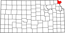 | |
| CDP | ||
| Unincorporated communities | ||
| Ghost town | ||
| Indian reservation | ||
| Townships | ||
| Footnotes | ‡This populated place also has portions in an adjacent county or counties | |