Denham, Western Australia
| Denham Western Australia | |||||||
|---|---|---|---|---|---|---|---|
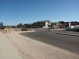 A view of Denham | |||||||
 Denham | |||||||
| Coordinates | 25°55′37″S 113°32′02″E / 25.92694°S 113.53389°ECoordinates: 25°55′37″S 113°32′02″E / 25.92694°S 113.53389°E | ||||||
| Population | 607 (2006 census)[1] | ||||||
| Postcode(s) | 6537 | ||||||
| Elevation | 9 m (30 ft)[2] | ||||||
| Location | |||||||
| LGA(s) | Shire of Shark Bay | ||||||
| State electorate(s) | North West | ||||||
| Federal Division(s) | Durack | ||||||
| |||||||
Denham is the administrative town for the Shire of Shark Bay, Western Australia. At the 2006 census, Denham had a population of 607.[1]
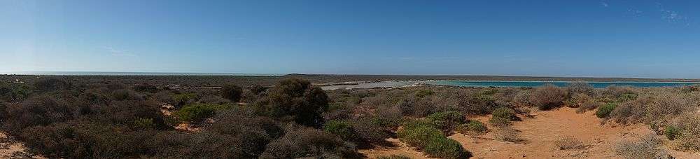
Located on the western coast of the Peron Peninsula 831 kilometres (516 mi) north of Perth, Denham is the westernmost publicly accessible town in Australia, and is named in honour of Captain Henry Mangles Denham of the Royal Navy, who charted Shark Bay in 1858. Today Denham survives as the gateway for the tourists who come to see the dolphins at Monkey Mia, which is located 23 kilometres (14 mi) northeast of the town. The town also has an attractive beach and a jetty popular with those interested in fishing and boating.
History

The Denham area was the first part of the Australian mainland discovered by European sailors. On 25 October 1616, Dutch explorer Dirk Hartog and crew came unexpectedly upon "various islands, which were, however, found uninhabited." He made landfall at an island now called Dirk Hartog Island off the coast of Shark Bay. Hartog spent three days examining the coast and nearby islands. He named the area Eendrachtsland after his ship, but this name has not endured. Finding little of interest, Hartog continued sailing northwards charting this previously undiscovered coast to about 22° South. In 1696 the Dutch explorer Willem de Vlamingh landed on the island. Later explorers included William Dampier, and the Frenchmen Freycinet, Hamelin and Baudin in the early 19th century.
The coast remained uninhabited by Europeans until the middle of the 19th century. The first pearls found in Western Australia were discovered in Shark Bay in 1854 by a Lieutenant Helpman, the so-called 'Admiral of the Swan River Navy', who found the dense beds of pearl-shell oysters that are abundant there.
The earlier name to that of Denham was 'Freshwater Camp' when it was a pearling camp [3]
Facilities
There is a Crisis centre, two Churches, a unit of the Red Cross, Returned Services League (R.S.L.), plus the normal amenities / facilities / social organisations to be found in any small Australian rural town; for example, two grocery shops, hardware, laundromat, hairdressing salon, two hotels, three caravan parks, various types of holiday accommodation, butcher, tourist and souvenir shops. There is also the unique Old Pearler Restaurant. Social organisation include a bowls club, golf club, speedway, arts society, film club, pistol club, bridge club, crafts group, youth association and facilities for various sports, for example netball, cricket, football. There is no resident Doctor but a full-time Nurse in charge of the local Silver Chain Nursing post. Currently a medical practitioner flies in for two days once a week. Emergency services are operated entirely by volunteers (Fire Brigade, Ambulance, State Emergency Service (SES) and Marine Rescue). Electricity is provided by a wind-diesel power plant.
Tourism
The tourist industry - which functions mainly from April until September - witnesses an influx of over 250,000 people passing through the Shire on the main North West Coastal Highway of which approximately 110,000 actually come into the communities including Denham and Monkey Mia. The 150 km stretch of road linking the highway with Denham is known as World Heritage Drive.[4]
A number of tour operators have land and water based operations using both Monkey Mia and Denham as their base.
Transport
There is an all-weather airstrip, Shark Bay Airport (also known at times as Denham Airport), which has Skippers Aviation operating regular services as the main tourist fly in location for Denham and Monkey Mia.
Climate
Denham has a semi-arid climate typical of most of central Western Australia. Summers are warm but not as hot as areas further inland due to coastal influence. The majority of Denhams rainfall falls in winter due to cold fronts moving in off the Indian Ocean, however the town receives far less rainfall from these systems than areas further south such as Geraldton and Perth. The period from September to March is largely rainless apart from possible erratic thunderstorms or influence from tropical cyclones.
| Climate data for Denham | |||||||||||||
|---|---|---|---|---|---|---|---|---|---|---|---|---|---|
| Month | Jan | Feb | Mar | Apr | May | Jun | Jul | Aug | Sep | Oct | Nov | Dec | Year |
| Record high °C (°F) | 45.1 (113.2) |
47.0 (116.6) |
46.2 (115.2) |
38.8 (101.8) |
36.5 (97.7) |
29.5 (85.1) |
29.0 (84.2) |
30.0 (86) |
36.0 (96.8) |
38.9 (102) |
41.6 (106.9) |
42.4 (108.3) |
47.0 (116.6) |
| Average high °C (°F) | 30.6 (87.1) |
31.9 (89.4) |
31.1 (88) |
28.6 (83.5) |
25.8 (78.4) |
22.9 (73.2) |
21.7 (71.1) |
22.4 (72.3) |
23.8 (74.8) |
25.5 (77.9) |
27.7 (81.9) |
29.2 (84.6) |
26.8 (80.2) |
| Average low °C (°F) | 22.0 (71.6) |
22.9 (73.2) |
22.0 (71.6) |
19.7 (67.5) |
16.5 (61.7) |
13.9 (57) |
12.7 (54.9) |
13.2 (55.8) |
14.8 (58.6) |
16.5 (61.7) |
18.6 (65.5) |
20.5 (68.9) |
17.8 (64) |
| Record low °C (°F) | 14.0 (57.2) |
15.9 (60.6) |
14.0 (57.2) |
11.9 (53.4) |
9.4 (48.9) |
8.0 (46.4) |
5.5 (41.9) |
6.7 (44.1) |
8.0 (46.4) |
7.8 (46) |
10.0 (50) |
12.5 (54.5) |
5.5 (41.9) |
| Average precipitation mm (inches) | 7.6 (0.299) |
15.1 (0.594) |
14.1 (0.555) |
14.0 (0.551) |
37.5 (1.476) |
54.8 (2.157) |
39.7 (1.563) |
21.7 (0.854) |
7.8 (0.307) |
6.1 (0.24) |
3.1 (0.122) |
2.4 (0.094) |
223.4 (8.795) |
| Average precipitation days (≥ 0.2 mm) | 1.0 | 1.4 | 1.5 | 2.1 | 5.0 | 7.1 | 7.2 | 5.6 | 2.9 | 1.9 | 0.9 | 0.5 | 37.1 |
| Source: Bureau of Meteorology.[5] | |||||||||||||
See also
| Wikimedia Commons has media related to Denham, Western Australia. |
References
- 1 2 Australian Bureau of Statistics (25 October 2007). "Denham (State Suburb)". 2006 Census QuickStats. Retrieved 9 July 2011.
- ↑ Bureau of Meteorolgy
- ↑ Thomson, Carolyn (1997) Discovering Shark Bay Marine Park and Monkey Mia Como, W.A. Department of Conservation and Land Management. ISBN 0-7309-6854-5 page 34 The streets of Freshwater Camp were constructed from the discarded (pearl) shells
- ↑
- ↑ "Denham Regional Office". Climate statistics for Australian locations. Bureau of Meteorology. Retrieved 29 April 2014.