Delaware Water Gap Toll Bridge
| Delaware Water Gap Toll Bridge | |
|---|---|
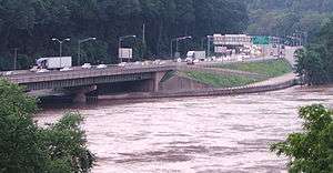
|
A view of the New Jersey side of the Delaware Water Gap Toll Bridge during a flood on June 29, 2006 | |
| Carries |
4 lanes of |
| Crosses | Delaware River |
| Locale |
Delaware Water Gap, PA and Hardwick Twp, NJ |
| Official name | Delaware Water Gap Toll Bridge |
| Other name(s) |
Delaware Water Gap Bridge Interstate 80 Toll Bridge |
| Maintained by | Delaware River Joint Toll Bridge Commission |
| Characteristics | |
| Design | Steel plate beam bridge |
| Total length | 2,465 ft (751 m) |
| Width | 28 ft (8.5 m) |
| History | |
| Opened | December 16, 1953 |
| Statistics | |
| Toll | $1.00 (Automobiles - Westbound) |
The Delaware Water Gap Toll Bridge (also known as the Interstate 80 Toll Bridge) is a toll bridge that carries Interstate 80 across the Delaware River at the Delaware Water Gap, connecting Hardwick Township, Warren County, New Jersey and Delaware Water Gap, Monroe County, Pennsylvania, in the United States. The bridge was built by the Delaware River Joint Toll Bridge Commission. The 2,465-foot (751 m)-long bridge is a multiple span dual roadway with a steel plate structure. The roadways are 28 feet (8.5 m) wide each and separated from each other by a concrete Jersey barrier.
The facility opened to the public on December 16, 1953, at ceremonies attended by Governor of Pennsylvania John S. Fine and Governor of New Jersey Alfred E. Driscoll.[1] The bridge carried US 611 (now Pennsylvania Route 611) for four miles (6 km) in New Jersey to a connection with Route 94. I-80 was routed onto the bridge in 1959.
There is a pedestrian sidewalk on the south side of the New Jersey-bound section of the bridge, separated from motor vehicles with a concrete divider. The pedestrian walkway on the Delaware Water Gap Toll Bridge connects Pennsylvania's northern terminus of the Appalachian Trail with New Jersey's southern end. The Delaware Water Gap National Recreation Area straddles both sides of the river near the bridge; Worthington State Forest is located along the bridge's New Jersey side.
A six-lane toll plaza, one of which is E-ZPass only, is located on the Pennsylvania side of the bridge, serving westbound traffic only. The toll for automobiles is $1.00. An E-ZPass Commuter 40% discount is available to those making 20 or more trips in 35 days.
See also
References
- ↑ "NEW SPAN CROSSES DELAWARE RIVER; Fine, Driscoll at Ceremonies for Water Gap Bridge -- Road to Link Poconos and New York", The New York Times, December 17, 1953. p. 51
External links
- Delaware Water Gap Toll Bridge at the Delaware River Joint Toll Bridge Commission website
- Delaware Water Gap Toll Bridge at Structurae
| Crossings of the Delaware River | ||||
|---|---|---|---|---|
| ||||
Coordinates: 40°58′37″N 75°08′07″W / 40.9770°N 75.1354°W