Delaware County, Iowa
| Delaware County, Iowa | |
|---|---|
|
| |
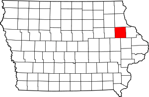 Location in the U.S. state of Iowa | |
 Iowa's location in the U.S. | |
| Founded | 1837 |
| Named for | State of Delaware |
| Seat | Manchester |
| Largest city | Manchester |
| Area | |
| • Total | 579 sq mi (1,500 km2) |
| • Land | 578 sq mi (1,497 km2) |
| • Water | 1.2 sq mi (3 km2), 0.2% |
| Population | |
| • (2010) | 17,764 |
| • Density | 31/sq mi (12/km²) |
| Congressional district | 1st |
| Time zone | Central: UTC-6/-5 |
| Website |
www |

Delaware County is a county located in the U.S. state of Iowa. As of the 2010 census, the population was 17,764.[1] The county seat is Manchester.[2] The county was named in honor of Delaware.
Geography

According to the U.S. Census Bureau, the county has a total area of 579 square miles (1,500 km2), of which 578 square miles (1,500 km2) is land and 1.2 square miles (3.1 km2) (0.2%) is water.[3] It has a rough hilly surface.[4]
Major highways
Adjacent counties
- Buchanan County (west)
- Clayton County (north)
- Dubuque County (east)
- Fayette County (northwest)
- Jones County (southeast)
- Linn County (southwest)
Demographics
| Historical population | |||
|---|---|---|---|
| Census | Pop. | %± | |
| 1850 | 1,759 | — | |
| 1860 | 11,024 | 526.7% | |
| 1870 | 17,432 | 58.1% | |
| 1880 | 17,950 | 3.0% | |
| 1890 | 17,349 | −3.3% | |
| 1900 | 19,185 | 10.6% | |
| 1910 | 17,888 | −6.8% | |
| 1920 | 18,183 | 1.6% | |
| 1930 | 18,122 | −0.3% | |
| 1940 | 18,487 | 2.0% | |
| 1950 | 17,734 | −4.1% | |
| 1960 | 18,483 | 4.2% | |
| 1970 | 18,770 | 1.6% | |
| 1980 | 18,933 | 0.9% | |
| 1990 | 18,035 | −4.7% | |
| 2000 | 18,404 | 2.0% | |
| 2010 | 17,764 | −3.5% | |
| Est. 2015 | 17,403 | [5] | −2.0% |
| U.S. Decennial Census[6] 1790-1960[7] 1900-1990[8] 1990-2000[9] 2010-2013[1] | |||
2010 census
The 2010 census recorded a population of 17,764 in the county, with a population density of 30.7415/sq mi (11.8694/km2). There were 8,028 housing units, of which 7,062 were occupied.[10]
2000 census
As of the census[11] of 2000, there were 18,404 people, 6,834 households, and 5,029 families residing in the county. The population density was 32 people per square mile (12/km²). There were 7,682 housing units at an average density of 13 per square mile (5/km²). The racial makeup of the county was 99.28% White, 0.07% Black or African American, 0.10% Native American, 0.14% Asian, 0.01% Pacific Islander, 0.10% from other races, and 0.30% from two or more races. 0.66% of the population were Hispanic or Latino of any race.
There were 6,834 households out of which 36.70% had children under the age of 18 living with them, 64.10% were married couples living together, 6.20% had a female householder with no husband present, and 26.40% were non-families. 23.00% of all households were made up of individuals and 11.20% had someone living alone who was 65 years of age or older. The average household size was 2.66 and the average family size was 3.15.
In the county the population was spread out with 29.00% under the age of 18, 7.00% from 18 to 24, 27.60% from 25 to 44, 21.50% from 45 to 64, and 15.00% who were 65 years of age or older. The median age was 37 years. For every 100 females there were 98.40 males. For every 100 females age 18 and over, there were 96.60 males.
The median income for a household in the county was $37,168, and the median income for a family was $43,607. Males had a median income of $30,712 versus $19,685 for females. The per capita income for the county was $17,327. About 6.30% of families and 7.90% of the population were below the poverty line, including 8.50% of those under age 18 and 9.80% of those age 65 or over.
Communities
Cities
Townships
Delaware County is divided into these townships:
Population ranking
The population ranking of the following table is based on the 2010 census of Delaware County.[12]
† county seat
| Rank | City/Town/etc. | Municipal type | Population (2010 Census)
|
|---|---|---|---|
| 1 | † Manchester | City | 5,179 |
| 2 | Dyersville (mostly in Dubuque County) | City | 4,058 |
| 3 | Edgewood (partially in Clayton County) | City | 864 |
| 4 | Earlville | City | 812 |
| 5 | Hopkinton | City | 628 |
| 6 | Delhi | City | 460 |
| 7 | Colesburg | City | 404 |
| 8 | Ryan | City | 361 |
| 9 | Greeley | City | 256 |
| 10 | Dundee | City | 174 |
| 11 | Delaware | City | 159 |
| 12 | Masonville | City | 127 |
See also
References
- 1 2 "State & County QuickFacts". United States Census Bureau. Retrieved July 16, 2014.
- ↑ "Find a County". National Association of Counties. Retrieved 2011-06-07.
- ↑ "US Gazetteer files: 2010, 2000, and 1990". United States Census Bureau. 2011-02-12. Retrieved 2011-04-23.
- ↑
 Ripley, George; Dana, Charles A., eds. (1879). "Delaware, the name of five counties in the United States. V. An E. county of Iowa". The American Cyclopædia.
- ↑ "County Totals Dataset: Population, Population Change and Estimated Components of Population Change: April 1, 2010 to July 1, 2015". Retrieved July 2, 2016.
- ↑ "U.S. Decennial Census". United States Census Bureau. Retrieved July 16, 2014.
- ↑ "Historical Census Browser". University of Virginia Library. Retrieved July 16, 2014.
- ↑ "Population of Counties by Decennial Census: 1900 to 1990". United States Census Bureau. Retrieved July 16, 2014.
- ↑ "Census 2000 PHC-T-4. Ranking Tables for Counties: 1990 and 2000" (PDF). United States Census Bureau. Retrieved July 16, 2014.
- ↑ "Population & Housing Occupancy Status 2010". United States Census Bureau American FactFinder. Retrieved May 9, 2011.
- ↑ "American FactFinder". United States Census Bureau. Retrieved 2008-01-31.
- ↑ "Archived copy". Archived from the original on December 21, 2013. Retrieved February 10, 2013.
External links
| Wikimedia Commons has media related to Delaware County, Iowa. |
 |
Fayette County | Clayton County | | |
| Buchanan County | |
Dubuque County | ||
| ||||
| | ||||
| Linn County | Jones County |
Municipalities and communities of Delaware County, Iowa, United States | ||
|---|---|---|
| Cities | ||
| Townships | ||
| Unincorporated communities | ||
| Footnotes | ‡This populated place also has portions in an adjacent county or counties | |

Coordinates: 42°28′10″N 91°22′13″W / 42.46944°N 91.37028°W