Decatur, Alabama
| Decatur | |
|---|---|
| City | |
| City of Decatur | |
|
From the north side of the Tennessee River | |
| Nickname(s): The River City, Chicago of the South, The Heart of the Valley | |
| Motto: "A Grand City on a Charming Scale" | |
 Location in Morgan County and the state of Alabama | |
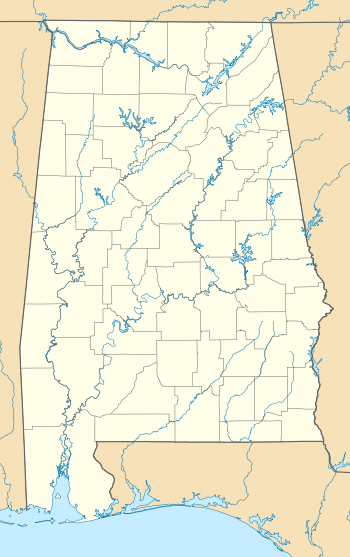 Decatur  Decatur Location in Alabama in the United States | |
| Coordinates: 34°34′51″N 86°59′0″W / 34.58083°N 86.98333°W | |
| Country |
|
| State |
|
| Counties | Morgan, Limestone |
| Founded | 1820[1] |
| Incorporation | December 8, 1827[1] |
| Government | |
| • Type | Mayoral-Council |
| • Mayor | Tab Bowling |
| Area | |
| • City | 64.9 sq mi (155.1 km2) |
| • Land | 58.4 sq mi (143.3 km2) |
| • Water | 6.5 sq mi (16.8 km2) |
| Elevation | 561 ft (171 m) |
| Population (2013)[2] | |
| • City | 55,816 (US: 653th) |
| • Density | 857.98/sq mi (388.58/km2) |
| • Metro | 153,374 (US: 263rd) |
| Time zone | Central (CST) (UTC-6) |
| • Summer (DST) | CDT (UTC-5) |
| ZIP code | 35600-35699 |
| Area code(s) | 256 |
| FIPS code | 01-20104 |
| GNIS feature ID | 0117185 |
| Website |
www |
Decatur is a city in Morgan and Limestone counties in the State of Alabama. The city, affectionately known as "The River City", is located in Northern Alabama on the banks of Wheeler Lake, along the Tennessee River. It is the largest city and county seat of Morgan County.[3] The population in 2010 census was 55,683.[2]
Decatur is also the core city of the two-county large Decatur, Alabama Metropolitan Area which had an estimated population of 153,374 in 2013. Combined with the Huntsville Metropolitan Area, the two create the Huntsville-Decatur Combined Statistical Area, of which Decatur is the second largest city.
Like many southern cities in the early 19th century, Decatur's early success was based upon its location along a river. Railroad routes and boating traffic pushed the city to the front of North Alabama's economic atmosphere. The city rapidly grew into a large economic center within the Tennessee Valley and was a hub for travelers and cargo between Nashville and Mobile, as well as Chattanooga and New Orleans. Throughout the 20th century, the city experienced steady growth, but was eclipsed as the regional economic center by the fast-growing Huntsville during the space race. The city now finds its economy heavily based on manufacturing, cargo transit, and hi-tech industries such as General Electric, and the United Launch Alliance.
History
Initially the area was known as "Rhodes Ferry Landing", named for Dr. Henry W. Rhodes, an early landowner who operated a ferry that crossed the Tennessee River in the 1810s at the present-day location of Rhodes Ferry Park. The city was incorporated as Decatur in 1821. It was named in honor of Stephen Decatur; after he was killed in a duel in 1820, President Monroe directed that the Alabama town be named for him.
In the early 1830s, Decatur was the eastern terminus of the Tuscumbia, Courtland and Decatur Railroad, the first railway built west of the Appalachian Mountains. In 1850 the Tuscumbia, Courtland and Decatur Railroad was incorporated into the Memphis & Charleston Railroad.
Because of its location on the Tennessee River at the strategically important crossing of two major railroads, Decatur was the site of several encounters during the American Civil War. When the Union army occupied the city early in the war, the commanding general ordered all but four buildings in the town destroyed. Bricks from some of the churches in town were used to build stoves and chimneys for the buildings that housed soldiers. The four buildings that remained (and are still standing) are the Old State Bank, the Dancy-Polk House, the Todd House, and the Burleson-Hinds-McEntire House. After the Union victory in the Battle of Atlanta, a Confederate army under the command of Gen. John Bell Hood briefly sparred with a vastly outmanned garrison during the 1864 Battle of Decatur, when Decatur was referred to as A Tough Nut To Crack.
While the city was under Confederate control, plans for the Battle of Shiloh were mapped out within the Burleson-Hinds-McEntire House. These activities make the house one of the most historic buildings in Decatur.
New Decatur, Alabama was a city that rose out of the ashes of former Decatur west of the railroad tracks. New Decatur was founded in 1887 and incorporated in 1889. However, residents of the older Decatur resented the new town, founded and occupied by people who moved down from northern states. Animosity built until New Decatur renamed their town Albany, after Albany, N.Y., in September 1916. The impetus to meld the two towns came from the need for a bridge, instead of a ferry, across the Tennessee River. The Decatur Kiwanis Club was formed with an equal number of members from each town to organize efforts to get the state to build the bridge. In 1925, the two cities merged to form one City of Decatur. There is a noticeable difference between the two sides of town. The cities developed differently at different times, and still to this day have somewhat different cultures. Eastern portions of Decatur tend to act more suburban and traditional, while western portions tend to look more metropolitan and contemporary.
The Old State Bank, on the edge of downtown, is the oldest bank building in the State of Alabama, being 173 years old. The first wave pool in the United States was built in Decatur and is still in operation at the Point Mallard Aquatic Center. The city has the largest Victorian era home district in the state of Alabama. Decatur is also home to Alabama's oldest opera house, the Cotaco Opera House, which still stands on Johnston Street.
In the past its industries included repair shops of the Louisville and Nashville Railroad, car works, engine works, bottling plants, and manufacturers of lumber, sashes and blinds, tannic acid, fertilizers, cigars, flour, cottonseed oil, and various other products.
Early historical timeline

- Area founded as Rhodes Ferry in 1810s
- Rhodes Ferry incorporated as Decatur in 1821
- Dancy-Polk House erected in 1829
- Also in 1829-1830, Decatur became the home to the first railroad ever built west of the Appalachian Mountains Tuscumbia, Courtland and Decatur Railroad
- Old State Bank erected on July 29, 1833
- Rhea-McEntire House built in 1836
- Battle of Decatur takes place during the American Civil War on October 26–29, 1864
- Decatur's Victorian Era Home District built between 1870 and 1910
- New Decatur founded in 1887, incorporated in 1889
- The Morgan County seat moved from Somerville to Decatur
- New Decatur renames itself Albany (although the post office designation is New Albany), 1916
- Princess Theatre built in 1919
- Albany and Old Decatur merge in 1925
- President Franklin Delano Roosevelt dedicates Delano Park in 1930s
- TVA brings new business to Decatur through the military, and energy management in the 1930s
- Alabama Governor George Wallace and Senator Edward Kennedy-Massachusetts- two leading possibilities for the 1976 Democratic Presidential nomination, appear at a widely reported Independence Day Celebration, 1973
Geography
The Tennessee River has traditionally been the northern border of the city and Morgan County, while Flint Creek and the Wheeler Wildlife Refuge on the east side of the city. The city does extend to the other side of Flint Creek and the Refuge in the Indian Hills and Burningtree subdivision areas. There is also an inlet that extends one mile (2 km) into the city limits from Wheeler Lake called Dry Branch. There is also a small portion of Decatur that extends into Limestone County north along the Highway 31 corridor to the Calhoun College area and along Hwy 20 Corridor until it reaches I-65.
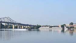
The northern portion of Decatur sits on top of a short hill that overlooks the Tennessee River, this creates a very steep dropoff to the river shore at Rhodes Ferry Park. This hill allows the "Steamboat Bill" Memorial Bridge to leave the mainland at grade without any major sloping required more height to cross the river while not interfering with Decatur's heavy barge traffic. This hill extends from the banks of the river about 1.5 miles (2.4 km) south to the 14th St./Magnolia St. intersection with 6th Avenue (US 31).
South past the 14th St. and 6th Ave. intersection, land continues to remain flat. South, and also west, past Alabama 67 there are a few minor mountains that sit within the city limits.
Decatur is located at 34°34′52″N 86°59′0″W / 34.58111°N 86.98333°W (34.580992, −86.983392).[4]
According to the U.S. Census Bureau, the city has a total area of 59.9 square miles (155 km2), of which, 53.4 square miles (138 km2) of it is land and 6.5 square miles (17 km2) of it (10.83%) is water.
Climate
Decatur has a humid subtropical climate (Köppen Cfa) with four distinct seasons.
Winters are generally mild, with a January daily average temperature of 40.6 °F (4.8 °C). On average, the low temperature falls to the freezing mark or below on 59 days a year, and to or below 20 °F (−7 °C) on 9.2 days.[5] Winters usually do not produce much snow; a large amount of snow is rare within the city limits. A small, measurable amount of snow can be experienced a few times each year. In 2011, Decatur received up to 8 inches (20 cm) of snow in a single storm. It tied for the most since 1963.Summers are hot and humid with a July daily average temperature of 79.6 °F (26.4 °C). There are 51–52 days of 90 °F (32 °C)+ highs annually and 1.7 days of 100 °F (38 °C)+ highs.[5] Thunderstorms are common during the summer months. The latter part of summer tends to be drier. Autumn, which spans from mid-September to early-December, tends to be similar to spring in terms of temperature and precipitation, although it begins relatively dry.
Occasionally, severe thunderstorms occur. These storms can produce damaging winds and large hail in addition to the usual hazards of lightning and very heavy rain. There is also the risk of Tornadoes. Severe thunderstorms can occur at any time of the year but are most common during the spring months. There is a secondary severe weather season during the fall months. Tropical disturbances - some of which reach the Gulf Coast as Hurricanes but lose intensity as they move inland - can occasionally bring heavy rains.
The highest recorded temperature was 108 °F (42 °C) on July 28, 1952 and August 16, 1954, while the lowest recorded temperature was −19 °F (−28 °C) on January 30, 1966.[5]
| Climate data for Decatur, Alabama | |||||||||||||
|---|---|---|---|---|---|---|---|---|---|---|---|---|---|
| Month | Jan | Feb | Mar | Apr | May | Jun | Jul | Aug | Sep | Oct | Nov | Dec | Year |
| Record high °F (°C) | 78 (26) |
82 (28) |
87 (31) |
94 (34) |
99 (37) |
105 (41) |
108 (42) |
108 (42) |
105 (41) |
97 (36) |
86 (30) |
80 (27) |
108 (42) |
| Average high °F (°C) | 50.1 (10.1) |
54.6 (12.6) |
63.9 (17.7) |
72.7 (22.6) |
80.4 (26.9) |
87.5 (30.8) |
90.3 (32.4) |
90.3 (32.4) |
84.4 (29.1) |
73.8 (23.2) |
62.9 (17.2) |
52.7 (11.5) |
72.1 (22.3) |
| Average low °F (°C) | 31.0 (−0.6) |
34.1 (1.2) |
40.9 (4.9) |
48.7 (9.3) |
58.3 (14.6) |
65.6 (18.7) |
68.8 (20.4) |
67.5 (19.7) |
60.3 (15.7) |
48.6 (9.2) |
39.7 (4.3) |
33.6 (0.9) |
49.8 (9.9) |
| Record low °F (°C) | −19 (−28) |
−4 (−20) |
7 (−14) |
20 (−7) |
35 (2) |
42 (6) |
51 (11) |
50 (10) |
36 (2) |
24 (−4) |
0 (−18) |
−5 (−21) |
−19 (−28) |
| Average precipitation inches (mm) | 4.63 (117.6) |
4.77 (121.2) |
4.89 (124.2) |
4.53 (115.1) |
4.44 (112.8) |
4.50 (114.3) |
4.58 (116.3) |
3.55 (90.2) |
3.58 (90.9) |
3.45 (87.6) |
4.79 (121.7) |
5.67 (144) |
53.38 (1,355.9) |
| Source: NOAA,[5] The Weather Channel (extremes)[6] | |||||||||||||
Bodies of water
- Wheeler Lake
- Tennessee River
- Wheeler National Wildlife Refuge
- Flint Creek
- Chula Vista Lake
- Lake Morgan
Neighboring cities/towns
- Athens (north) - Limestone County
- Hartselle (south) - Morgan County
- Hillsboro (west) - Lawrence County
- Huntsville (northeast) - Madison/Limestone Counties
- Madison (northeast) - Madison/Limestone Counties
- Mooresville (northeast) - Limestone County
- Moulton (southwest) - Lawrence County
- Priceville (east) - Morgan County
- Trinity (west) - Morgan County
Neighborhoods
Decatur is divided into four different regions of town (Northeast, Southeast, Northwest, Southwest). Southeast and Northeast Decatur lie East of the CSX Railroad's mainline. North of Lee Street the dividing line is Bank Street which runs a block east of and parallel to the RR. Northeast & Southeast and are divided by Moulton Street. Southwest consists of the area west of the CSX Railroad and south of Moulton Street. Northwest is bordered by Moulton Street, the CSX Railroad from Moulton Street to Lee Street and then by Bank Street from Lee Street to the Tennessee River. While there are few major cultural differences between the East and the West, minute differences such as street grid patterns, zoning patterns, and architectural styles are noticeable.
Northeast
- Albany (New Decatur)
- Downtown Decatur
- East Acres
- Old Decatur
- Bank Street & Second Avenue (Downtown Shopping District)
- Harborview (Riverfront)
Limestone County
- Whiteside
- Irvington
Southeast
- Bayside
- Brookmeade
- Burleson Mountain
- Burningtree Mountain
- Cedar Lake
- Fairview
- Flint
- Hickory Hills
- Indian Hills
- Point Mallard Estates
Northwest
- West Decatur (the portion north of Moulton Street)
Southwest
- Autumn Ridge
- Austinville
- Basham
- Braswell
- Cedar Ridge
- Chapel Hill
- Chula Vista
- Deerfoot Estates
- Dogwood Estates
- Dunbarton
- Flint
- Graystone
- Griffin Addition
- Longleaf Estates
- Moulton Heights
- Oak Lea
- Oakworth
- Timberlake
- Russell Village
- Vestavia
- West Decatur (the portion south of Moulton Street)
- Westmeade
- Woodtrail
Infrastructure
Government
The current mayor of Decatur is Don Kyle, who was elected in 2012 The city has a five-member/district City Council. The current members are:
- District 1 Billy Jackson
- District 2 Roger Anders
- District 3 Gary Hammon (Council President)
- District 4 Charles Kirby
- District 5 Chuck Ard
There are also many boards and commissions run by the city, supervising schools, planning, downtown development, and so on.
Past Decatur, AL Mayors include:
- Don Stanford (2008–2012)
- Don Kyle (2004–2008; 2012-2016)
- Lynn Fowler (2000–2004)
- Julian Price (1994–2000)
- Bill Dukes (1976–1994)
- Russell Bolding (1972–1976)
- J. Gilmer Blackburn (1962–1968)
- H.R. Summer (1952–1954)
2012 City Elections: On October 9, former Decatur Mayor Don Kyle defeated opponent Carl Cole with a 56% margin to win his second term as Mayor. The preliminary election, held on August 28, left incumbent Mayor Don Stanford with only 6% of the vote and Gail Busby with about 20%.
City Council Elections showed Billy Jackson winning his 5th consecutive council term and Roger Anders and Gary Hammon also getting re-elected. Councilman Charles Kirby was appointed the previous term when Ronny Russell resigned and he won his district without opposition. Kirby was narrowly defeated by Russell in the 2008 election. Councilman Greg Reeves did not seek re-election, and Charles Ard won District 5.
Past Mayors and City Councilmen:
| Mayor | District 1 | District 2 | District 3 | District 4 | District 5 | ||
|---|---|---|---|---|---|---|---|
| 2012-2016 | Don Kyle | Billy Jackson | Roger Anders | Gary Hammon | Charles Kirby | Chuck Ard | |
| 2008-2012 | Don Stafford | Billy Jackson | Roger Anders | Gary Hammon | Ronny Russell - Charles Kirby | Greg Reeves | |
| 2004-2008 | Don Kyle | Billy Jackson | Dot Montgomery | Gary Hammon | Ronny Russell | Ray Metzner | |
| 2000-2004 | Lynn Fowler | Billy Jackson | Pat Woller | Ronny Russell | Phil Hastings | ||
- Charles Kirby was appointed in 2011 after Ronny Russell resigned
2016 City Elections (Preliminary):
On August 23rd the preliminary election resulted in runoff of Don Kyle and Tab Bowling for Mayor with Jeremy Goforth, Reggie Jackson and Butch Matthews not receiving enough vote to make the runoff. [7]
| Candidate | Votes | Percentage |
|---|---|---|
| Don Kyle (i) * | 2,047 | 23.94% |
| Tab Bowling * | 4,133 | 48.33% |
| Jeremy Goforth | 1,020 | 11.93% |
| Reggie Jackson | 339 | 3.96% |
| Butch Matthews | 1,012 | 11.83% |
2016 Preliminary Council Seat Election Results:
Billy Jackson defeated Samuel King for District 1 for his 6th term. Councilman Roger Anders elected not to run and District 2 resulted in a runoff between Jake Reed and Kirsti Husky. (Jason Tindall did not make District 2 runoff) Paige Bibbee ousted 3 time Councilman Gary Hammon for District 3 Spot with 50.15% of the vote. (Gerald Maxwell did not make District 3 runoff) . Charles Kirby defeated Eugene McNutt in District 4. In District 5, Chuck Ard defeated Brandon McMurrry. [8]
Public safety
The Public Safety Department consists of the Decatur Police Department and Decatur Fire & Rescue. The Public Safety annex is located at 4119 Old Highway 31 in the Flint Community at the south end of the city and houses the Fire Department's administrative offices. This is also the site of the fire and police training facilities. The Police and Fire Departments currently cover approx. 130 square miles (340 km2) in and around the city. Both the Decatur Police and Decatur Fire & Rescue are dispatched by the Morgan County E-911 Center. The Decatur Police Department consists of approx. 140 officers, assigned to 4 divisions (Operations, Traffic, Investigations, & Administration). The current Chief of Police is Nate Allen. Decatur Fire & Rescue is an Advanced Life Support, full service department consisting of approx. 150 firefighters. The department currently runs 7 Engine Companies (with 3 in reserve), 1 Ladder Company (with 1 in reserve), 1 Heavy Rescue (which also responds as part of AL-TF3), 1 Brush Truck, 1 HazMat Unit, 1 Battalion Chief Vehicle, and several other staff and support vehicles out of 8 Fire Stations. The current Fire Chief is Anthony Grande.
Emergency medical services and healthcare
Decatur is served by First Response EMS, which began operations in July 2012. First Response is a private company contracted through the city of Decatur to provide emergency medical services. Huntsville MedFlight, a division of Air Methods, and Air Evac Lifeteam provide aeromedical services for the city of Decatur and North Alabama.
Decatur is served by two hospitals, Decatur General Hospital and Parkway Medical Center. Decatur General Hospital is a 273-bed, general acute care hospital and a 64-bed behavioral medicine hospital making it the third largest employer in Morgan County. Decatur General is accredited by the Joint Commission and its medical staff consists of more than 200 physicians representing 20 specialties. Decatur General Hospital is designated as a level two trauma center by the Alabama Department of Public Health. Parkway Medical Center is a 120-bed hospital that is designated as a level three trauma center by the Alabama Department of Public Health. As of January 1, 2012, Huntsville Hospital is the full owner of Parkway Medical Center. Parkway was formally a private not-for-profit hospital until their purchase from the public Huntsville Hospital System. Huntsville Hospital is the regions referral center and also serves as North Alabama's level one trauma center. As of November 2010 Decatur General Hospital and Huntsville Hospital are affiliate hospitals, ensuring the continued tradition and excellence of public, not-for-profit health care in North Alabama.
Demographics
| Historical population | |||
|---|---|---|---|
| Census | Pop. | %± | |
| 1850 | 606 | — | |
| 1870 | 671 | — | |
| 1880 | 1,063 | 58.4% | |
| 1890 | 2,765 | 160.1% | |
| 1900 | 3,114 | 12.6% | |
| 1910 | 4,228 | 35.8% | |
| 1920 | 4,752 | 12.4% | |
| 1930 | 15,593 | 228.1% | |
| 1940 | 16,604 | 6.5% | |
| 1950 | 19,974 | 20.3% | |
| 1960 | 29,217 | 46.3% | |
| 1970 | 38,044 | 30.2% | |
| 1980 | 42,002 | 10.4% | |
| 1990 | 48,761 | 16.1% | |
| 2000 | 53,929 | 10.6% | |
| 2010 | 55,683 | 3.3% | |
| Est. 2015 | 55,437 | [9] | −0.4% |
| U.S. Decennial Census[10] 2013 Estimate[11] | |||
As of the census of 2000, there were 53,929 people, 21,824 households, and 14,753 families residing in the city. The population density was 1,009.7 people per square mile (389.9/km2). There were 23,950 housing units at an average density of 448.4 per square mile (173.1/km2). The racial makeup of the city was 75.50% White, 19.56% Black or African American, 0.58% Native American, 0.70% Asian, 0.13% Pacific Islander, 2.22% from other races, and 1.33% from two or more races. 5.64% of the population were Hispanic or Latino of any race.
There were 21,824 households out of which 31.8% had children under the age of 18 living with them, 50.7% were married couples living together, 13.4% had a female householder with no husband present, and 32.4% were non-families. 28.9% of all households were made up of individuals and 10.7% had someone living alone who was 65 years of age or older. The average household size was 2.43 and the average family size was 2.99.
In the city the population was spread out with 25.4% under the age of 18, 8.8% from 18 to 24, 29.6% from 25 to 44, 23.1% from 45 to 64, and 13.1% who were 65 years of age or older. The median age was 36 years. For every 100 females there were 92.4 males. For every 100 females age 18 and over, there were 89.5 males.
The median income for a household in the city was $37,192, and the median income for a family was $47,574. Males had a median income of $37,108 versus $22,471 for females. The per capita income for the city was $20,431. About 11.9% of families and 14.9% of the population were below the poverty line, including 21.2% of those under age 18 and 11.1% of those age 65 or over.
2010 census
As of the census of 2010, there were 55,683 people, 22,576 households, and 14,918 families residing in the city. The population density was 953.5 people per square mile (388.6/km2). There were 24,538 housing units at an average density of 420.2 per square mile (171.2/km2). The racial makeup of the city was 66.5% White, 21.7% Black or African American, 0.7% Native American, 0.9% Asian, 0.1% Pacific Islander, 7.9% from other races, and 2.2% from two or more races. 12.4% of the population were Hispanic or Latino of any race.
There were 22,576 households out of which 28.7% had children under the age of 18 living with them, 46.0% were married couples living together, 15.6% had a female householder with no husband present, and 33.9% were non-families. 29.9% of all households were made up of individuals and 11.4% had someone living alone who was 65 years of age or older. The average household size was 2.42 and the average family size was 2.99.
In the city the population was spread out with 24.1% under the age of 18, 9.0% from 18 to 24, 26.1% from 25 to 44, 26.3% from 45 to 64, and 14.5% who were 65 years of age or older. The median age was 37.9 years. For every 100 females there were 92.7 males. For every 100 females age 18 and over, there were 96.2 males.
The median income for a household in the city was $43,090, and the median income for a family was $55,158. Males had a median income of $42,146 versus $27,477 for females. The per capita income for the city was $23,615. About 12.8% of families and 17.5% of the population were below the poverty line, including 28.3% of those under age 18 and 11.1% of those age 65 or over.
Economy
Decatur has grown to be the busiest river port on the Tennessee River. The Port of Decatur sees large amounts of barge traffic from up and down the Tennessee River, which has led to twenty Fortune 500 companies opening plants in the city.
Decatur is also known as the "Home of Meow Mix", after the company bought a 200,000-square-foot (19,000 m2) facility in town, and now utilizes its riverfront property to ship the finished product up and down the Tennessee River.
Being part of the Huntsville-Decatur CSA, the city lies within the region having the most engineers per capita in the nation.
A recent BRAC Base realignment will bring a population, conservatively estimated at 5,000−10,000 people (not including their families), to the area surrounding Redstone Arsenal.

Approval of the United Launch Alliance combined Lockheed-Martin and Boeing's rocket manufacturing contracts to a central location at the plant in Decatur. All satellite launching rockets used by the U.S. government will be built in Decatur. This approval brought over 230 new jobs to the Decatur area. The ULA plant utilizes the Tennessee River to ship the rockets to Cape Canaveral.[12]
In March 2008, a $1.3 billion development, including a Bass Pro Shops was announced for the Interstate 65/Interstate 565 interchange inside the city limits. The development, named Sweetwater, would have included more than 1,000,000 square feet (93,000 m2) of retail space, 825,000 square feet (76,600 m2) of medical and office space, 2,700 residences, and an entertainment venue with seating for up to 8,000 people. A school, fire department, parks and lakes were expected to support the future development.[13] As of Spring 2010, this project still seems to be on the horizon, but there is no set date for the project to start.[14] As of 2012, Bass Pro Shop has removed Decatur from its list of stores "Coming Soon" on its webpage. In 2013, Mayor Don Kyle announced that the "Sweet Water" complex was back on track, but has not announced whether Bass Pro Shops will be involved or not. Research from the Franklin Center for Government and Public Integrity suggests that the economic impact of Bass Pro Shops is typically limited despite the large subsidies the company often receives.[15]
Top employers
According to Decatur's 2011 Comprehensive Annual Financial Report,[16] the top employers in the city are:
| # | Employer | # of Employees |
|---|---|---|
| 1 | General Electric | 1,250 |
| 2 | Decatur City Schools | 1,205 |
| 3 | Decatur General Hospital | 1,000 |
| 4 | 3M | 880 |
| 5 | Wayne Farms Fresh | 826 |
| 6 | United Launch Alliance | 760 |
| 7 | Nucor | 719 |
| 8 | City of Decatur | 680 |
| 9 | Wayne Farms East/West | 568 |
| 10 | Parkway Medical Center | 414 |
Other large employers include:
- Ascend Performance Materials
- BP Petrochemicals
- Bunge
- Daikin America
- Hyosung
- Meow Mix
- Tennessee Valley Authority
- MPW Industrial Services

Tourism
Tourism is a major part of Decatur's economy. Hundreds of thousands of people from in and out of town, and from many other countries and territories, attend some of the premier festivals in the South.[17]
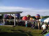
The Alabama Jubilee, begun in 1978, is the oldest hot air balloon race south of the Kentucky Derby's Great Balloon Race (from 1973). With visiting populations rising into 100,000, people crowd around more than 60 seven-story-tall balloons as they inflate. Because of the Alabama Jubilee, Decatur has been named "The Ballooning Capital of Alabama" by the Alabama State Legislature.
The Spirit of America Festival is one of the largest free 4 July festivals in the south. More than 65,000 people arrive in Decatur to watch annual celebrations and the Miss Spirit of America beauty pageant. (The contest was known as "Miss Point Mallard" from 1976 through 2013. It moved to the Princess Theater in 2014.)[18]
Riverfest is a celebration sponsored by the Decatur Jaycees. Set at Ingalls Harbor, along the beautiful Tennessee River, barbecuers come from all over the country to try their luck at beating Big Bob Gibson's Barbecue, the seven-time world champion.
Another large event in Decatur and North Alabama, the Racking Horse World Celebration attracts horses from around the world to compete in the largest Racking Horse competition. Held in the Celebration Arena near Priceville, the celebration draws up to 75,000 fans and competitors each year.
Parks and celebrations

- Alabama Jubilee
- Decatur City Cemetery
- Delano Park
- Jack Allen Soccer Complex
- Point Mallard Park
- Spirit of America Festival
- Riverfest
- Racking Horse World Celebration
- Wilson Morgan Park
Media
Newspapers
The Decatur Daily has been the only major newspaper based in the Decatur Metropolitan Area since 1912, and one of the few family owned newspapers in Alabama. It has an average daily circulation of 20,824 and a Sunday circulation of 23,840. The paper circulates in the morning to an area that includes Morgan County, Lawrence County, and Limestone County, and parts of Cullman County, and Winston County
The Huntsville Times is the only other newspaper with a larger circulation in the Huntsville-Decatur Combined Statistical Area, and has been in circulation since 1996 to most area counties, when the Huntsville News closed. Before then, the News was the morning paper, and the Times was the afternoon paper. After the News closed, the Times remained an afternoon paper until 2004.
Cable/Phone
Charter Communications, AT&T and Knology offer cable TV to Decatur. AT&T, Charter and Knology offer phone service to Decatur. With AT&T, Huntsville and Madison are local calls (Madison County only), but Athens is long distance. Decatur comes within 3 miles (5 km) of Athens and touches Huntsville. AT&T has not kept pace with growth in the region as reported in the Huntsville Times/Decatur Daily/Athens-News-Courier.[19]
Transportation
Air
Decatur is served by two major airports. The Huntsville International Airport, in suburban Huntsville is the second busiest airport in Alabama, behind Birmingham International Airport. The city is also served by the busiest regional airport in Alabama, the Pryor Field Regional Airport.[20]
Roads

Decatur, being only a mid-sized city, has not yet seen the conveniences of a major controlled access highway passing through the city limits.
Decatur's main thoroughfares are 6th Avenue (US 31) and The Beltline (State Route 67). 6th Avenue begins as both SR 20, US 72 Alt., and U.S. 31 split after being carried by the twin-span "Steamboat Bill" Hudson Memorial Bridge that crosses Tennessee River at the north central part of town. SR 20/Alternate U.S. 72 continues west towards The Shoals, after the Beltline begins in the vicinity of the Ascend Performance Materials LLC plant. 6th Avenue continues southward where it eventually intersects with Beltline Road. After that intersection, 6th Avenue continues southward to Birmingham as Decatur Highway.
Busiest intersections
| Rank | Intersection | Traffic Per Day |
|---|---|---|
| 1 | 6th Avenue (US 31) SR 20 Alternate U.S. 72 |
45,290 |
| 2 | The Beltline (AL 67) Spring Avenue SW |
38,000 |
| 3 | 6th Avenue (US 31) Stratford Road SE |
34,000 |
| 4 | PT Mallard Parkway (AL 67) Interstate 65 |
32,000 |
| 5 | The Beltline Betty Street Westmead Street |
31,000 |
Major highways
Improvements
Plans are under way to construct a controlled access beltway from Interstate 65 south of the city to Alternate U.S. 72 in Lawrence County, known as Veteran's Parkway.
In addition, there are plans to transform Alabama Highway 20/Alternate U.S. 72 into an extension of Interstate 565 into the city. Governor Bob Riley has said he will make sure that plans for the road will be put on the fast track, since more than 85 vehicle accidents occur on Highway 20's final approach into Decatur each year.[21]
The Beltline was built as a western bypass to relieve congestion on 6th Avenue. In doing so, however, this created another problem as sprawl quickly developed along the new arterial. Construction is currently under way to widen the road from four to six lanes, which was expected to be complete by 2012. As of August 2013 news reports, the project is well behind schedule and forecast to be into 2014 before it is completed.
Water (River)
Large shipments can move from Decatur to the Atlantic Ocean via the Tennessee River to the Mississippi River and the Gulf of Mexico. The United States builds some of its space launch vehicles in Decatur (United Launch Alliance vehicles only), and ships them to both Cape Canaveral and Vandenberg Air Force Base via this water route.
Education
Austin High and Decatur High are the two main high schools of the city. With the addition of the International Baccalaureate Program to Austin and Decatur High Schools, Decatur has become the first Alabama school system north of Birmingham and one of five in the state to offer the honors program for juniors and seniors (as of July 2006).
All high school football and soccer teams compete in the 10,000 seat Ogle Stadium.
However, both Austin and Decatur failed to make adequate yearly progress in 2006 as mandated in the No Child Left Behind Act. The state said Austin's 86 percent graduation rate was four points too low.
Decatur High missed in two categories: percent of special education students the system tested in reading and percent tested in math. The graduate rate was 76 percent.
The only institution of higher education located within the Decatur city limits is Calhoun Community College. It has three campuses; the main campus is located just north of the city on Highway 31.
Local public schools
High Schools
Middle Schools
Local private schools
- Decatur Heritage Christian Academy (Pre-K through 12th Grade) (SACS & ACSI)[22]
- Cornerstone Christian School
- Faith Christian Academy (K-12) (SACS & ACSI)[23][24]
- St. Ann's Catholic School (K-8)
Area higher education
- North Alabama School of Fine Arts - Decatur
- Alabama A&M University - Huntsville
- Athens State University - Athens
- Calhoun Community College System
- University of Alabama in Huntsville - Huntsville
- University of North Alabama - Florence
Nicknames
- "A Grand City on a Charming Scale" - The official Decatur City tag line adopted in 2005.
- "The River City" - So named because of the Tennessee River that flows on the northern edge of town and that inspires festivals and culture in the city.
- "The Chicago of the South" - Given to Decatur in the 1880s by a company formed to create a planned community, "New Decatur," just south of the original Decatur. At that time the city was home to several industries, including a boxcar plant, and home to the huge Louisville & Nashville railyards.
- "Ballooning Capital of Alabama" - Bestowed by the Alabama Legislature because of the annual Alabama Jubilee Hot Air Balloon Classic, which brings over 50 hot air balloons to Point Mallard Park. Begun in 1978, it is one of the oldest hot-air balloon rallies in the U.S.
- "The Heart of the Valley" - Because of Decatur's location at the very center of the Alabama portion of the Tennessee River and Tennessee Valley.
- "Home of America's First Wave Pool" - Decatur claims to be the home of the first wave pool ever built in the United States at the Point Mallard Aquatic Center.
- "Home of Meow Mix" - Decatur is home to one of the Meow Mix production facilities, and a sign reading "Decatur: Home of Meow Mix" is visible on one of the city's buildings from the Tennessee River bridge.
- "D-Rock or The Dec" - nickname given by high school students inside Decatur. Many people outside of Decatur also refer to the city with this nickname.[25]
- "Hub of the South" - Decatur is in a convenient location nearby many important southern cities.
- "City of Opportunity" - a popular name in the 1950s and 1960s due to the city's rapid growth during that era.
- "Decatur where it's Greater/ Greater Decatur" - a more recent phrase used by people in the area.
Notable people
- Joseph Abbott, Texas politician
- Richard W. Austin, U.S. congressman
- Taye Biddle, professional football player
- Lucas Black, actor
- Alonzo Boone, Negro League baseball player
- Marv Breeding, former Major League Baseball second baseman
- Anna Laura Bryan, Miss Alabama 2012
- Rufus Columbus Burleson, president of Baylor University from 1851 to 1861 and 1886 to 1897
- Charlie Burse, blues musician, noted for his skill playing a ukulele
- Kendrick Burton, former professional football defensive lineman
- John A. Caddell, attorney
- Jason Carthen, former professional football player and public speaker
- David Charles, neurologist
- Grace Curzon, Marchioness Curzon of Kedleston, second wife of George Curzon, 1st Marquess Curzon of Kedleston
- Bill J. Dukes, Alabama politician and mayor of Decatur from 1976 to 1994
- Paul T. Entrekin, aviator and stunt pilot
- Pop Gates, former professional basketball player and member of the Harlem Globetrotters
- Jerry Gillespie, songwriter
- Eugene C. Gordon, founder of Decatur Land Improvement and Furnace Company
- Micky Hammon, member of the Alabama House of Representatives
- Christopher Columbus Harris, U.S. Representative from 1914 to 1915
- Robin Henderson, Associate Director, Management, of the NASA Marshall Space Flight Center
- Richard Hendrix, professional basketball player
- Charlie Hodge, singer, vocal coach, musician, and close friend of Elvis Presley
- Mae C. Jemison, first African American woman in space
- Dean Jones, actor
- Leslie Kelley, former professional football player
- Seth Kimbrough, professional BMX rider, Former front man of Mortal Treason
- Gary Knotts, baseball player
- Alan Koch, former Major League Baseball pitcher
- Cricket Lee, entrepreneur and inventor
- Donold Lourie, member of the College Football Hall of Fame and former president of the Quaker Oats Company
- Seybourn Harris Lynne, United States federal judge from 1946 to 1973
- Rolando McClain, current Dallas Cowboys linebacker
- Arthur Orr, member of the Alabama Senate
- John O'Sullivan, conservative columnist and pundit
- Luther Patrick, U.S. Representative from 1937 to 1943
- Ray Pepper, former Major League Baseball outfielder
- Bennie Perrin, former Arizona Cardinals safety
- Charles Redding Pitt, United States Attorney for the U.S. District Court for the Middle District of Alabama; private lawyer; Democratic politician
- Jerraud Powers, current Arizona Cardinals cornerback
- Andy Price, comic artist, known for illustrating My Little Pony: Friendship is Magic
- Gary Redus, baseball player
- Kristopher Reisz, novelist
- Philip Rivers, current San Diego Chargers quarterback
- Rip Sewell, professional baseball player
- Charles Christopher Sheats, U.S. Representative from 1873 to 1875
- Perry Stephens, actor and singer
- Mandisa Stevenson, basketball player with the Women's National Basketball Association
- David Stewart, former professional football offensive tackle
- Skip Stewart, aerobatic pilot
- Travis S. Taylor, aerospace engineer and subject of National Geographic Channel's Rocket City Rednecks
- Gordon Terry, bluegrass and country music fiddler and guitarist
- Carson Tinker, professional football long snapper
- Judith Toups, birder and columnist for the Sun Herald of Biloxi
- Phil Waldrep, minister
- Don Whitmire, former professional football offensive tackle
- Mildred Wolfe, artist
References
| Wikimedia Commons has media related to Decatur, Alabama. |
- 1 2 Act 93. "AN ACT to incorporate the town of Decatur, in Morgan county." Acts Passed at the Eighth Annual Session of the General Assembly of the State of Alabama. 1826. Printed by Grantland & Robinson, State Printers. Pages 88-89.
- 1 2 "Annual Estimates of the Population for Incorporated Places in Alabama, Listed Alphabetically: April 1, 2010 to July 1, 2013". 2013 Population Estimates. U.S. Census Bureau, Population Division. June 3, 2014. Retrieved June 3, 2014.
- ↑ "Find a County". National Association of Counties. Archived from the original on 2011-05-31. Retrieved 2011-06-07.
- ↑ "US Gazetteer files: 2010, 2000, and 1990". United States Census Bureau. 2011-02-12. Retrieved 2011-04-23.
- 1 2 3 4 "Station Name: AL DECATUR PRYOR FLD". National Oceanic and Atmospheric Administration. Retrieved 2013-03-09.
- ↑ "Monthly Averages for Decatur, AL". The Weather Channel. June 2011.
- ↑ http://www.decaturdaily.com/news/elections/race_results/morgan_county/
- ↑ http://www.decaturdaily.com/news/elections/race_results/morgan_county/
- ↑ "Annual Estimates of the Resident Population for Incorporated Places: April 1, 2010 to July 1, 2015". Retrieved July 2, 2016.
- ↑ United States Census Bureau. "Census of Population and Housing". Archived from the original on May 11, 2015. Retrieved November 20, 2013.
- ↑ "Annual Estimates of the Resident Population: April 1, 2010 to July 1, 2013". Retrieved June 3, 2014.
- ↑ "FTC Gives Approval". Decatur Daily Newspaper. 2006-10-03.
- ↑ "Bass Pro, convention center planned for major Decatur development". Birmingham Business Journal. 2008-03-17.
- ↑ "Decatur Mayor: Sweetwater Deal Still Good". WHNT 19 News. 15 March 2010.
- ↑ "Why Have So Many Cities and Towns Given Away So Much Money to Bass Pro Shops and Cabela's?". The Atlantic. 13 August 2012.
- ↑ City of Decatur CAFR
- ↑ "Festivals and celebrations". Decatur-Morgan County Convention and Visitors Bureau. 2006. Archived from the original on 2007-07-28.
- ↑ Godbey, Catherine (June 22, 2014). "Beauty & Grace: Contestants to vie for Miss Spirit of America title". The Decatur Daily. Decatur, AL. Retrieved July 17, 2014.
- ↑ at&t/Huntsville/Athens/Decatur/Madison
- ↑ "Rivers, rails, roads, and air". Decatur Daily Newspaper. 2006-10-01.
- ↑ "3-year transit plan". Decatur Daily Newspaper. 2005-06-05.
- ↑
- ↑
- ↑
- ↑ "The overcome negatives, focus on positives". Decatur Daily Newspaper. 2006-06-28.
External links
- Official City Website: Decatur, Alabama, USA
- Official City Tourist Website: Decatur, Alabama, USA
- Decatur's Historic Albany Neighborhood
- Morgan County 911
- Decatur Police Department
- Decatur Fire and Rescue
- Cook's Natural Science Museum
- Official Decatur-Morgan County Website
- Decatur Convention & Visitor's Bureau
- Decatur Morgan County Chamber of Commerce
- Decatur City Schools
- Decatur Sports
- Decatur Parks and Recreation
- Morgan County Economic Development Association
- Institute of Southern Jewish Life, History of Decatur
Coordinates: 34°34′52″N 86°59′00″W / 34.580992°N 86.983392°W
Municipalities and communities of Limestone County, Alabama, United States | ||
|---|---|---|
| Cities |  | |
| Towns | ||
| Unincorporated communities | ||
| Footnotes | ‡This populated place also has portions in an adjacent county or counties | |
Municipalities and communities of Morgan County, Alabama, United States | ||
|---|---|---|
| Cities | 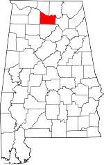 | |
| Towns | ||
| Unincorporated communities | ||
| Ghost town | ||
| Footnotes | ‡This populated place also has portions in an adjacent county or counties | |