Debdeb
| Debdeb دبدب | |
|---|---|
| Town and Commune | |
| Debdeb | |
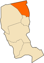 Location of Debdeb Commune within Illizi Province | |
 Debdeb Location of Debdeb within Algeria | |
| Coordinates: DZ 29°58′3″N 9°25′26″E / 29.96750°N 9.42389°ECoordinates: DZ 29°58′3″N 9°25′26″E / 29.96750°N 9.42389°E | |
| Country |
|
| Province | Illizi |
| District | In Amenas |
| Government | |
| • PMA Seats | 7 |
| Area | |
| • Total | 31,537 km2 (12,177 sq mi) |
| Population (2008)[1] | |
| • Total | 4,341 |
| • Density | 0.14/km2 (0.36/sq mi) |
| Time zone | CET (UTC+01) |
| Postal code | 33220 |
| ONS code | 3303 |
Debdeb is a town and commune in In Amenas District, Illizi Province, Algeria. According to the 2008 census it has a population of 4,341,[1] up from 3,212 in 1998,[2] and an annual population growth rate of 3.1%, the lowest in the province.[1] Its postal code is 33220 and its municipal code is 3303.
Geography
Debdeb lies at an altitude of 345 metres (1,132 ft) near the northern edge of the Hamada de Tinrhert, a large rocky area of the Sahara around the border of Algeria and Libya. The Grand Erg Oriental, a vast area of sand dunes, lies to the north.
Climate
Debdeb has a hot desert climate (Köppen climate classification BWh), with extremely hot summers and mild winters, and very little precipitation throughout the year.
| Climate data for Debdeb | |||||||||||||
|---|---|---|---|---|---|---|---|---|---|---|---|---|---|
| Month | Jan | Feb | Mar | Apr | May | Jun | Jul | Aug | Sep | Oct | Nov | Dec | Year |
| Average high °C (°F) | 17.9 (64.2) |
20.7 (69.3) |
25.7 (78.3) |
31.5 (88.7) |
36.0 (96.8) |
41.5 (106.7) |
42.6 (108.7) |
41.6 (106.9) |
38.2 (100.8) |
31.9 (89.4) |
24.3 (75.7) |
18.9 (66) |
30.9 (87.63) |
| Daily mean °C (°F) | 10.4 (50.7) |
12.7 (54.9) |
17.0 (62.6) |
22.3 (72.1) |
27.2 (81) |
32.0 (89.6) |
32.5 (90.5) |
32.0 (89.6) |
29.0 (84.2) |
23.4 (74.1) |
16.8 (62.2) |
11.7 (53.1) |
22.25 (72.05) |
| Average low °C (°F) | 2.9 (37.2) |
4.8 (40.6) |
8.4 (47.1) |
13.2 (55.8) |
18.5 (65.3) |
22.5 (72.5) |
22.4 (72.3) |
22.4 (72.3) |
19.8 (67.6) |
15.0 (59) |
9.4 (48.9) |
4.5 (40.1) |
13.65 (56.56) |
| Average precipitation mm (inches) | 4 (0.16) |
4 (0.16) |
6 (0.24) |
4 (0.16) |
2 (0.08) |
1 (0.04) |
0 (0) |
0 (0) |
1 (0.04) |
2 (0.08) |
3 (0.12) |
3 (0.12) |
30 (1.2) |
| Source: climate-data.org[3] | |||||||||||||
Transportation
Debdeb is on the national highway N53, which leads north to Ghadames (in Libya) and south to In Amenas.
Education
4.0% of the population has a tertiary education, and another 13.2% has completed secondary education.[4] The overall literacy rate is 71.8%, and is 79.9% among males and 63.0% among females.[5]
Localities
The commune is composed of seven localities:[6]
- Debdeb
- Aïn Sabri
- Fort Saint
- Stah
- Merixen
- Alrar Erg
- Yagous
References
- 1 2 3 "Population: Illizi Wilaya" (PDF) (in French). Office National des Statistiques Algérie. Retrieved 24 February 2013.
- ↑ "Algeria Communes". Statoids. Retrieved 8 March 2013.
- ↑ "Climate data for: Debdeb". climate-data.org. Retrieved 21 May 2013.
- ↑ "Structure relative de la population résidente des ménages ordinaires et collectifs âgée de 6 ans et plus selon le niveau d'instruction et la commune de résidence." (PDF) (in French). Office National des Statistiques Algérie. Retrieved 13 February 2013.
- ↑ "Taux d'analphabétisme et taux d'alphabétisation de la population âgée de 15 ans et plus, selon le sexe et la commune de résidence ." (PDF) (in French). Office National des Statistiques Algérie. Retrieved 21 May 2013.
- ↑ "Décret n° 84-365, fixant la composition, la consistance et les limites territoriale des communes. Wilaya d'El Oued" (PDF) (in French). Journal officiel de la République Algérienne,. 19 December 1984. p. 1554. Archived from the original (PDF) on 2 March 2013 or before. Retrieved 2 March 2013. Check date values in:
|archive-date=(help)
 |
Ouargla Hassi Messaoud (Ouargla) |
El Borma (Ouargla) Merixen |
Ghadames (Libya) | |
| Gassi Touil El Goléa (Ghardaïa) |
|
Sabha (Libya) | ||
| ||||
| | ||||
| Bordj Omar Driss | Ohanet In Amenas Illizi |
Ubari (Libya) |
