De Kooy (hamlet)
| De Kooy | |
|---|---|
| Buurtschap | |
| Coordinates: 52°54′52″N 4°47′9″E / 52.91444°N 4.78583°E | |
| Country | Netherlands |
| Province | Noord-Holland |
| Municipality | Den Helder |
Coordinates: 52°54′51″N 4°47′45″E / 52.91417°N 4.79583°E
De Kooy is a hamlet in the Dutch province of North Holland. It is a part of the municipality of Den Helder, and lies about 5 kilometers (3.1 mi) southeast of the Den Helder city centre.
The hamlet is known for the nearby naval air field De Kooy.
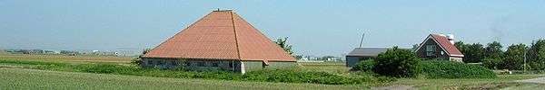
Countryside around De Kooy
Climate
| Climate data for De Koog | |||||||||||||
|---|---|---|---|---|---|---|---|---|---|---|---|---|---|
| Month | Jan | Feb | Mar | Apr | May | Jun | Jul | Aug | Sep | Oct | Nov | Dec | Year |
| Average high °C (°F) | 5 (41) |
4 (40) |
7 (45) |
10 (50) |
14 (58) |
17 (62) |
19 (66) |
19 (67) |
17 (63) |
13 (56) |
9 (49) |
7 (44) |
12 (54) |
| Average low °C (°F) | 1 (34) |
1 (33) |
3 (37) |
4 (40) |
8 (47) |
11 (52) |
13 (56) |
14 (57) |
12 (53) |
8 (47) |
5 (41) |
3 (37) |
7 (45) |
| Average precipitation mm (inches) | 58 (2.3) |
43 (1.7) |
46 (1.8) |
41 (1.6) |
41 (1.6) |
43 (1.7) |
64 (2.5) |
79 (3.1) |
81 (3.2) |
89 (3.5) |
80 (3) |
69 (2.7) |
726 (28.6) |
| Source: Weatherbase [1] | |||||||||||||
References
- ↑ "Weatherbase: Historical Weather for De Koog, Netherlands". Weatherbase. 2011. Retrieved on November 24, 2011.
This article is issued from Wikipedia - version of the 9/19/2016. The text is available under the Creative Commons Attribution/Share Alike but additional terms may apply for the media files.