Deštné v Orlických horách
| Deštné v Orlických horách | |||
| Village | |||
 Upper part of Deštné | |||
|
|||
| Country | Czech Republic | ||
|---|---|---|---|
| Region | Hradec Králové | ||
| District | Rychnov nad Kněžnou | ||
| Little District | Dobruška | ||
| Elevation | 649 m (2,129 ft) | ||
| Coordinates | CZ 50°18′13″N 16°20′53″E / 50.30361°N 16.34806°ECoordinates: CZ 50°18′13″N 16°20′53″E / 50.30361°N 16.34806°E | ||
| Area | 32.08 km2 (12.39 sq mi) | ||
| Population | 625 (2006-08-28) | ||
| Density | 19/km2 (49/sq mi) | ||
| First mentioned | 1362 | ||
| Mayor | Alena Křížová | ||
| Timezone | CET (UTC+1) | ||
| - summer (DST) | CEST (UTC+2) | ||
| Postal code | 517 91 | ||
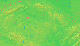  Location in the Czech Republic
| |||
| Wikimedia Commons: Deštné v Orlických horách | |||
| Website: www.destne.cz | |||


Deštné v Orlických horách (German: Deschnei im Adlergebirge) is a village in the Rychnov nad Kněžnou District, Czech Republic. It lies in the Orlické Mountains.
Football club FK Náchod-Deštné plays here.
Gallery
 The cableway
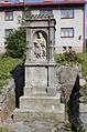 The piety
 The Hotel
External links
-
 Media related to Deštné v Orlických horách at Wikimedia Commons
 - Municipal website
- Deštné — ski centre
This article is issued from Wikipedia - version of the 4/7/2016. The text is available under the Creative Commons Attribution/Share Alike but additional terms may apply for the media files.