Dawki
| Dawki Duki | |
|---|---|
| town | |
 Dawki  Dawki Location in Meghalaya, India | |
| Coordinates: 25°11′0″N 92°1′0″E / 25.18333°N 92.01667°ECoordinates: 25°11′0″N 92°1′0″E / 25.18333°N 92.01667°E | |
| Country |
|
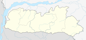
| State | Meghalaya |
| District | West Jaintia Hills |
| Languages | |
| • Official | English |
| Time zone | IST (UTC+5:30) |
| PIN | 793109 |
| Vehicle registration | ML |
| Nearest city | Shillong, Syllhet |
Dawki is a town in West Jaintia Hills district, Meghalaya, India.
Geography
It is located at 25°11′0″N 92°1′0″E / 25.18333°N 92.01667°E.[1]
It is on the border between India and Bangladesh.[2]
Border-crossing
Dawki-Tamabil is one of the few road border crossings between India and Bangladesh. It is used mainly for coal transportation to Bangladesh. Some 500 trucks cross the border every day in peak season.[3][4][5]
Some shared transport is available from Barabazar in Shillong to the border post at Dawki every morning. Buses are also available for the 70 kilometres (43 mi) journey from Shillong. On the other side inside Bangladesh the Tamabil bus station, 1.5 kilometres (0.93 mi) away, has regular bus service to Sylhet 55 kilometres (34 mi) away.[6][7]
Places of interest
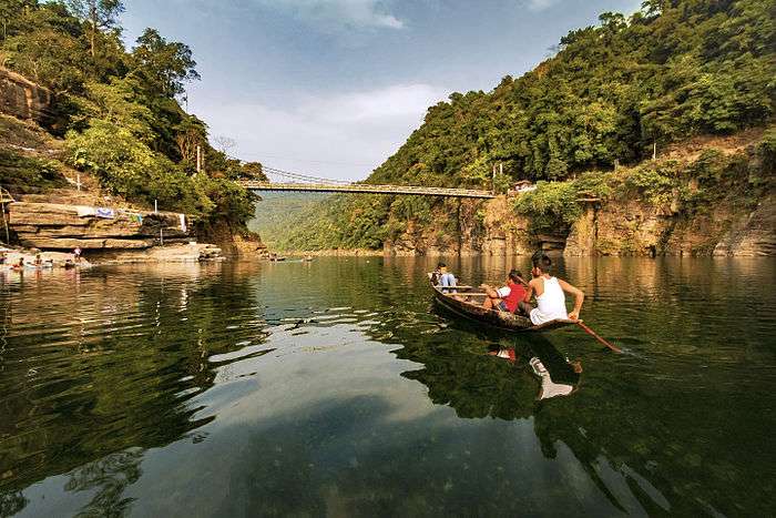
Dawki Bridge, is a suspension bridge over the Umngot river. It was constructed in 1932 by the British[8]
References
- ↑ http://wikimapia.org/559420/Dawki Wikimapia
- ↑ http://blogs.timesofindia.indiatimes.com/talkingturkey/a-trip-to-dawki-a-hidden-paradise-and-a-friendly-international-border/
- ↑ "Travel and Tourism Information". Retrieved 2011-12-16.
- ↑ "Coal-laden trucks stranded on Bangladesh border". The Hindu Business Line, 13 December 2011. Retrieved 2011-12-16.
- ↑ "Notification No. 63/94-Cus. (N.T.) dtd 21/11/1994 with amendments - Land Customs Stations and Routes for import and export of goods by land or inland water ways". Retrieved 2012-03-15.
- ↑ Shillong to Sylhet. India Lonely Planet. Retrieved 2011-12-16.
- ↑ From India. Bangladesh Lonely Planet. Retrieved 2011-12-16.
- ↑ http://en.structurae.de/structures/data/index.cfm?id=s0010632 Dawki Suspension Bridge