Davidson, Minnesota
Davidson is an unorganized territory in Aitkin County, Minnesota, United States. The population was 42 at the 2010 census.[1]
History
Davidson is named for A. D. Davidson, an early prominent landowner.[2]
Geography
According to the United States Census Bureau, the unorganized territory has a total area of 37.3 square miles (96.7 km2), of which 32.1 square miles (83.1 km2) is land and 5.3 square miles (13.6 km2), or 14.06%, is water.[1]
Demographics
As of the census[3] of 2000, there were 57 people, 28 households, and 21 families residing in the unorganized territory. The population density was 1.8 people per square mile (0.7/km²). There were 54 housing units at an average density of 1.7/sq mi (0.7/km²). The racial makeup of the unorganized territory was 96.49% White, 1.75% Native American, and 1.75% from two or more races. Hispanic or Latino of any race were 1.75% of the population.
There were 28 households out of which 25.0% had children under the age of 18 living with them, 53.6% were married couples living together, 14.3% had a female householder with no husband present, and 25.0% were non-families. 21.4% of all households were made up of individuals and 14.3% had someone living alone who was 65 years of age or older. The average household size was 2.04 and the average family size was 2.29.
In the unorganized territory the population was spread out with 14.0% under the age of 18, 5.3% from 18 to 24, 26.3% from 25 to 44, 36.8% from 45 to 64, and 17.5% who were 65 years of age or older. The median age was 48 years. For every 100 females there were 111.1 males. For every 100 females age 18 and over, there were 104.2 males.
The median income for a household in the unorganized territory was $23,438, and the median income for a family was $30,000. Males had a median income of $36,250 versus $19,375 for females. The per capita income for the unorganized territory was $18,886. There were 8.3% of families and 11.0% of the population living below the poverty line, including 28.6% of under eighteens and 20.0% of those over 64.
References
- 1 2 "Geographic Identifiers: 2010 Demographic Profile Data (G001): Davidson UT, Aitkin County, Minnesota". U.S. Census Bureau, American Factfinder. Retrieved June 17, 2013.
- ↑ Upham, Warren (2001). Minnesota Place Names: A Geographical Encyclopedia. Minnesota Historical Society Press. p. 14.
- ↑ "American FactFinder". United States Census Bureau. Retrieved 2008-01-31.
Municipalities and communities of Aitkin County, Minnesota, United States | ||
|---|---|---|
| Cities | 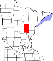 | |
| Townships |
| |
| Unorganized territories | ||
| Unincorporated communities | ||
| Indian reservations | ||
| Footnotes | ‡This populated place also has portions in an adjacent county or counties | |
Coordinates: 47°52′36″N 96°50′50″W / 47.87667°N 96.84722°W