Darrang district
| Darrang district দৰং | |
|---|---|
| District | |
|
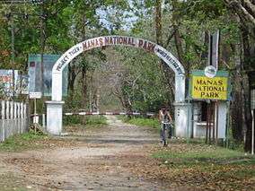
An entrance to Manas National Park, Darrang | |
 Darrang district's location in Assam | |
| Country |
|
| State | Assam |
| Headquarters | Mangaldoi |
| Population (2011) | |
| • Total | 908,090 |
| Time zone | IST (UTC+05:30) |
| ISO 3166 code | IN-AS |
| Website | http://darrang.gov.in/ |
Darrang (Pron: ˌdəˈræŋ or dæˈræŋ) (Assamese: দৰং) is an administrative district in the state of Assam in India. The district headquarters are located at Mangaldoi. The district occupies an area of 3481 km2.
History
In the 16th century Darrang was subject to the Koch king of Kamarupa, Nara Narayan, and on the division of his dominions among his heirs passed to an independent line of rajas. Early in the 17th century the raja Bali Narayan invoked the aid of the Ahoms of Upper Assam against the Muslim invaders; after his defeat and death in 1637 the Ahoms dominated the whole district. About 1785 the Darrang rajas took advantage of the decay of the Ahom kingdom to try and re-establish their independence, but they were defeated by a British expedition in 1792, and in 1826 Darrang, with the rest of Assam, passed under British control.[1]
In 1983 Sonitpur district was formed from part of Darrang.[2] This was repeated on 14 June 2004 with the creation of Udalguri district.[2]
Geography
Darrang district occupies an area of 3,481 square kilometres (1,344 sq mi).[3]
National protected area
Divisions
There are four Assam Legislative Assembly constituencies in this district: Kalaigaon, Sipajhar, Mangaldoi, and Dalgaon.[4] Mangaldoi is designated for scheduled castes.[4] All four are in the Mangaldoi Lok Sabha constituency.[5]
Demographics
According to the 2011 census Darrang district has a population of 908,090,[6] roughly equal to the nation of Fiji[7] or the US state of Delaware.[8] This gives it a ranking of 463rd in India (out of a total of 640).[6] The district has a population density of 491 inhabitants per square kilometre (1,270/sq mi) .[6] Its population growth rate over the decade 2001-2011 was 19.51%.[6] Darrang has a sex ratio of 923 females for every 1000 males,[6] and a literacy rate of 64.55%.[6]
868,532 (57.74%) are Hindus, 534,658 (35.54%) are Muslims, and 97,306 (1.75%) are Christians.[9]
Flora and fauna
In 1990 Darrang district became home to Manas National Park, which has an area of 500 km2 (193.1 sq mi).[10] It shares the park with four other districts. It is also home to Orang National Park, which it shares with Sonitpur district. Orang was established in 1999 and has an area of 79 km2 (30.5 sq mi).[10] Apart from the two national parks, it's also home to a wildlife sanctuary: the Bornadi.[10]
References
- ↑
 One or more of the preceding sentences incorporates text from a publication now in the public domain: Chisholm, Hugh, ed. (1911). "Darrang". Encyclopædia Britannica. 7 (11th ed.). Cambridge University Press. p. 837.
 - 1 2 Law, Gwillim (2011-09-25). "Districts of India". Statoids. Retrieved 2011-10-11.
- ↑ Srivastava, Dayawanti et al. (ed.) (2010). "States and Union Territories: Assam: Government". India 2010: A Reference Annual (54th ed.). New Delhi, India: Additional Director General, Publications Division, Ministry of Information and Broadcasting (India), Government of India. p. 1116. ISBN 978-81-230-1617-7.
- 1 2 "List of Assembly Constituencies showing their Revenue & Election District wise break - up" (PDF). Chief Electoral Officer, Assam website. Retrieved 26 September 2011.
- ↑ "List of Assembly Constituencies showing their Parliamentary Constituencies wise break - up" (PDF). Chief Electoral Officer, Assam website. Retrieved 26 September 2011.
- 1 2 3 4 5 6 "District Census 2011". Census2011.co.in. 2011. Retrieved 2011-09-30.
- ↑ US Directorate of Intelligence. "Country Comparison:Population". Retrieved 2011-10-01.
Fiji 883,125 July 2011 est.
- ↑ "2010 Resident Population Data". U. S. Census Bureau. Retrieved 2011-09-30.
Delaware 897,934
- ↑ "Demographic Features of the District". Retrieved 2009-10-19.
- 1 2 3 Indian Ministry of Forests and Environment. "Protected areas: Assam". Retrieved September 25, 2011.
External links
 |
Udalguri district | | ||
| Kamrup district | |
Sonitpur district | ||
| ||||
| | ||||
| Morigaon district |
| Topics | |
|---|---|
| History | |
| Districts & Divisions |
|
| Geography | |
| Culture | |
| Arts, Literature, Music Cinema |
|
| People | |
| Notable surnames |
|
| Urban centres | |
| |
Coordinates: 26°45′N 92°30′E / 26.750°N 92.500°E