Darkot Pass
| Darkot Pass | |
|---|---|
|
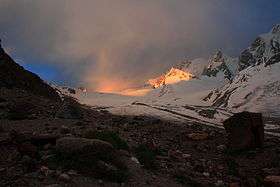
Darkot Pass in Gilgit Baltistan, Pakistan | |
| Elevation | 4,703 m (15,430 ft) |
| Location | Pakistan |
| Range | Hindukush Mountains |
| Coordinates | 36°44′42″N 73°25′59″E / 36.74500°N 73.43306°ECoordinates: 36°44′42″N 73°25′59″E / 36.74500°N 73.43306°E |
Darkot pass (el. 15,430 ft., open May through October) is a high mountain pass that connects Baroghil Valley in Chitral and Rawat valley of Ghizer District in Gilgit, Pakistan. It is also known as "Darkut".
The pass is about 10 miles to the east of Koyo Zom (Zum) (6872m), the highest peak in Ghizer district. The border between Chitral and Northern Areas runs through the pass over Darkot Glacier. Eight miles to the south is Darkot village on the River Darkot, a small tributary of Ghizar River). To the northeast of Darkot pass is Chitral. Ten miles to the northwest of the pass is Chilmarabad, a village one mile south of the Boroghil pass.
See also
This article is issued from Wikipedia - version of the 2/8/2015. The text is available under the Creative Commons Attribution/Share Alike but additional terms may apply for the media files.