Daniels, West Virginia
| Daniels, West Virginia | |
|---|---|
| Census-designated place (CDP) | |
 Location of Daniels, West Virginia | |
| Coordinates: 37°44′23″N 81°7′29″W / 37.73972°N 81.12472°WCoordinates: 37°44′23″N 81°7′29″W / 37.73972°N 81.12472°W | |
| Country | United States |
| State | West Virginia |
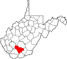
| County | Raleigh |
| Area[1] | |
| • Total | 4.6 sq mi (12.0 km2) |
| • Land | 4.6 sq mi (12.0 km2) |
| • Water | 0.0 sq mi (0.0 km2) |
| Elevation | 2,372 ft (723 m) |
| Population (2010)[2] | |
| • Total | 1,881 |
| • Density | 410/sq mi (160/km2) |
| Time zone | Eastern (EST) (UTC-5) |
| • Summer (DST) | EDT (UTC-4) |
| ZIP code | 25832 |
| Area code(s) | 304 |
| FIPS code | 54-20164[3] |
| GNIS feature ID | 1537988[4] |
Daniels is a census-designated place (CDP) in Raleigh County, West Virginia, United States. The population was 1,881 at the 2010 census.[2]
Geography
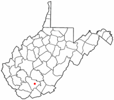
Daniels is located at 37°44′23″N 81°7′29″W / 37.73972°N 81.12472°W (37.739752, -81.124609).[1]
According to the United States Census Bureau, the CDP has a total area of 4.6 square miles (12.0 km²), all land.
Daniels is located on U.S. Route 19, south of Interstate 64.
Demographics
As of the census[3] of 2000, there were 1,846 people, 818 households, and 525 families residing in the CDP. The population density was 395.0 people per square mile (152.6/km²). There were 913 housing units at an average density of 195.4/sq mi (75.5/km²). The racial makeup of the CDP was 97.72% White, 1.08% African American, 0.22% Native American, 0.60% Asian, 0.16% from other races, and 0.22% from two or more races. Hispanic or Latino of any race were 0.43% of the population.
There were 818 households out of which 23.7% had children under the age of 18 living with them, 53.3% were married couples living together, 8.3% had a female householder with no husband present, and 35.7% were non-families. 32.4% of all households were made up of individuals and 19.6% had someone living alone who was 65 years of age or older. The average household size was 2.17 and the average family size was 2.70.
In the CDP the population was spread out with 18.9% under the age of 18, 7.5% from 18 to 24, 25.4% from 25 to 44, 23.6% from 45 to 64, and 24.7% who were 65 years of age or older. The median age was 43 years. For every 100 females there were 82.6 males. For every 100 females age 18 and over, there were 76.4 males.
The median income for a household in the CDP was $27,955, and the median income for a family was $40,125. Males had a median income of $29,519 versus $20,000 for females. The per capita income for the CDP was $22,266. About 11.6% of families and 12.4% of the population were below the poverty line, including 7.9% of those under age 18 and 9.7% of those age 65 or over.
References
- 1 2 "US Gazetteer files: 2010, 2000, and 1990". United States Census Bureau. 2011-02-12. Retrieved 2011-04-23.
- 1 2 "American FactFinder". United States Census Bureau. Retrieved 2011-05-14.
- 1 2 "American FactFinder". United States Census Bureau. Retrieved 2008-01-31.
- ↑ "US Board on Geographic Names". United States Geological Survey. 2007-10-25. Retrieved 2008-01-31.