Damascus Township, Wayne County, Pennsylvania
| Damascus, Pennsylvania | |
|---|---|
| Second-class township | |
| Township of Damascus | |
|
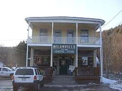
The Milanville General Store in Milanville. | |
 Location in Wayne County and the state of Pennsylvania. | |
| Country | United States |
| State | Pennsylvania |
| US Congressional District | PA-10 |
| State Senatorial District | 20 |
| State House of Representatives District | 139 |
| County | Wayne |
| School District |
Wayne Highlands Region I |
| First settlement | 1670[1] |
| First permanent settlement | 1855[1] |
| Incorporated |
March 21, 1798 (original township of Wayne County) |
| Founded by | Joseph Skinner[1] |
| Named for | Damascus, Syria |
| Government | |
| • Type | Board of Supervisors |
| • Board of Supervisors[2] |
Supervisors
|
| • US Representative | Tom Marino (R) |
| • State Senator | Lisa Baker (R) |
| • State Representative | Michael Peifer (R) |
| Area | |
| • Total | 80.3 sq mi (208 km2) |
| • Land | 78.7 sq mi (204 km2) |
| • Water | 1.6 sq mi (4 km2) |
| Elevation | 1,283 ft (391 m) |
| Population (2010) | |
| • Total | 3,659 |
| • Density | 46.5/sq mi (18.0/km2) |
| Time zone | Eastern (EST) (UTC-5) |
| • Summer (DST) | Eastern Daylight (EDT) (UTC-4) |
| Area code(s) | 570 |
| GNIS feature ID | 1217217[3] |
| FIPS code | 42-127-18104[4] |
| Website | Damascus Township |
Damascus is a second-class township in Wayne County, Pennsylvania. The township's population was 3,659 at the time of the 2010 United States Census.[5]
History
The Damascus Historic District, Milanville Historic District, Hill's Sawmill, and Milanville-Skinners Falls Bridge are listed on the National Register of Historic Places.[6]
Geography
According to the United States Census Bureau, the township has a total area of 80.3 square miles (208 km2), of which, 78.7 square miles (204 km2) of it is land and 1.6 square miles (4.1 km2) of it (1.99%) is water.
The eastern township boundary is the Delaware River, which also forms the border with the state of New York. The Callicoon, Cochecton–Damascus and Skinners Falls–Milanville bridges connect the township with the towns of Delaware and Cochecton in Sullivan County across the river.
Communities
The following villages are located in Damascus Township:
Demographics
As of the census of 2010, there were 3,659 people, 1,588 households, and 1,060 families residing in the township. The population density was 46.5 people per square mile (18/km²). There were 2,296 housing units at an average density of 29.2/sq mi (11.4/km²). The racial makeup of the township was 97.7% White, 0.5% African American, 0.1% Native American, 0.4% Asian, 0.2% from other races, and 1.1% from two or more races. Hispanic or Latino of any race were 2.2% of the population.
There were 1,588 households out of which 23.3% had children under the age of 18 living with them, 56.6% were married couples living together, 6.5% had a female householder with no husband present, and 33.2% were non-families. 29.2% of all households were made up of individuals and 13.5% had someone living alone who was 65 years of age or older. The average household size was 2.30 and the average family size was 2.82.
In the township the population was spread out with 20.6% under the age of 18, 58% from 18 to 64, and 21.4% who were 65 years of age or older. The median age was 48 years.
The median income for a household in the township was $47,772, and the median income for a family was $59,866. Males had a median income of $41,607 versus $27,917 for females. The per capita income for the township was $24,463. About 6% of families and 7.4% of the population were below the poverty line, including 15.4% of those under age 18 and 4.2% of those age 65 or over.
References
- 1 2 3 Goodrich, Phineas G. (1992) [1880]. History of Wayne County. Baltimore: Gateway Press, Inc. p. 118.
- ↑ "BOARD OF SUPERVISORS". Damascus Township. Doteasy.com. 17 September 2014. Retrieved 4 December 2014.
- ↑ "Township of Damascus". Geographic Names Information System. United States Geological Survey. 1 December 1989. Retrieved 4 December 2014.
- ↑ U.S. Census Bureau. Census 2000. "Census Demographic Profiles, Damascus Township" (PDF). CenStats Databases. Retrieved 2009-01-31.
- ↑ "American FactFinder". United States Census Bureau. Archived from the original on September 11, 2013. Retrieved 2011-05-14.
- ↑ National Park Service (2010-07-09). "National Register Information System". National Register of Historic Places. National Park Service.
- 1 2 3 4 5 6 7 8 9 10 11 12 13 14 15 "DAMASCUS: SECOND CLASS TOWNSHIP MAP" (PDF). Pennsylvania Department of Transportation. Commonwealth of Pennsylvania. 4 December 2007. Retrieved 4 December 2014.
- ↑ "Atco". Geographic Names Information System. United States Geological Survey. 2 August 1979. Retrieved 4 December 2014.
- ↑ Goodrich. p. 136.
- ↑ "Boyds Mills". Geographic Names Information System. United States Geological Survey. 2 August 1979. Retrieved 4 December 2014.
- ↑ Commemorative Biographical Record of Northeastern Pennsylvania. Chicago: J.H. Beers and Co. 1900. p. 600.
- ↑ Mathews, Alfred (1886). History of Wayne, Pike, and Monroe Counties, Pennsylvania. Philadelphia: R. T. Peck & Company. p. 472. Retrieved 4 December 2014.
- ↑ "Calkins". Geographic Names Information System. United States Geological Survey. 2 August 1979. Retrieved 4 December 2014.
- ↑ "Conklin Hill". Geographic Names Information System. United States Geological Survey. 2 August 1979. Retrieved 4 December 2014.
- ↑ Mathews. p. 458.
- ↑ "Darbytown". Geographic Names Information System. United States Geological Survey. 2 August 1979. Retrieved 4 December 2014.
- ↑ "Fallsdale". Geographic Names Information System. United States Geological Survey. 2 August 1979. Retrieved 4 December 2014.
- ↑ "Hilltown". Geographic Names Information System. United States Geological Survey. 30 August 1990. Retrieved 4 December 2014.
- ↑ "Rutledgedale". Geographic Names Information System. United States Geological Survey. 2 August 1979. Retrieved 4 December 2014.
- ↑ "Stanton Corner". Geographic Names Information System. United States Geological Survey. 2 August 1979. Retrieved 4 December 2014.
- ↑ "Tyler Hill". Geographic Names Information System. United States Geological Survey. 2 August 1979. Retrieved 4 December 2014.
- ↑ "West Damascus". Geographic Names Information System. United States Geological Survey. 2 August 1979. Retrieved 4 December 2014.
Municipalities and communities of Wayne County, Pennsylvania, United States | ||
|---|---|---|
| Boroughs |  | |
| Townships | ||
| CDPs | ||
| Unincorporated communities | ||