Daly Basin
| Daly Basin Northern Territory | |||||||||||||
|---|---|---|---|---|---|---|---|---|---|---|---|---|---|
 | |||||||||||||
| Area | 20,922 km2 (8,078.0 sq mi) | ||||||||||||
| |||||||||||||
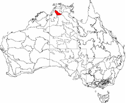
The Daly Basin, an interim Australian bioregion, is located in the Northern Territory,[1][2] comprising an area of 2,092,229 hectares (5,170,010 acres)[3] of central Arnhem Land in the Top End of the Northern Territory.[4]
The bioregion includes gently undulating plains with scattered low plateau remnants and some rocky hills and gorges along its western edge. The dominant vegetation is Darwin woolybutt and stringybark open forests. Land uses include extensive grazing, intensive horticulture, and tourism. There are also areas of Aboriginal land. The major population centre is Katherine.[4]
See also
References
- ↑ Environment Australia. "Revision of the Interim Biogeographic Regionalisation for Australia (IBRA) and Development of Version 5.1 - Summary Report". Department of the Environment and Water Resources, Australian Government. Archived from the original on 2006-09-05. Retrieved 2007-01-31.
- ↑ IBRA Version 6.1 Archived September 8, 2006, at the Wayback Machine. data
- ↑ "Interim Biogeographic Regionalisation for Australia (IBRA7) regions and codes". Department of Sustainability, Environment, Water, Population and Communities. Commonwealth of Australia. 2012. Retrieved 13 January 2013.
- 1 2 "Daly Basin bioregion" (PDF). Department of the Environment. Australian Government. Retrieved 1 June 2015.
This article is issued from Wikipedia - version of the 11/14/2016. The text is available under the Creative Commons Attribution/Share Alike but additional terms may apply for the media files.