Daly's Cross
| Daly's Cross Crosaire Uí Dhalaigh | |
|---|---|
| Town | |
 Daly's Cross Location in Ireland | |
| Coordinates: 52°42′34″N 8°29′27″W / 52.7094°N 8.4907°WCoordinates: 52°42′34″N 8°29′27″W / 52.7094°N 8.4907°W | |
| Country | Ireland |
| Province | Munster |
| County | County Limerick |
| Time zone | WET (UTC+0) |
| • Summer (DST) | IST (WEST) (UTC-1) |
| Irish Grid Reference | R660627 |
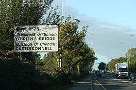
Daly's Cross (Irish: Crosaire Uí Dhalaigh) is a small settlement in County Limerick, Ireland, lying some 12 km east of Limerick city, at the junction of the R445 with R525. Daly's Cross was bypassed in September 2010 by the M7. Prior to being bypassed Daly's Cross was noted as a dangerous junction and heavily trafficked as the R445 formed part of the old N7 Dublin to Limerick primary route.
Daly's Cross on the N7
Transport
Castleconnell railway station, which first opened to traffic on 8 August 1858, is nearby.[1]
See also
References
- ↑ "Castleconnell station" (PDF). Railscot - Irish Railways. Retrieved 2007-09-05.
This article is issued from Wikipedia - version of the 3/17/2013. The text is available under the Creative Commons Attribution/Share Alike but additional terms may apply for the media files.