Dahisar railway station
दहिसर | |||||||||||
|---|---|---|---|---|---|---|---|---|---|---|---|
| Mumbai Suburban Railway station | |||||||||||
 | |||||||||||
| Location | Dahisar | ||||||||||
| Coordinates | 19°15′00″N 72°51′33″E / 19.2501°N 72.8593°ECoordinates: 19°15′00″N 72°51′33″E / 19.2501°N 72.8593°E | ||||||||||
| Owned by | Ministry of Railways, Indian Railways | ||||||||||
| Line(s) | Western Line | ||||||||||
| Platforms | 4 | ||||||||||
| Tracks | 4 | ||||||||||
| Construction | |||||||||||
| Structure type | Standard on-ground station | ||||||||||
| Parking | No | ||||||||||
| Bicycle facilities | No | ||||||||||
| Other information | |||||||||||
| Fare zone | Western Railways | ||||||||||
| Electrified | Yes | ||||||||||
| Services | |||||||||||
| |||||||||||
| Location | |||||||||||
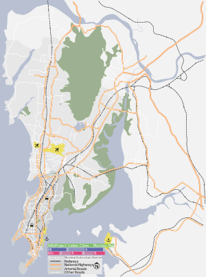 Dahisar Location within Mumbai | |||||||||||
Dahisar is a railway station on the Western line of the Mumbai Suburban Railway network. Dahisar station is the last station in Mumbai (officially). The area around the station is heavily trafficked and congested.
With the construction of the railway line connecting Dahisar to the city of Mumbai in 1867,[1] came the first lot of migrants, the people from Sindhudurg region of Konkan. These migrants established the first planned residential areas of Dahisar - Maratha Colony in Dahisar East and Mhatre Wadi in the West. The Railway authorities wanted to name the Railhead at Dahisar as Mount Poinsur, but the locals opposed this move and forced the authorities to name it as Dahisar. Currently, it has 4 platforms with 2 for Slow line (Up and Down) and 2 for fast line(Up and Down). All platforms can handle 15-coach Suburban trains.


Connectivity
Dahisar East: Dahisar station mostly serves the areas of Rawalpada, Kokanipada, Anand Nagar, Vaishali Nagar, Parbat Nagar, Dahisar Check Naka, Ketki pada etc. Auto Rikshaw services (individually and sharing both) are available to the above-mentioned areas. Since the road leading to Dahisar station is narrow, no buses directly ply till the entrance of Dahisar station. Only one bus service has been started till now but with very poor frequency (bus route no. 696 plying towards ketki pada diamond industries).[2] Bharucha road or a skywalk above it connects the station entrance to SV Road near Canara Bank (distance 360m) and from there, buses plying to Mira road (701,703,710), Bhayander(709,710), Dahisar Check Naka, Western Park Mira road(705), Borivali East, Kandivali East(701), Samta Nagar kandivali (703), Goregaon Dindoshi(705), Bandra (225), Shivajinagar Mankhurd via aarey colony powai vikhroli ghatkopar(489) are available.[3]
Dahisar West: LT road runs parallel to railway line and also immediately outside station entrance. It mostly serves the areas of Dahisar Bridge, Kandarpada, Nava gaon, St. Francis school etc. Skywalk connects the areas of Gomant Nagar/Dahisar Phatak and Dahisar Bridge. Buses are available to Borivali West (208,260,205), Jogeshwari west(205), Dahisar Bridge(204,260), Kandarpada(260) and Saraswati complex/Anand Nagar Dahisar east(208).[4]
References
- ↑ http://theory.tifr.res.in/bombay/history/transport.html
- ↑ mindicator app
- ↑ mindicator app
- ↑ mindicator app