Daguerre (crater)
|
LRO image | |
| Coordinates | 11°54′S 33°36′E / 11.9°S 33.6°ECoordinates: 11°54′S 33°36′E / 11.9°S 33.6°E |
|---|---|
| Diameter | 46 km |
| Depth | None |
| Colongitude | 327° at sunrise |
| Eponym | Louis Daguerre |


Oblique view facing south from Apollo 11
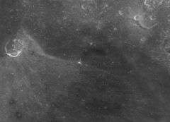
Daguerre is at the center of this image, but is barely visible due to its low relief and the high sun angle. A ray from Mädler to the west crosses Daguerre. The bright spot near center is the small crater pictured at left.

This image shows the striking bilateral symmetry of the rays of a small (2-km diameter) crater in the floor of Daguerre. Continuous areas and narrow filaments of light-gray ejecta extend from the crater across the dark mare surface through 270°, but are entirely absent in the southern 90° sector. Within the crater, dark material occurs on the southern crater wall while the remaining walls are bright. This crater probably resulted from the impact of a projectile traveling from south to north along an oblique trajectory. Its pattern of ejecta distribution is similar to that of small craters produced by the impact of missiles along oblique trajectories at the White Sands Missile Range, NM. Some observers postulate that the dark material is a talus deposit of mare material that has fallen into the crater. Another geological explanation is that the unusual pattern may be due to an intrinsic characteristic of the local terrain, probably an abrupt lateral change in the composition of the bedrock within the area that was excavated. (edited NASA caption.)
Daguerre is a circular formation near the north end of Mare Nectaris. To the west-northwest is the crater Mädler, and beyond it to the west is the prominent Theophilus. To the north in the rugged continental area between the maria is Isidorus.
This feature has the appearance of a lunar crater that has been nearly submerged by a lava flow, leaving a gap in the southwest wall that gives the feature the shape of a horse-shoe. The floor is overlaid by the linear ray from Mädler. The maximum altitude of the surviving rim is 1.5 km.
The crater's name was approved by the IAU in 1935.[1]
Satellite craters
By convention these features are identified on lunar maps by placing the letter on the side of the crater midpoint that is closest to Daguerre.
| Daguerre | Latitude | Longitude | Diameter |
|---|---|---|---|
| K | 12.2° S | 35.8° E | 5 km |
| U | 15.1° S | 35.7° E | 4 km |
| X | 14.0° S | 34.5° E | 4 km |
| Y | 13.9° S | 35.4° E | 3 km |
| Z | 14.9° S | 34.7° E | 4 km |
References
- Andersson, L. E.; Whitaker, E. A. (1982). NASA Catalogue of Lunar Nomenclature. NASA RP-1097.
- Blue, Jennifer (July 25, 2007). "Gazetteer of Planetary Nomenclature". USGS. Retrieved 2007-08-05.
- Bussey, B.; Spudis, P. (2004). The Clementine Atlas of the Moon. New York: Cambridge University Press. ISBN 978-0-521-81528-4.
- Cocks, Elijah E.; Cocks, Josiah C. (1995). Who's Who on the Moon: A Biographical Dictionary of Lunar Nomenclature. Tudor Publishers. ISBN 978-0-936389-27-1.
- McDowell, Jonathan (July 15, 2007). "Lunar Nomenclature". Jonathan's Space Report. Retrieved 2007-10-24.
- Menzel, D. H.; Minnaert, M.; Levin, B.; Dollfus, A.; Bell, B. (1971). "Report on Lunar Nomenclature by the Working Group of Commission 17 of the IAU". Space Science Reviews. 12 (2): 136–186. Bibcode:1971SSRv...12..136M. doi:10.1007/BF00171763.
- Moore, Patrick (2001). On the Moon. Sterling Publishing Co. ISBN 978-0-304-35469-6.
- Price, Fred W. (1988). The Moon Observer's Handbook. Cambridge University Press. ISBN 978-0-521-33500-3.
- Rükl, Antonín (1990). Atlas of the Moon. Kalmbach Books. ISBN 978-0-913135-17-4.
- Webb, Rev. T. W. (1962). Celestial Objects for Common Telescopes (6th revised ed.). Dover. ISBN 978-0-486-20917-3.
- Whitaker, Ewen A. (1999). Mapping and Naming the Moon. Cambridge University Press. ISBN 978-0-521-62248-6.
- Wlasuk, Peter T. (2000). Observing the Moon. Springer. ISBN 978-1-85233-193-1.
External links
-
 Media related to Daguerre (crater) at Wikimedia Commons
This article is issued from Wikipedia - version of the 6/25/2016. The text is available under the Creative Commons Attribution/Share Alike but additional terms may apply for the media files.